Estimated Value: $257,115 - $300,000
3
Beds
1
Bath
1,268
Sq Ft
$220/Sq Ft
Est. Value
About This Home
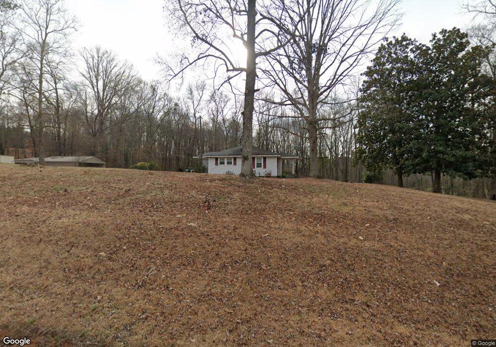
This home is located at 1259 Sanford Rd, Hull, GA 30646 and is currently estimated at $278,779, approximately $219 per square foot. 1259 Sanford Rd is a home located in Madison County with nearby schools including Madison County High School.
Ownership History
Date
Name
Owned For
Owner Type
Purchase Details
Closed on
Apr 30, 2014
Sold by
Smith Phillip
Bought by
Smith Phillip and Smith Christine R
Current Estimated Value
Home Financials for this Owner
Home Financials are based on the most recent Mortgage that was taken out on this home.
Original Mortgage
$90,892
Outstanding Balance
$28,659
Interest Rate
4.44%
Mortgage Type
New Conventional
Estimated Equity
$250,120
Purchase Details
Closed on
Feb 9, 2008
Sold by
Bradford Ouida
Bought by
Smith Phillip
Home Financials for this Owner
Home Financials are based on the most recent Mortgage that was taken out on this home.
Original Mortgage
$105,300
Interest Rate
5.46%
Mortgage Type
New Conventional
Purchase Details
Closed on
May 26, 2004
Sold by
Lester Michael Z
Bought by
Bradford Ouida C
Purchase Details
Closed on
Jun 10, 1996
Bought by
Lester Michael Z
Create a Home Valuation Report for This Property
The Home Valuation Report is an in-depth analysis detailing your home's value as well as a comparison with similar homes in the area
Home Values in the Area
Average Home Value in this Area
Purchase History
| Date | Buyer | Sale Price | Title Company |
|---|---|---|---|
| Smith Phillip | -- | -- | |
| Smith Phillip | $117,000 | -- | |
| Bradford Ouida C | $107,000 | -- | |
| Lester Michael Z | $43,000 | -- |
Source: Public Records
Mortgage History
| Date | Status | Borrower | Loan Amount |
|---|---|---|---|
| Open | Smith Phillip | $90,892 | |
| Previous Owner | Smith Phillip | $105,300 |
Source: Public Records
Tax History Compared to Growth
Tax History
| Year | Tax Paid | Tax Assessment Tax Assessment Total Assessment is a certain percentage of the fair market value that is determined by local assessors to be the total taxable value of land and additions on the property. | Land | Improvement |
|---|---|---|---|---|
| 2024 | $1,901 | $75,037 | $12,058 | $62,979 |
| 2023 | $2,093 | $68,571 | $10,048 | $58,523 |
| 2022 | $1,552 | $58,259 | $6,909 | $51,350 |
| 2021 | $1,321 | $45,271 | $6,909 | $38,362 |
| 2020 | $1,299 | $44,266 | $5,904 | $38,362 |
| 2019 | $1,286 | $43,358 | $5,904 | $37,454 |
| 2018 | $1,230 | $41,449 | $5,402 | $36,047 |
| 2017 | $1,178 | $40,903 | $5,024 | $35,879 |
| 2016 | $927 | $34,288 | $4,568 | $29,719 |
| 2015 | $927 | $34,288 | $4,568 | $29,719 |
| 2014 | $937 | $34,445 | $4,656 | $29,789 |
| 2013 | -- | $34,445 | $4,656 | $29,789 |
Source: Public Records
Map
Nearby Homes
- 534 Sawdust Rd
- 310 Sawdust Rd
- 260 Oak Cir
- 166 Oak Cir
- 1061 Garnett Ward Rd Unit 3
- 1067 Garnett Ward Rd Unit 2
- 1176 Kimberly Cir
- 125 Sandy Springs Rd
- 103 Three Rivers Ct
- 149 Candlestick Dr
- 8986 Highway 29 S
- 175 Norwood Ln
- 150 Norwood Ln
- 465 Stone Creek Dr
- 0 Nowhere Ln Unit 10544151
- 3080 Danielsville Rd
- 1246 Stone Stewart Rd
- 261 Adams Duncan Rd
- 0 Highway 29 S Unit 1024268
- 0 Highway 29 S Unit 10475312
- 1199 Sanford Rd
- 1175 Sanford Rd
- 782 Snow Farm Rd
- 1127 Sanford Rd
- 971 Sanford Rd
- 0 Sanford Rd Unit 7204072
- 0 Sanford Rd Unit 3243082
- 0 Sanford Rd Unit 8590683
- 0 Sanford Rd Unit 7558211
- 0 Sanford Rd Unit 7352368
- 0 Sanford Rd Unit 8136698
- 0 Sanford Rd
- 1501 Sanford Rd
- 600 Snow Farm Rd
- 898 Sanford Rd
- 1150 Sanford Rd
- 291 Snow Farm Rd
- 0 Snow Farm Rd
- 1629 Sanford Rd
- 812 Sanford Rd