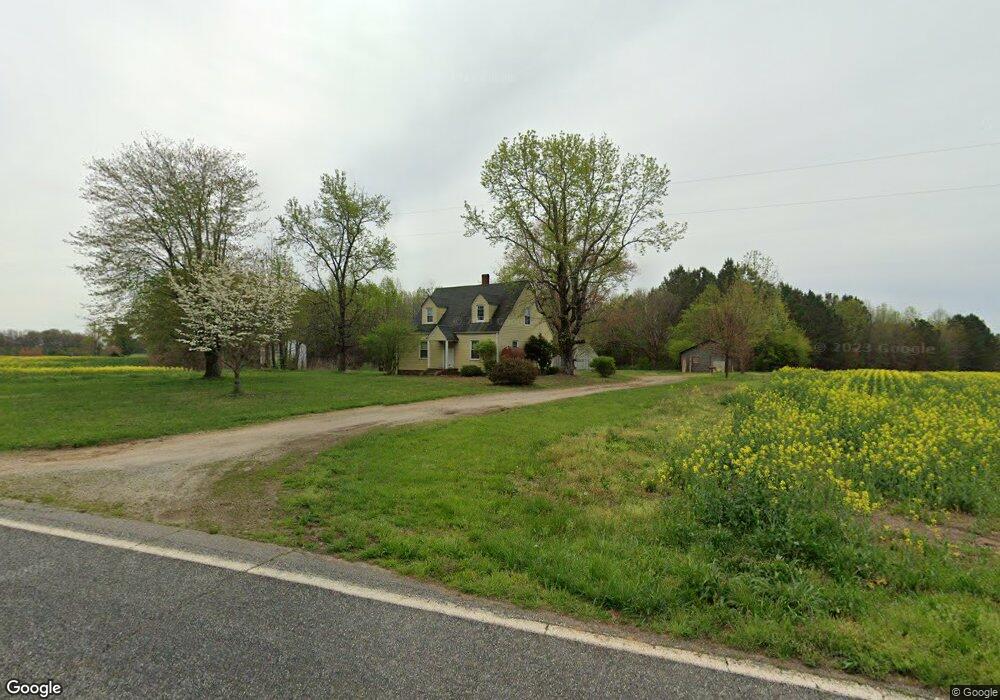
1259 Union Grove Rd Harmony, NC 28634
Estimated Value: $220,000 - $543,000
4
Beds
1
Bath
1,320
Sq Ft
$323/Sq Ft
Est. Value
About This Home
This home is located at 1259 Union Grove Rd, Harmony, NC 28634 and is currently estimated at $425,874, approximately $322 per square foot. 1259 Union Grove Rd is a home located in Iredell County with nearby schools including Union Grove Elementary School, North Iredell Middle School, and North Iredell High School.
Ownership History
Date
Name
Owned For
Owner Type
Purchase Details
Closed on
Sep 23, 2022
Sold by
Harold D Knight Living Trust
Bought by
Knight Pamela D
Current Estimated Value
Purchase Details
Closed on
Aug 23, 2017
Sold by
Knight Harold Dean
Bought by
Knight Harold D and Knight Pamela D
Purchase Details
Closed on
Jul 16, 2006
Sold by
The Harold & Gail Knight Family Lp
Bought by
Knight Harold Dean and Knight Gail A
Purchase Details
Closed on
Mar 17, 2006
Sold by
Knight Harold Dean and Knight Gail A
Bought by
The Harold & Gail Knight Family Lp
Purchase Details
Closed on
Mar 9, 2000
Sold by
Knight Marshall L and Knight Harold Dean
Bought by
Knight Harold Dean
Create a Home Valuation Report for This Property
The Home Valuation Report is an in-depth analysis detailing your home's value as well as a comparison with similar homes in the area
Home Values in the Area
Average Home Value in this Area
Purchase History
| Date | Buyer | Sale Price | Title Company |
|---|---|---|---|
| Knight Pamela D | -- | -- | |
| Knight Pamela D | -- | None Listed On Document | |
| Knight Harold D | -- | None Available | |
| Knight Harold Dean | -- | None Available | |
| The Harold & Gail Knight Family Lp | -- | None Available | |
| Knight Harold Dean | -- | -- |
Source: Public Records
Tax History
| Year | Tax Paid | Tax Assessment Tax Assessment Total Assessment is a certain percentage of the fair market value that is determined by local assessors to be the total taxable value of land and additions on the property. | Land | Improvement |
|---|---|---|---|---|
| 2025 | $607 | $92,740 | $0 | $0 |
| 2024 | $607 | $92,740 | $0 | $0 |
| 2023 | $607 | $92,740 | $0 | $0 |
| 2022 | $624 | $89,810 | $0 | $0 |
| 2021 | $620 | $89,810 | $0 | $0 |
| 2020 | $620 | $89,810 | $0 | $0 |
| 2019 | $611 | $89,810 | $0 | $0 |
| 2018 | $594 | $82,070 | $0 | $0 |
| 2017 | $594 | $323,320 | $299,950 | $23,370 |
| 2016 | $594 | $323,320 | $299,950 | $23,370 |
| 2015 | $574 | $323,320 | $299,950 | $23,370 |
| 2014 | $589 | $331,490 | $299,950 | $31,540 |
Source: Public Records
Map
Nearby Homes
- 160 Mullis Rd
- 120 Mitch Rd
- 142 Mitch Rd
- 145 Cornwall Rd
- 455 Mitch Rd
- 516 Lake Mullis Rd
- 499 Indian Hill Rd
- 489 Eagle Mills Rd
- 501 Eagle Mills Rd
- 520 Eagle Mills Rd
- 526 Houstonville Rd W Unit 2
- 00 Somers Rd
- 8.562 Williamsburg Rd
- 8.562 ac Williamsburg Rd
- 121 Haystack Ln
- 101 Allen Hills Way
- 103 Willies Ln
- 104 Willies Ln
- 136 Speaks Rd
- 144 Speaks Rd
- 1314 Union Grove Rd
- 1325 Union Grove Rd
- 1348 Union Grove Rd
- 1355 Union Grove Rd
- 1367 Union Grove Rd
- 1366 Union Grove Rd
- 134 Fork In the Rd
- 153 Mann Rd
- 175 Fork In the Rd
- 143 Mann Rd
- 1376 Union Grove Rd
- 105 Foxfield Dr
- 105 Foxfield Dr
- 242 Homestead Rd
- 145 Foxfield Dr
- 139 Foxfield Dr
- 139 Foxfield Dr
- 1393 Union Grove Rd
- 1384 Union Grove Rd
- 1386 Union Grove Rd
Your Personal Tour Guide
Ask me questions while you tour the home.