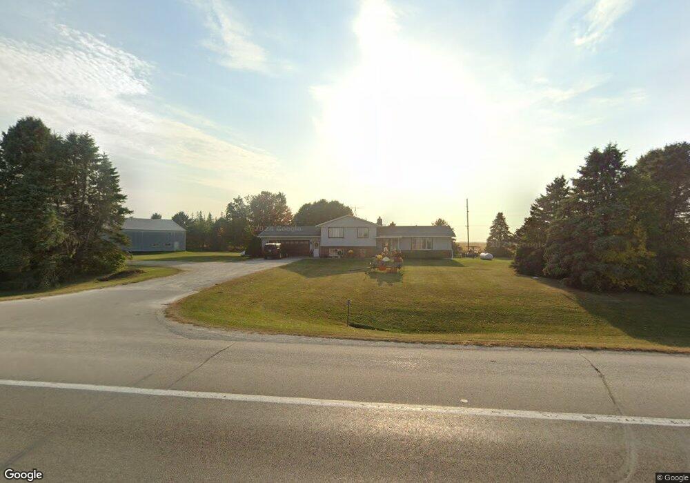
12597 Us 52 Canton, MN 55922
Estimated Value: $207,000 - $407,000
4
Beds
2
Baths
1,594
Sq Ft
$198/Sq Ft
Est. Value
About This Home
This home is located at 12597 Us 52, Canton, MN 55922 and is currently estimated at $315,612, approximately $198 per square foot. 12597 Us 52 is a home located in Fillmore County with nearby schools including Mabel-Canton Elementary School and Mabel-Canton Secondary School.
Ownership History
Date
Name
Owned For
Owner Type
Purchase Details
Closed on
Apr 7, 2017
Sold by
Peterson Kenneth S and Peterson Donna M
Bought by
Gulbranson Tina M
Current Estimated Value
Home Financials for this Owner
Home Financials are based on the most recent Mortgage that was taken out on this home.
Original Mortgage
$140,000
Outstanding Balance
$116,501
Interest Rate
4.21%
Mortgage Type
New Conventional
Estimated Equity
$199,111
Create a Home Valuation Report for This Property
The Home Valuation Report is an in-depth analysis detailing your home's value as well as a comparison with similar homes in the area
Purchase History
| Date | Buyer | Sale Price | Title Company |
|---|---|---|---|
| Gulbranson Tina M | $210,000 | None Available |
Source: Public Records
Mortgage History
| Date | Status | Borrower | Loan Amount |
|---|---|---|---|
| Open | Gulbranson Tina M | $140,000 |
Source: Public Records
Tax History
| Year | Tax Paid | Tax Assessment Tax Assessment Total Assessment is a certain percentage of the fair market value that is determined by local assessors to be the total taxable value of land and additions on the property. | Land | Improvement |
|---|---|---|---|---|
| 2025 | $2,648 | $192,700 | $57,000 | $135,700 |
| 2024 | $2,648 | $173,500 | $48,900 | $124,600 |
| 2023 | $2,592 | $173,500 | $48,900 | $124,600 |
| 2022 | $2,592 | $148,900 | $50,900 | $98,000 |
| 2021 | $2,592 | $134,100 | $42,800 | $91,300 |
| 2020 | $2,592 | $134,100 | $42,800 | $91,300 |
| 2019 | $1,080 | $134,100 | $42,800 | $91,300 |
| 2018 | $1,036 | $134,100 | $42,800 | $91,300 |
| 2017 | -- | $127,900 | $39,400 | $88,500 |
| 2016 | $990 | $124,100 | $35,600 | $88,500 |
| 2015 | $1,158 | $101,400 | $31,169 | $70,231 |
| 2014 | $1,158 | $101,400 | $31,169 | $70,231 |
| 2013 | $1,158 | $101,700 | $31,188 | $70,512 |
Source: Public Records
Map
Nearby Homes
- 12549 County 21
- 202 N Ash St
- 13130 County 21
- 348 7th Ave SE
- TBD ( Lot 6, Blk 2) 3rd Ave SE
- TBD ( Lot 2, Blk 2) 3rd Ave SE
- TBD (Lot 3, Blk 1) 3rd Ave SE
- TBD ( Lot 4, Blk 1) 3rd Ave SE
- TBD ( Lot 3, Blk 2) 3rd Ave SE
- TBD ( Lot 1, Blk 1) 3rd Ave SE
- 315 2nd St SE
- 340 1st St SE
- 16325 351st Ave
- 16128 331st Ave
- 39871 Highway 44
- 39871 State Hwy 44
- County Road 16
- 10422 401st Ave
- TBD County Road 16
- 30550 County 16
- 12516 Us 52
- 12668 Us 52
- 12932 351st Ave
- 35153 120th St
- 12043 351st Ave
- 35127 130th St
- 500 W Highway 52
- 11771 351st Ave
- 401 W Highway 52
- 13375 351st Ave
- 13328 351st Ave
- 211 N 3rd St
- 11769 351st Ave
- TBD County 21 Rd
- 12574 341st Ave
- 501 W Prairie Ave
- 34493 34493 130th-Street-
- 34493 130th St
- 303 N 3rd St
- 301 N 3rd St
Your Personal Tour Guide
Ask me questions while you tour the home.