Estimated Value: $85,000 - $87,000
--
Bed
--
Bath
--
Sq Ft
10.7
Acres
About This Home
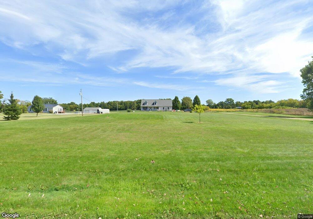
This home is located at 12599 Barnes Rd, Byron, MI 48418 and is currently estimated at $86,332. 12599 Barnes Rd is a home located in Shiawassee County with nearby schools including Byron Area Elementary School, Byron Area Middle School, and Byron Area High School.
Ownership History
Date
Name
Owned For
Owner Type
Purchase Details
Closed on
Jan 23, 2014
Sold by
Mcdowell Family Trust
Bought by
Adams Keith Robert
Current Estimated Value
Purchase Details
Closed on
Dec 20, 2013
Sold by
White Patricia M and White Dewitt T
Bought by
Mcdowell Family Trust
Purchase Details
Closed on
Mar 9, 2005
Sold by
White Andrea and Jones Dwayne
Bought by
Koebel Harold T
Home Financials for this Owner
Home Financials are based on the most recent Mortgage that was taken out on this home.
Original Mortgage
$100,000
Interest Rate
5.64%
Mortgage Type
Purchase Money Mortgage
Create a Home Valuation Report for This Property
The Home Valuation Report is an in-depth analysis detailing your home's value as well as a comparison with similar homes in the area
Home Values in the Area
Average Home Value in this Area
Purchase History
| Date | Buyer | Sale Price | Title Company |
|---|---|---|---|
| Adams Keith Robert | $35,000 | E Title | |
| Mcdowell Family Trust | $25,000 | Eit Title | |
| Koebel Harold T | $224,000 | Consolidated Title Services |
Source: Public Records
Mortgage History
| Date | Status | Borrower | Loan Amount |
|---|---|---|---|
| Previous Owner | Koebel Harold T | $100,000 |
Source: Public Records
Tax History Compared to Growth
Tax History
| Year | Tax Paid | Tax Assessment Tax Assessment Total Assessment is a certain percentage of the fair market value that is determined by local assessors to be the total taxable value of land and additions on the property. | Land | Improvement |
|---|---|---|---|---|
| 2025 | $552 | $24,600 | $0 | $0 |
| 2024 | $527 | $24,600 | $0 | $0 |
| 2023 | $233 | $24,100 | $0 | $0 |
| 2022 | $503 | $23,600 | $0 | $0 |
| 2021 | $472 | $23,600 | $0 | $0 |
| 2020 | $462 | $23,600 | $0 | $0 |
| 2019 | $455 | $23,600 | $0 | $0 |
| 2018 | $444 | $23,600 | $0 | $0 |
| 2017 | $423 | $23,600 | $0 | $0 |
| 2016 | -- | $23,600 | $0 | $0 |
| 2015 | -- | $17,050 | $0 | $0 |
| 2014 | $1 | $22,200 | $0 | $0 |
Source: Public Records
Map
Nearby Homes
- 00 Lehring and Britton Roads
- Parcel E Turkey Trail
- Parcel F Turkey Trail
- Parcel D Turkey Trail
- 206 Emmett
- Parcel B Turkey Trail
- vl Lehring Rd
- 301 N Church St
- 111 N Ann St
- 3901 Lovejoy Rd
- 4527 W Lovejoy Rd
- 6035 Beard Rd
- 9503 Vernon Rd
- 14830 County Line Rd
- VL W Bruff Rd
- 12266 Lillie Rd
- 8812 S Byron Rd
- 0 Bancroft Rd
- 11240 Silver Lake Rd
- 5832 E Cole Rd
- 12599 Barnes Rd
- 12637 Barnes Rd
- 12433 Barnes Rd
- 12424 Barnes Rd
- 9081 E Quail Run Dr
- 9081 E Quail Run Dr
- 9125 E Quail Run Dr
- 9125 E Quail Run
- 9155 E Quail Run Dr
- 12385 Barnes Rd
- 12385 Barnes Rd
- 12402 Barnes Rd
- 12751 Barnes Rd Unit Bldg-Unit
- 12751 Barnes Rd
- 12363 Barnes Rd
- 12758 Barnes Rd
- 12758 Barnes Rd
- 12400 Barnes Rd
- 12360 Barnes Rd
- 12311 Barnes Rd