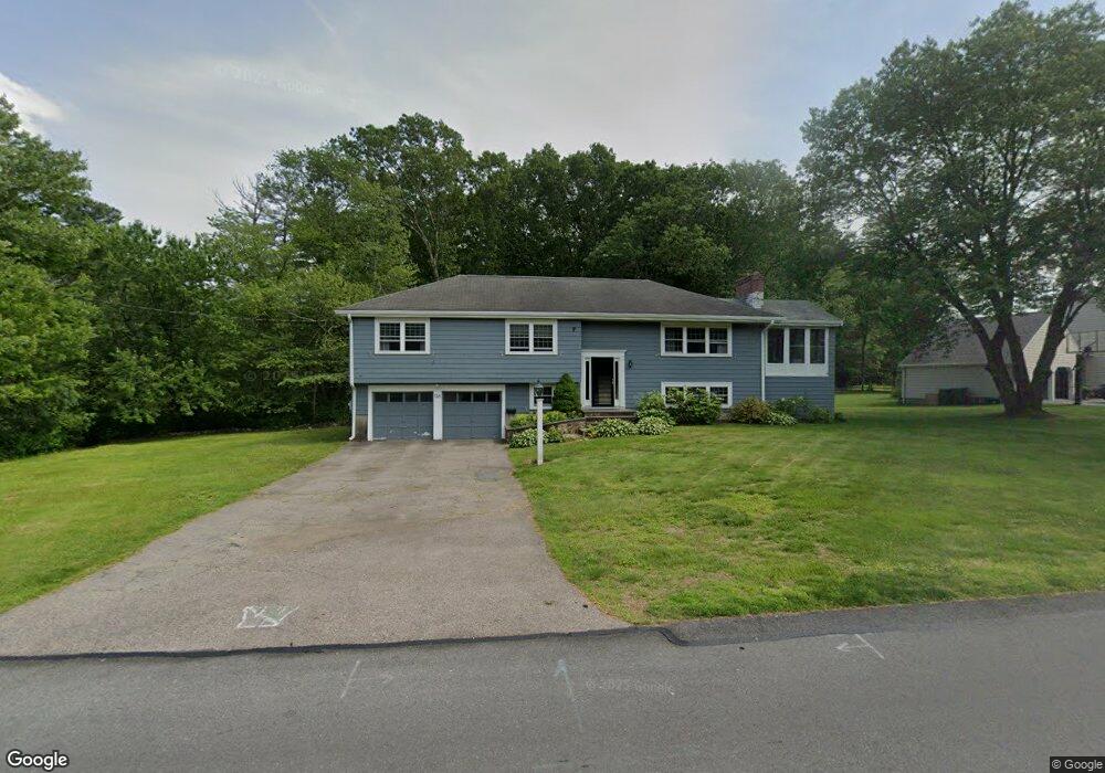
126 Conant Rd Westwood, MA 02090
Estimated Value: $1,350,000 - $1,410,000
3
Beds
3
Baths
2,411
Sq Ft
$569/Sq Ft
Est. Value
About This Home
This home is located at 126 Conant Rd, Westwood, MA 02090 and is currently estimated at $1,370,672, approximately $568 per square foot. 126 Conant Rd is a home located in Norfolk County with nearby schools including Westwood High School, St. Sebastian's School, and Xaverian Brothers High School.
Ownership History
Date
Name
Owned For
Owner Type
Purchase Details
Closed on
Feb 28, 1992
Sold by
Gagliard Frances A and Gagliard Josephw
Bought by
Rehbein Carl G and Rehbein Kathy A
Current Estimated Value
Home Financials for this Owner
Home Financials are based on the most recent Mortgage that was taken out on this home.
Original Mortgage
$169,600
Interest Rate
8.38%
Mortgage Type
Purchase Money Mortgage
Create a Home Valuation Report for This Property
The Home Valuation Report is an in-depth analysis detailing your home's value as well as a comparison with similar homes in the area
Home Values in the Area
Average Home Value in this Area
Purchase History
| Date | Buyer | Sale Price | Title Company |
|---|---|---|---|
| Rehbein Carl G | $212,000 | -- |
Source: Public Records
Mortgage History
| Date | Status | Borrower | Loan Amount |
|---|---|---|---|
| Open | Rehbein Carl G | $35,000 | |
| Open | Rehbein Carl G | $247,500 | |
| Closed | Rehbein Carl G | $165,000 | |
| Closed | Rehbein Carl G | $169,600 |
Source: Public Records
Tax History Compared to Growth
Tax History
| Year | Tax Paid | Tax Assessment Tax Assessment Total Assessment is a certain percentage of the fair market value that is determined by local assessors to be the total taxable value of land and additions on the property. | Land | Improvement |
|---|---|---|---|---|
| 2025 | $14,947 | $1,166,800 | $568,800 | $598,000 |
| 2024 | $14,947 | $1,166,800 | $568,800 | $598,000 |
| 2023 | $13,413 | $938,000 | $474,000 | $464,000 |
| 2022 | $13,394 | $903,200 | $419,200 | $484,000 |
| 2021 | $13,949 | $943,750 | $399,200 | $544,550 |
| 2020 | $12,671 | $873,250 | $399,200 | $474,050 |
| 2019 | $12,690 | $866,200 | $380,000 | $486,200 |
| 2018 | $11,585 | $767,750 | $380,000 | $387,750 |
| 2017 | $12,046 | $826,800 | $380,000 | $446,800 |
| 2016 | $11,713 | $798,950 | $380,000 | $418,950 |
| 2015 | $12,070 | $792,000 | $380,000 | $412,000 |
Source: Public Records
Map
Nearby Homes
- 18 Longmeadow Dr
- 20 Longmeadow Dr
- 670-672 High St Unit 3
- 26 Longmeadow Dr
- 314 Grove St
- 300 Summer St
- 298 Summer St
- 429 Summer St
- 401 Sandy Valley Rd
- 4 Shoestring Ln
- 15 Wilsondale St
- 60 Warwick Dr
- 162 Mayfair Dr
- 85 Schoolmaster Ln
- 250 Meadowbrook Rd
- 223 Robert Rd
- 49 Fisher St
- 262 Meadowbrook Rd
- 175 Schoolmaster Ln
- 36 Kingswood Rd