Estimated Value: $335,000 - $434,000
5
Beds
5
Baths
3,100
Sq Ft
$124/Sq Ft
Est. Value
About This Home
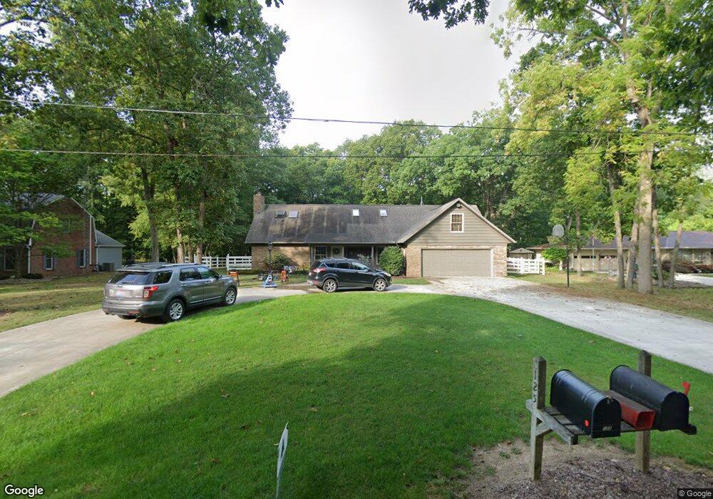
This home is located at 126 Dorothy Dr, Bryan, OH 43506 and is currently estimated at $383,998, approximately $123 per square foot. 126 Dorothy Dr is a home located in Williams County with nearby schools including Bryan Elementary PK-5, Washington Elementary School, and Bryan Middle School/High School.
Ownership History
Date
Name
Owned For
Owner Type
Purchase Details
Closed on
Feb 19, 2009
Sold by
Ruihley Robert E and Ruihley Carla A
Bought by
Vashaw Kirkland B and Vashaw Sarah T
Current Estimated Value
Purchase Details
Closed on
Feb 11, 2009
Sold by
Vashaw Kirkland B and Vashaw Sarah T
Bought by
Ruihley Robert E and Ruihley Carla A
Purchase Details
Closed on
May 19, 2007
Sold by
Kreeger Kenneth M and Kreeger Shelley R
Bought by
Vashaw Kirkland B and Vashaw Sarah T
Home Financials for this Owner
Home Financials are based on the most recent Mortgage that was taken out on this home.
Original Mortgage
$172,800
Interest Rate
6.2%
Mortgage Type
Purchase Money Mortgage
Purchase Details
Closed on
Nov 18, 1999
Sold by
Essman William T And
Bought by
Kreeger Kenneth M and Kreeger Shelley R
Purchase Details
Closed on
May 2, 1994
Bought by
Essman William T And
Create a Home Valuation Report for This Property
The Home Valuation Report is an in-depth analysis detailing your home's value as well as a comparison with similar homes in the area
Home Values in the Area
Average Home Value in this Area
Purchase History
| Date | Buyer | Sale Price | Title Company |
|---|---|---|---|
| Vashaw Kirkland B | -- | Maumee Valley Title Agency | |
| Ruihley Robert E | -- | Maumee Valley Title Agency | |
| Vashaw Kirkland B | $216,000 | None Available | |
| Kreeger Kenneth M | $215,000 | -- | |
| Essman William T And | $205,000 | -- |
Source: Public Records
Mortgage History
| Date | Status | Borrower | Loan Amount |
|---|---|---|---|
| Previous Owner | Vashaw Kirkland B | $172,800 |
Source: Public Records
Tax History
| Year | Tax Paid | Tax Assessment Tax Assessment Total Assessment is a certain percentage of the fair market value that is determined by local assessors to be the total taxable value of land and additions on the property. | Land | Improvement |
|---|---|---|---|---|
| 2025 | $5,809 | $131,990 | $6,930 | $125,060 |
| 2024 | $5,809 | $131,990 | $6,930 | $125,060 |
| 2023 | $5,867 | $110,810 | $7,140 | $103,670 |
| 2022 | $5,461 | $110,810 | $7,140 | $103,670 |
| 2021 | $5,460 | $110,810 | $7,140 | $103,670 |
| 2020 | $4,695 | $92,330 | $5,950 | $86,380 |
| 2019 | $4,654 | $92,330 | $5,950 | $86,380 |
| 2018 | $2,323 | $92,330 | $5,950 | $86,380 |
| 2017 | $4,305 | $84,990 | $6,270 | $78,720 |
| 2016 | $4,112 | $84,990 | $6,270 | $78,720 |
| 2015 | $4,074 | $84,990 | $6,270 | $78,720 |
| 2014 | $4,074 | $80,920 | $5,950 | $74,970 |
| 2013 | $4,090 | $80,920 | $5,950 | $74,970 |
Source: Public Records
Map
Nearby Homes
- 144 Deerfield Cir
- 1001 Greystone Dr
- 0 Whetstone Unit 7
- 12341 County Road C
- 630 Center Ridge Rd
- 000 C R C (West 828)
- 000 C R C (East 787)
- 723 W High St
- 412 Center St
- 414 Rosemont Ave
- 425 Oakwood Ave
- 000 Spring Meadow Ln
- 311 W South St
- 1006 S Beech St
- 542 S Beech St
- 000 N Main St
- 206 Brown Dr
- 205 Indiana Dr
- 422 S Main St
- 821 S Main St
Your Personal Tour Guide
Ask me questions while you tour the home.