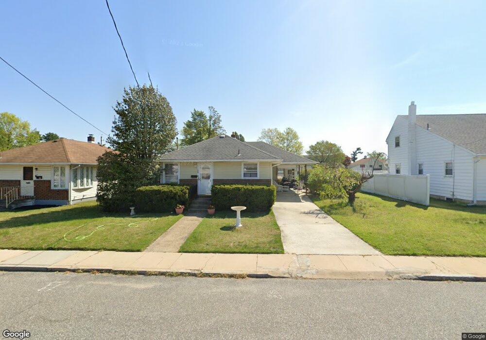
126 Dupont Ave Gibbstown, NJ 08027
Greenwich Township NeighborhoodEstimated Value: $196,703 - $258,000
--
Bed
--
Bath
960
Sq Ft
$231/Sq Ft
Est. Value
About This Home
This home is located at 126 Dupont Ave, Gibbstown, NJ 08027 and is currently estimated at $221,676, approximately $230 per square foot. 126 Dupont Ave is a home located in Gloucester County with nearby schools including Nehaunsey Middle School and Guardian Angels Regional School.
Ownership History
Date
Name
Owned For
Owner Type
Purchase Details
Closed on
Oct 16, 2023
Sold by
Previtera Alfia
Bought by
Lake Kathy E and Lake Dennis R
Current Estimated Value
Home Financials for this Owner
Home Financials are based on the most recent Mortgage that was taken out on this home.
Original Mortgage
$152,000
Outstanding Balance
$149,011
Interest Rate
7.12%
Mortgage Type
New Conventional
Estimated Equity
$72,665
Purchase Details
Closed on
Jul 1, 2001
Sold by
Previtera Alfia and Estate Of Vincent R Tomarchio
Bought by
Previtera Alfia and Tomarchio Vincent R
Create a Home Valuation Report for This Property
The Home Valuation Report is an in-depth analysis detailing your home's value as well as a comparison with similar homes in the area
Home Values in the Area
Average Home Value in this Area
Purchase History
| Date | Buyer | Sale Price | Title Company |
|---|---|---|---|
| Lake Kathy E | $160,000 | Southern United Title | |
| Previtera Alfia | -- | -- |
Source: Public Records
Mortgage History
| Date | Status | Borrower | Loan Amount |
|---|---|---|---|
| Open | Lake Kathy E | $152,000 |
Source: Public Records
Tax History Compared to Growth
Tax History
| Year | Tax Paid | Tax Assessment Tax Assessment Total Assessment is a certain percentage of the fair market value that is determined by local assessors to be the total taxable value of land and additions on the property. | Land | Improvement |
|---|---|---|---|---|
| 2025 | $4,245 | $123,300 | $29,700 | $93,600 |
| 2024 | $4,022 | $123,300 | $29,700 | $93,600 |
| 2023 | $4,022 | $123,300 | $29,700 | $93,600 |
| 2022 | $4,025 | $123,300 | $29,700 | $93,600 |
| 2021 | $3,983 | $123,300 | $29,700 | $93,600 |
| 2020 | $4,038 | $123,300 | $29,700 | $93,600 |
| 2019 | $4,041 | $123,300 | $29,700 | $93,600 |
| 2018 | $3,926 | $123,300 | $29,700 | $93,600 |
| 2017 | $3,831 | $123,300 | $29,700 | $93,600 |
| 2016 | $3,789 | $123,300 | $29,700 | $93,600 |
| 2015 | $3,667 | $123,300 | $29,700 | $93,600 |
| 2014 | $3,509 | $123,300 | $29,700 | $93,600 |
Source: Public Records
Map
Nearby Homes
- 431 Washington St
- 433 Jefferson St
- 157 S Poplar St
- 132 Tomlin Station Rd
- 752 Duncan Ave
- W Broad St
- 0 S Democrat Rd Unit NJGL2065008
- 456 Freund Ave
- 126 Repaupo Station Rd
- 43 45 Repaupo Station Rd
- 0 Swedesboro Ave Unit NJGL2061592
- 792 Paulsboro Rd
- 788 Paulsboro Rd
- 330 Croce Ave
- 219 Vanneman Blvd
- 0 Rd Unit NJGL2061600
- 344 W Washington St
- 335 W Buck St
- L18 20 W Broad St
- 120 Bartram Ave
- 128 Dupont Ave
- 124 Dupont Ave
- 116 Dupont Ave
- 123 Jackson Ave
- 129 Jackson Ave
- 117 Jackson Ave
- 491 Hill St
- 117 Dupont Ave
- 127 Dupont Ave
- 113 Dupont Ave
- 133 Dupont Ave
- 111 Jackson Ave
- 107 Dupont Ave
- 139 Dupont Ave
- 103 Jackson Ave
- 139 Jackson Ave
- 147 Dupont Ave
- 149 Jackson Ave
- 153 Dupont Ave
- 126 N Repauno Ave