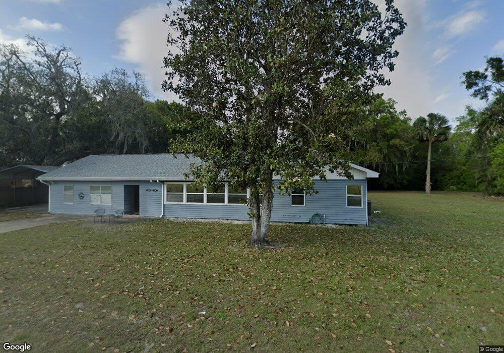
126 E 1st Ave Pierson, FL 32180
Estimated Value: $203,000 - $281,000
4
Beds
3
Baths
1,970
Sq Ft
$116/Sq Ft
Est. Value
About This Home
This home is located at 126 E 1st Ave, Pierson, FL 32180 and is currently estimated at $229,233, approximately $116 per square foot. 126 E 1st Ave is a home located in Volusia County with nearby schools including Pierson Elementary School and T. Dewitt Taylor Middle/High School.
Ownership History
Date
Name
Owned For
Owner Type
Purchase Details
Closed on
Jan 10, 2002
Sold by
Henderson Mary E and Henderson Mary
Bought by
Mcculley Anthony J
Current Estimated Value
Home Financials for this Owner
Home Financials are based on the most recent Mortgage that was taken out on this home.
Original Mortgage
$69,800
Outstanding Balance
$28,138
Interest Rate
6.85%
Estimated Equity
$201,095
Purchase Details
Closed on
Feb 15, 1984
Bought by
Mcculley Anthony J
Purchase Details
Closed on
Apr 15, 1975
Bought by
Mcculley Anthony J
Create a Home Valuation Report for This Property
The Home Valuation Report is an in-depth analysis detailing your home's value as well as a comparison with similar homes in the area
Home Values in the Area
Average Home Value in this Area
Purchase History
| Date | Buyer | Sale Price | Title Company |
|---|---|---|---|
| Mcculley Anthony J | $76,000 | -- | |
| Mcculley Anthony J | $45,000 | -- | |
| Mcculley Anthony J | $25,000 | -- |
Source: Public Records
Mortgage History
| Date | Status | Borrower | Loan Amount |
|---|---|---|---|
| Open | Mcculley Anthony J | $69,800 |
Source: Public Records
Tax History Compared to Growth
Tax History
| Year | Tax Paid | Tax Assessment Tax Assessment Total Assessment is a certain percentage of the fair market value that is determined by local assessors to be the total taxable value of land and additions on the property. | Land | Improvement |
|---|---|---|---|---|
| 2025 | $934 | $92,659 | -- | -- |
| 2024 | $934 | $90,048 | -- | -- |
| 2023 | $934 | $87,426 | $0 | $0 |
| 2022 | $890 | $84,880 | $0 | $0 |
| 2021 | $905 | $82,408 | $0 | $0 |
| 2020 | $882 | $81,270 | $0 | $0 |
| 2019 | $880 | $79,443 | $0 | $0 |
| 2018 | $865 | $77,962 | $0 | $0 |
| 2017 | $853 | $76,358 | $0 | $0 |
| 2016 | $813 | $74,787 | $0 | $0 |
| 2015 | $833 | $74,267 | $0 | $0 |
| 2014 | $832 | $73,678 | $0 | $0 |
Source: Public Records
Map
Nearby Homes
- 0 Us-17 & 1st St E
- 125 W 1st Ave
- 195 N Frederick St
- 765 U S 17
- 103 E 2nd Ave
- 207 E 2nd Ave
- 161 W 2nd Ave
- 110 N Volusia Ave
- 0 Minshew Rd
- 642 Glenhaven Ave
- 0 6th Ave W
- 499 Alpha Pkwy
- 516 Central Blvd
- 521 Central Blvd
- 225 Melodieln
- 320 Melodie Ln
- 0 No St Unit MFRGC517561
- 1640 Shell Harbor Rd
- 850 Menton Rd
- 0 N St Unit R11070082
- 118 E 1st Ave
- 123 E Orange Ave
- 132 E Orange Ave
- 0 W 1st Ave Unit V4720837
- 150 E 1st Ave
- 125 E Washington Ave
- 163 E Orange Ave
- 178 N Center St
- 139 E Washington Ave
- 151 E Washington Ave
- 155 E Washington Ave
- 303 N Center St
- 103 N Center St
- 0 E 1st Ave
- 213 Frederick St
- 195 Frederick St
- 163 Frederick St
- 163 Frederick St
- 152 W 1st Ave
- 108 S Center St