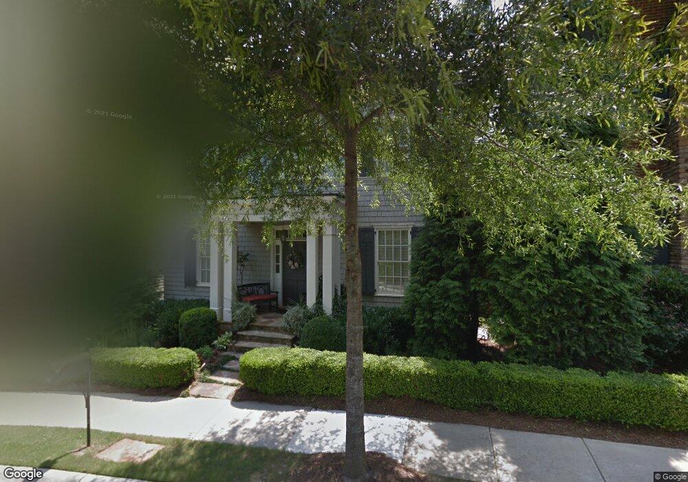
126 Hubbard Rd Woodstock, GA 30188
Estimated Value: $893,879 - $1,042,000
3
Beds
3
Baths
2,798
Sq Ft
$346/Sq Ft
Est. Value
About This Home
This home is located at 126 Hubbard Rd, Woodstock, GA 30188 and is currently estimated at $967,940, approximately $345 per square foot. 126 Hubbard Rd is a home located in Cherokee County with nearby schools including Woodstock Elementary School, Woodstock Middle School, and Woodstock High School.
Ownership History
Date
Name
Owned For
Owner Type
Purchase Details
Closed on
Jun 28, 2016
Sold by
Cook Carole
Bought by
Breitbart Brian and Breitbart Sylvia A
Current Estimated Value
Home Financials for this Owner
Home Financials are based on the most recent Mortgage that was taken out on this home.
Original Mortgage
$417,000
Outstanding Balance
$333,748
Interest Rate
3.66%
Estimated Equity
$634,192
Create a Home Valuation Report for This Property
The Home Valuation Report is an in-depth analysis detailing your home's value as well as a comparison with similar homes in the area
Home Values in the Area
Average Home Value in this Area
Purchase History
| Date | Buyer | Sale Price | Title Company |
|---|---|---|---|
| Breitbart Brian | $540,000 | -- |
Source: Public Records
Mortgage History
| Date | Status | Borrower | Loan Amount |
|---|---|---|---|
| Open | Breitbart Brian | $417,000 |
Source: Public Records
Tax History Compared to Growth
Tax History
| Year | Tax Paid | Tax Assessment Tax Assessment Total Assessment is a certain percentage of the fair market value that is determined by local assessors to be the total taxable value of land and additions on the property. | Land | Improvement |
|---|---|---|---|---|
| 2024 | $7,680 | $315,280 | $64,000 | $251,280 |
| 2023 | $1,601 | $320,120 | $64,000 | $256,120 |
| 2022 | $6,490 | $240,400 | $44,000 | $196,400 |
| 2021 | $5,314 | $218,360 | $44,000 | $174,360 |
| 2020 | $6,264 | $200,840 | $40,000 | $160,840 |
| 2019 | $5,013 | $203,320 | $40,000 | $163,320 |
| 2018 | $4,958 | $198,960 | $40,000 | $158,960 |
| 2017 | $4,940 | $490,500 | $40,000 | $156,200 |
| 2016 | $1,549 | $453,900 | $40,000 | $141,560 |
| 2015 | $1,409 | $431,600 | $33,600 | $139,040 |
| 2014 | $1,103 | $395,400 | $33,600 | $124,560 |
Source: Public Records
Map
Nearby Homes
- 147 Hubbard Rd
- 719 Hammond Dr
- 191 Fowler St
- 360 Chambers St Unit 155
- 360 Chambers St Unit 456
- 360 Chambers St Unit 408
- 360 Chambers St Unit 407
- 360 Chambers St Unit 210
- 360 Chambers St Unit 402
- 360 Chambers St Unit 405
- 360 Chambers St Unit 301
- 170 Fowler St Unit 100
- 170 Fowler St Unit 200
- 114 Parks Cir
- 204 Melanie Ln
- 108 Barnesdale Terrace
- 318 Lantana Ln
- 110 Barnesdale Terrace
- 128 Hubbard Rd
- 124 Hubbard Rd
- 425 Latimer St
- 130 Hubbard Rd
- 423 Latimer St
- 429 Latimer St
- 135 Hubbard Rd
- 703 Hammond Dr Unit 703
- 431 Latimer St
- 132 Hubbard Rd
- 122 Hubbard Rd
- 705 Hammond Dr
- 120 Hubbard Rd
- 134 Hubbard Rd
- 433 Latimer St
- 707 Hammond Dr
- 0 Latimer St Unit 7397716
- 0 Latimer St Unit 8505851
- 0 Latimer St Unit 8267006
- 0 Latimer St Unit 8135351