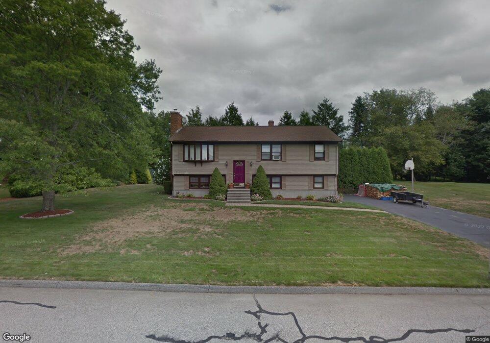
126 King Philip Rd Seekonk, MA 02771
Estimated Value: $530,000 - $631,000
3
Beds
2
Baths
1,288
Sq Ft
$438/Sq Ft
Est. Value
About This Home
This home is located at 126 King Philip Rd, Seekonk, MA 02771 and is currently estimated at $564,559, approximately $438 per square foot. 126 King Philip Rd is a home located in Bristol County with nearby schools including Seekonk High School, Ocean State Montessori School, and St Mary Academy-Bay View.
Ownership History
Date
Name
Owned For
Owner Type
Purchase Details
Closed on
Apr 20, 1999
Sold by
Lynch Donald M and Lynch Arlene E
Bought by
Porto Frank and Porto Lisa M
Current Estimated Value
Home Financials for this Owner
Home Financials are based on the most recent Mortgage that was taken out on this home.
Original Mortgage
$115,375
Outstanding Balance
$29,215
Interest Rate
7.04%
Mortgage Type
Purchase Money Mortgage
Estimated Equity
$535,344
Create a Home Valuation Report for This Property
The Home Valuation Report is an in-depth analysis detailing your home's value as well as a comparison with similar homes in the area
Home Values in the Area
Average Home Value in this Area
Purchase History
| Date | Buyer | Sale Price | Title Company |
|---|---|---|---|
| Porto Frank | $177,500 | -- |
Source: Public Records
Mortgage History
| Date | Status | Borrower | Loan Amount |
|---|---|---|---|
| Open | Porto Frank | $115,375 |
Source: Public Records
Tax History Compared to Growth
Tax History
| Year | Tax Paid | Tax Assessment Tax Assessment Total Assessment is a certain percentage of the fair market value that is determined by local assessors to be the total taxable value of land and additions on the property. | Land | Improvement |
|---|---|---|---|---|
| 2025 | $5,674 | $459,400 | $164,900 | $294,500 |
| 2024 | $5,457 | $441,900 | $164,900 | $277,000 |
| 2023 | $5,270 | $402,000 | $147,900 | $254,100 |
| 2022 | $4,833 | $362,300 | $147,900 | $214,400 |
| 2021 | $4,627 | $341,000 | $126,600 | $214,400 |
| 2020 | $4,347 | $330,100 | $126,500 | $203,600 |
| 2019 | $4,212 | $322,500 | $126,500 | $196,000 |
| 2018 | $4,169 | $312,300 | $126,500 | $185,800 |
| 2017 | $4,090 | $303,900 | $127,900 | $176,000 |
| 2016 | $4,051 | $302,100 | $127,900 | $174,200 |
| 2015 | $3,642 | $275,300 | $116,100 | $159,200 |
Source: Public Records
Map
Nearby Homes
- 358 Olney St
- 57 Mohawk Dr
- 147 Olney St
- 454 Fall River Ave
- 30 Rosemarie Dr
- 759 Fall River Ave
- 349 County St
- 25 Pimental Dr
- 42 Tee Jay Dr
- 698 Fall River Ave
- 524 County St
- 679 County St
- 420 Chestnut St
- 296 Fall River Ave
- 39 John Alden Rd
- 0 Milton St Unit 72633661
- 62 Chestnut St
- 206 Wheeler St
- 442 Taunton Ave
- 7 Jill Ct
- 383 Olney St
- 116 King Philip Rd
- 136 King Philip Rd
- 395 Olney St
- 131 King Philip Rd
- 123 King Philip Rd
- 371 Olney St
- 143 King Philip Rd
- 106 King Philip Rd
- 113 King Philip Rd
- 146 King Philip Rd
- 409 Olney St
- 386 Olney St
- 126 Mohawk Dr
- 136 Mohawk Dr
- 400 Olney St
- 359 Olney St
- 372 Olney St
- 116 Mohawk Dr
- 147 King Philip Rd