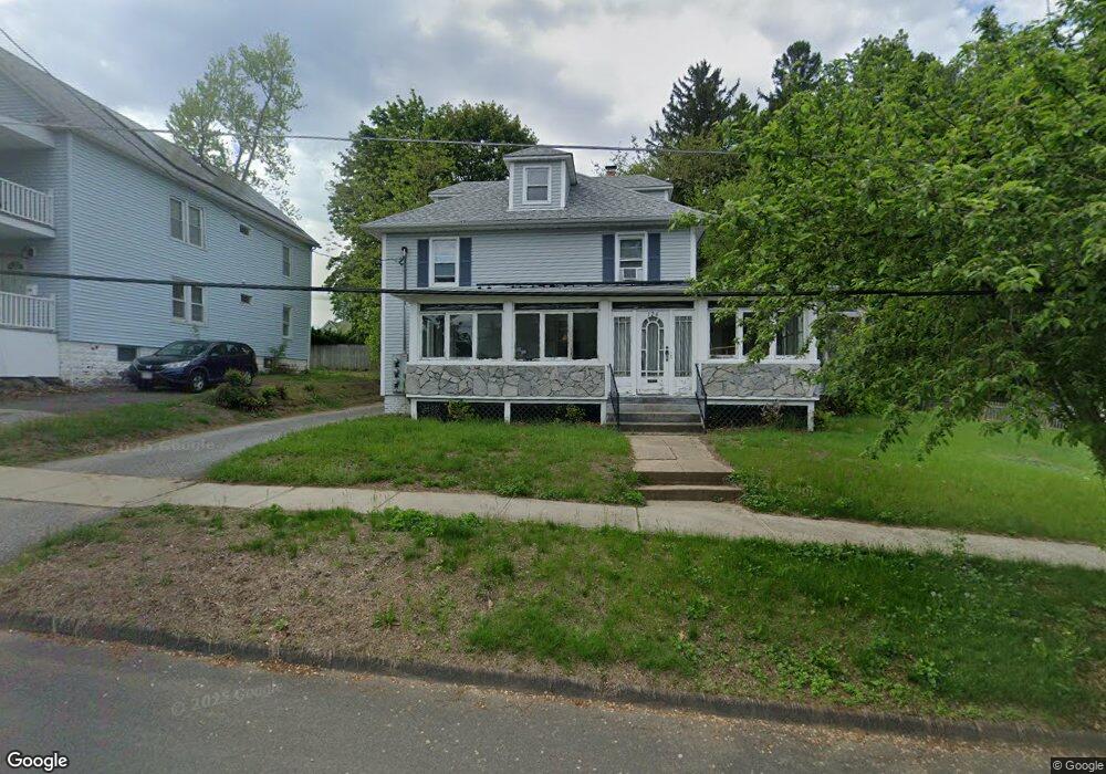
126 Maple St West Springfield, MA 01089
Estimated Value: $334,000 - $375,000
4
Beds
2
Baths
2,006
Sq Ft
$178/Sq Ft
Est. Value
About This Home
This home is located at 126 Maple St, West Springfield, MA 01089 and is currently estimated at $357,746, approximately $178 per square foot. 126 Maple St is a home located in Hampden County with nearby schools including St Thomas The Apostle School.
Ownership History
Date
Name
Owned For
Owner Type
Purchase Details
Closed on
Jul 31, 1998
Sold by
Belden Carolyn E
Bought by
Corey Paul M and Corey Joy E
Current Estimated Value
Purchase Details
Closed on
Jul 31, 1989
Sold by
Schaub James L
Bought by
Belden Raymond L
Create a Home Valuation Report for This Property
The Home Valuation Report is an in-depth analysis detailing your home's value as well as a comparison with similar homes in the area
Home Values in the Area
Average Home Value in this Area
Purchase History
| Date | Buyer | Sale Price | Title Company |
|---|---|---|---|
| Corey Paul M | $113,500 | -- | |
| Belden Raymond L | $115,000 | -- |
Source: Public Records
Mortgage History
| Date | Status | Borrower | Loan Amount |
|---|---|---|---|
| Open | Belden Raymond L | $18,500 | |
| Open | Belden Raymond L | $172,500 | |
| Closed | Belden Raymond L | $26,342 |
Source: Public Records
Tax History Compared to Growth
Tax History
| Year | Tax Paid | Tax Assessment Tax Assessment Total Assessment is a certain percentage of the fair market value that is determined by local assessors to be the total taxable value of land and additions on the property. | Land | Improvement |
|---|---|---|---|---|
| 2025 | $4,520 | $304,000 | $112,200 | $191,800 |
| 2024 | $4,502 | $304,000 | $112,200 | $191,800 |
| 2023 | $4,085 | $262,900 | $109,800 | $153,100 |
| 2022 | $3,983 | $252,700 | $99,600 | $153,100 |
| 2021 | $3,534 | $209,100 | $94,800 | $114,300 |
| 2020 | $3,539 | $208,300 | $94,800 | $113,500 |
| 2019 | $3,533 | $208,300 | $94,800 | $113,500 |
| 2018 | $3,552 | $208,300 | $94,800 | $113,500 |
| 2017 | $3,552 | $208,300 | $94,800 | $113,500 |
| 2016 | $3,447 | $202,900 | $89,400 | $113,500 |
| 2015 | $3,376 | $198,700 | $87,300 | $111,400 |
| 2014 | $819 | $198,700 | $87,300 | $111,400 |
Source: Public Records
Map
Nearby Homes