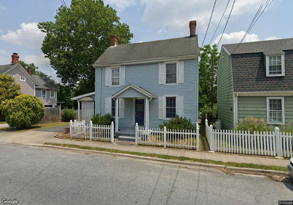
126 N Main St Greensboro, MD 21639
Estimated Value: $307,000 - $345,085
--
Bed
2
Baths
1,902
Sq Ft
$171/Sq Ft
Est. Value
About This Home
This home is located at 126 N Main St, Greensboro, MD 21639 and is currently estimated at $324,521, approximately $170 per square foot. 126 N Main St is a home located in Caroline County with nearby schools including Greensboro Elementary School, Lockerman Middle School, and North Caroline High School.
Ownership History
Date
Name
Owned For
Owner Type
Purchase Details
Closed on
Oct 2, 1996
Sold by
Utkewicz Karen A
Bought by
Knox Diana T
Current Estimated Value
Purchase Details
Closed on
Jan 5, 1989
Sold by
Kelly Bernard P
Bought by
Utkewicz Karen A
Home Financials for this Owner
Home Financials are based on the most recent Mortgage that was taken out on this home.
Original Mortgage
$40,000
Interest Rate
10.77%
Create a Home Valuation Report for This Property
The Home Valuation Report is an in-depth analysis detailing your home's value as well as a comparison with similar homes in the area
Home Values in the Area
Average Home Value in this Area
Purchase History
| Date | Buyer | Sale Price | Title Company |
|---|---|---|---|
| Knox Diana T | $92,500 | -- | |
| Utkewicz Karen A | $79,500 | -- |
Source: Public Records
Mortgage History
| Date | Status | Borrower | Loan Amount |
|---|---|---|---|
| Previous Owner | Utkewicz Karen A | $40,000 | |
| Closed | Knox Diana T | -- |
Source: Public Records
Tax History Compared to Growth
Tax History
| Year | Tax Paid | Tax Assessment Tax Assessment Total Assessment is a certain percentage of the fair market value that is determined by local assessors to be the total taxable value of land and additions on the property. | Land | Improvement |
|---|---|---|---|---|
| 2025 | $4,168 | $255,200 | $0 | $0 |
| 2024 | $4,168 | $241,800 | $98,500 | $143,300 |
| 2023 | $3,969 | $230,200 | $0 | $0 |
| 2022 | $3,797 | $218,600 | $0 | $0 |
| 2021 | $3,643 | $207,000 | $98,500 | $108,500 |
| 2020 | $3,643 | $205,567 | $0 | $0 |
| 2019 | $3,658 | $204,133 | $0 | $0 |
| 2018 | $3,592 | $202,700 | $113,500 | $89,200 |
| 2017 | $3,592 | $202,700 | $0 | $0 |
| 2016 | -- | $202,700 | $0 | $0 |
| 2015 | $3,257 | $210,400 | $0 | $0 |
| 2014 | $3,257 | $210,400 | $0 | $0 |
Source: Public Records
Map
Nearby Homes
- 116 Stonesifer Dr
- 206 N Academy St
- 123 Park Ave
- 125 Park Ave
- 218 E Sunset Ave
- 320 N Main St
- 306 Bernard Ave
- 0 Mill & Lincoln St
- 122 Mill St
- 406 N Academy St
- SULLIVAN Plan at Kinnamon Meadows
- PERRY Plan at Kinnamon Meadows
- CURTIS Plan at Kinnamon Meadows
- HELENA Plan at Kinnamon Meadows
- 119 Parkland Rd
- 123 Parkland Rd
- 120 Parkland Rd
- 124 Parkland Rd
- 115 Boyce Mill Rd
- 113 Parkland Rd