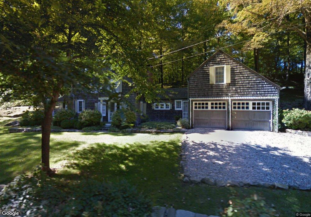
126 New Preston Hill Rd New Preston Marble Dale, CT 06777
Estimated Value: $536,000 - $913,000
3
Beds
3
Baths
1,470
Sq Ft
$510/Sq Ft
Est. Value
About This Home
This home is located at 126 New Preston Hill Rd, New Preston Marble Dale, CT 06777 and is currently estimated at $749,672, approximately $509 per square foot. 126 New Preston Hill Rd is a home located in Litchfield County with nearby schools including Shepaug Valley School, Washington Montessori School, and Rumsey Hall School.
Ownership History
Date
Name
Owned For
Owner Type
Purchase Details
Closed on
Jul 1, 2004
Sold by
Lorenti Richard and Flatt Andrew
Bought by
Johnson Eric
Current Estimated Value
Home Financials for this Owner
Home Financials are based on the most recent Mortgage that was taken out on this home.
Original Mortgage
$390,100
Interest Rate
6.3%
Mortgage Type
Purchase Money Mortgage
Purchase Details
Closed on
Apr 30, 2003
Sold by
Visnapuu Neil and Visnapuu Carol
Bought by
Lorenti Richard and Flatt Andrew
Purchase Details
Closed on
Jul 17, 2001
Sold by
Cohen Paula
Bought by
Visnapuu Neil and Visnapuu Carol
Purchase Details
Closed on
Dec 30, 1996
Sold by
Colmery Naomi and Swanberg Jeudith
Bought by
Cohen Paula
Create a Home Valuation Report for This Property
The Home Valuation Report is an in-depth analysis detailing your home's value as well as a comparison with similar homes in the area
Home Values in the Area
Average Home Value in this Area
Purchase History
| Date | Buyer | Sale Price | Title Company |
|---|---|---|---|
| Johnson Eric | $489,000 | -- | |
| Johnson Eric | $489,000 | -- | |
| Lorenti Richard | $470,000 | -- | |
| Lorenti Richard | $470,000 | -- | |
| Visnapuu Neil | $380,000 | -- | |
| Visnapuu Neil | $380,000 | -- | |
| Cohen Paula | $179,000 | -- | |
| Cohen Paula | $179,000 | -- |
Source: Public Records
Mortgage History
| Date | Status | Borrower | Loan Amount |
|---|---|---|---|
| Open | Cohen Paula | $412,500 | |
| Closed | Cohen Paula | $390,100 |
Source: Public Records
Tax History Compared to Growth
Tax History
| Year | Tax Paid | Tax Assessment Tax Assessment Total Assessment is a certain percentage of the fair market value that is determined by local assessors to be the total taxable value of land and additions on the property. | Land | Improvement |
|---|---|---|---|---|
| 2025 | $3,391 | $312,550 | $94,780 | $217,770 |
| 2024 | $3,391 | $312,550 | $94,780 | $217,770 |
| 2023 | $3,327 | $233,460 | $95,640 | $137,820 |
| 2022 | $3,253 | $228,250 | $95,640 | $132,610 |
| 2021 | $3,253 | $228,250 | $95,640 | $132,610 |
| 2020 | $3,253 | $228,250 | $95,640 | $132,610 |
| 2019 | $3,253 | $228,250 | $95,640 | $132,610 |
| 2018 | $3,371 | $236,560 | $99,790 | $136,770 |
| 2017 | $3,371 | $236,560 | $99,790 | $136,770 |
| 2016 | $3,371 | $236,560 | $99,790 | $136,770 |
| 2015 | $3,253 | $236,560 | $99,790 | $136,770 |
| 2014 | $3,194 | $236,560 | $99,790 | $136,770 |
Source: Public Records
Map
Nearby Homes
- 226 Tinker Hill Rd
- 35 Quarry Ridge Rd Unit 35
- 29 Quarry Ridge Rd
- 217 Sawyer Hill Rd
- 198 Tinker Hill Rd
- 93 Quarry Ridge Rd Unit 93
- 54 Scofield Hill Rd
- 1 N Shore Rd
- 10 Biliski Rd
- 35 Hillendale Dr
- 15 Connelly Rd
- 31 June Rd
- 77 New Milford Turnpike
- 46 June Rd
- 18 Arrow Point Rd
- 7 Owls Nest
- Lot 2 060804A Popple Swamp Rd
- LOT 1 060804 Popple Swamp Rd
- Lot 3 060804C Upper Church Hill Rd
- Lot 4 060804B Upper Church Hill Rd
- 132 New Preston Hill Rd
- 114 New Preston Hill Rd
- 135 New Preston Hill Rd
- 142 New Preston Hill Rd
- 106 New Preston Hill Rd
- 141 New Preston Hill Rd
- 105 New Preston Hill Rd
- 67 Findlay Rd
- 63 Findlay Rd
- 101 New Preston Hill Rd
- 145 New Preston Hill Rd
- 158 New Preston Hill Rd
- 9 Gunn Hill Rd
- 151 New Preston Hill Rd
- 59 Findlay Rd
- 7 Gunn Hill Rd
- 00 Gunn Hill Rd
- 92 Findlay Rd
- 15 Gunn Hill Rd
- 57 Findlay Rd