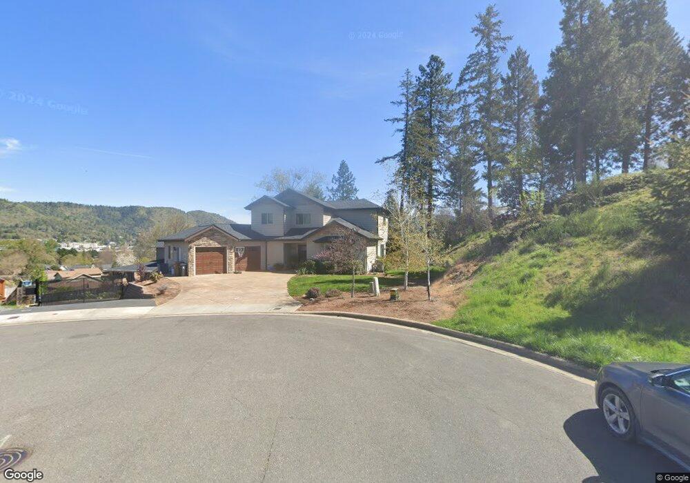
126 NW Rook Dr Unit Lt 15 Grants Pass, OR 97526
Estimated Value: $563,176 - $613,000
3
Beds
3
Baths
2,336
Sq Ft
$252/Sq Ft
Est. Value
About This Home
This home is located at 126 NW Rook Dr Unit Lt 15, Grants Pass, OR 97526 and is currently estimated at $588,088, approximately $251 per square foot. 126 NW Rook Dr Unit Lt 15 is a home located in Josephine County with nearby schools including Highland Elementary School, North Middle School, and Grants Pass High School.
Ownership History
Date
Name
Owned For
Owner Type
Purchase Details
Closed on
Dec 5, 2024
Sold by
Garibay Katherine
Bought by
Garibay Family Trust and Garibay
Current Estimated Value
Purchase Details
Closed on
Sep 24, 2020
Sold by
Albertson Jessica and Matthews David
Bought by
Garibay Katherine
Home Financials for this Owner
Home Financials are based on the most recent Mortgage that was taken out on this home.
Original Mortgage
$446,500
Interest Rate
2.9%
Mortgage Type
New Conventional
Purchase Details
Closed on
Jul 6, 2016
Sold by
Solution Associates Llc
Bought by
Albertson Jessica and Matthews David
Home Financials for this Owner
Home Financials are based on the most recent Mortgage that was taken out on this home.
Original Mortgage
$304,900
Interest Rate
3.48%
Mortgage Type
New Conventional
Create a Home Valuation Report for This Property
The Home Valuation Report is an in-depth analysis detailing your home's value as well as a comparison with similar homes in the area
Home Values in the Area
Average Home Value in this Area
Purchase History
| Date | Buyer | Sale Price | Title Company |
|---|---|---|---|
| Garibay Family Trust | -- | None Listed On Document | |
| Garibay Katherine | $470,000 | First American | |
| Albertson Jessica | $359,900 | First American |
Source: Public Records
Mortgage History
| Date | Status | Borrower | Loan Amount |
|---|---|---|---|
| Previous Owner | Garibay Katherine | $446,500 | |
| Previous Owner | Albertson Jessica | $304,900 |
Source: Public Records
Tax History Compared to Growth
Tax History
| Year | Tax Paid | Tax Assessment Tax Assessment Total Assessment is a certain percentage of the fair market value that is determined by local assessors to be the total taxable value of land and additions on the property. | Land | Improvement |
|---|---|---|---|---|
| 2025 | $5,432 | $413,190 | -- | -- |
| 2024 | $5,432 | $401,160 | -- | -- |
| 2023 | $5,118 | $389,480 | $0 | $0 |
| 2022 | $5,144 | $378,140 | -- | -- |
| 2021 | $4,833 | $367,130 | $0 | $0 |
| 2020 | $4,696 | $356,440 | $0 | $0 |
| 2019 | $4,562 | $346,060 | $0 | $0 |
| 2018 | $4,643 | $335,990 | $0 | $0 |
| 2017 | $4,609 | $326,210 | $0 | $0 |
| 2016 | $4,059 | $316,710 | $0 | $0 |
| 2015 | $3,592 | $288,620 | $0 | $0 |
| 2014 | $310 | $49,630 | $0 | $0 |
Source: Public Records
Map
Nearby Homes
- 908 NW Bishop St
- 2203 NW Juliet Ln
- 107 NW Wrightwood Cir
- 1024 NW Cooke Ave
- 201 NW Creekside Dr
- 2034 NW Sarum Cir
- 208 NW Creekside Dr
- 206 NW Creekside Dr
- 214 NW Creekside Dr
- 1126 NW Morgan Ln
- 1946 NW Crown St
- 210 NW Woodbrook Dr
- 1285 NW Cooke Ave
- 0 NW Scenic Dr Unit 220207296
- 1805 NW Candler Ave
- 1137 Sunburst Way
- 334 NW Scenic Dr
- 1172 NW Starlite Place
- 1129 NW Starlite Place
- 1162 NW Starlite Place
- 126 NW Rook Dr
- 203 NW Knight Ct Unit Lt 14
- 122 NW Rook Dr
- 122 NW Rook Dr Unit Lt 16
- 118 NW Rook Dr
- 118 NW Rook Dr Unit Lt 17
- 2207 NW Queens Way
- 825 NW Pawn Way
- 825 NW Pawn Way Unit Lt 27
- 207 NW Knight Ct
- 207 NW Knight Ct Unit Lt 13
- 810 NW Pawn Way
- 810 NW Pawn Way Unit Lt 26
- 114 NW Rook Dr
- 114 NW Rook Dr Unit Lt 18
- 821 NW Pawn Way
- 821 NW Pawn Way Unit Lt 28
- 2205 NW Queens Way
- 909 NW Bishop St
- 909 NW Bishop St Unit Lt21