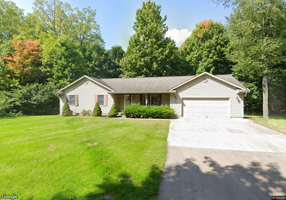
126 Pelham St Concord, MI 49237
Estimated Value: $195,000 - $280,000
4
Beds
3
Baths
1,550
Sq Ft
$156/Sq Ft
Est. Value
About This Home
This home is located at 126 Pelham St, Concord, MI 49237 and is currently estimated at $241,900, approximately $156 per square foot. 126 Pelham St is a home located in Jackson County with nearby schools including Concord Elementary School, Concord Middle School, and Concord High School.
Ownership History
Date
Name
Owned For
Owner Type
Purchase Details
Closed on
Jun 7, 2005
Sold by
Firman Marie E
Bought by
Firman Marie E and Firman Donna M
Current Estimated Value
Purchase Details
Closed on
Aug 18, 2004
Sold by
Miller Kenneth L and Dobbins Richard L
Bought by
Firman Marie E
Purchase Details
Closed on
Jul 8, 2002
Sold by
North Concord Farms Inc
Bought by
Dobbins Richard L and Miller Kenneth L
Create a Home Valuation Report for This Property
The Home Valuation Report is an in-depth analysis detailing your home's value as well as a comparison with similar homes in the area
Purchase History
| Date | Buyer | Sale Price | Title Company |
|---|---|---|---|
| Firman Marie E | -- | -- | |
| Firman Marie E | $159,000 | At | |
| Dobbins Richard L | $9,000 | -- |
Source: Public Records
Tax History
| Year | Tax Paid | Tax Assessment Tax Assessment Total Assessment is a certain percentage of the fair market value that is determined by local assessors to be the total taxable value of land and additions on the property. | Land | Improvement |
|---|---|---|---|---|
| 2025 | $2,371 | $107,200 | $107,200 | $0 |
| 2024 | $18 | $104,400 | $104,400 | $0 |
| 2023 | $1,754 | $95,600 | $95,600 | $0 |
| 2022 | $3,096 | $84,200 | $84,200 | $0 |
| 2021 | $3,046 | $80,600 | $80,600 | $0 |
| 2020 | $3,014 | $70,000 | $0 | $0 |
| 2019 | $2,941 | $67,900 | $0 | $0 |
| 2018 | $1,991 | $64,400 | $0 | $0 |
| 2017 | $1,786 | $59,300 | $0 | $0 |
| 2016 | $648 | $60,650 | $60,650 | $0 |
| 2015 | -- | $62,650 | $62,650 | $0 |
| 2014 | -- | $56,650 | $56,650 | $0 |
| 2013 | -- | $56,650 | $56,650 | $0 |
Source: Public Records
Map
Nearby Homes
- 125 Coxon St
- 731 Sears Rd
- 316 Monroe St
- 229 S Concord St
- 213 Railroad St
- 313 Michigan St
- 0 River Bend Drive Lot #11
- 0 River Bend Drive Lot #4
- 0 River Bend Drive Lot #3
- 0 River Bend Drive Lot #5
- 0 River Bend Drive Lot #9
- 0 River Bend Drive Lot #10
- 190 Maple St
- 516 Cecil Dr
- 0 Albion Rd
- 201 Lake Hills Dr
- 270 Wood Hills Dr
- 0 River Bend Drive Lot #2
- 0 River Bend Drive Lot #1
- 7210 Pulaski Rd Rd
Your Personal Tour Guide
Ask me questions while you tour the home.