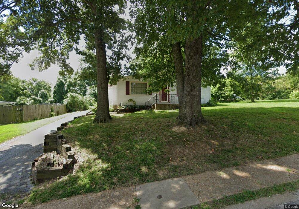
126 Powell Ave Saint Louis, MO 63135
Estimated Value: $105,000 - $154,000
2
Beds
1
Bath
1,112
Sq Ft
$111/Sq Ft
Est. Value
About This Home
This home is located at 126 Powell Ave, Saint Louis, MO 63135 and is currently estimated at $123,443, approximately $111 per square foot. 126 Powell Ave is a home located in St. Louis County with nearby schools including Lee Hamilton Elementary School, Ferguson Middle School, and McCluer High School.
Ownership History
Date
Name
Owned For
Owner Type
Purchase Details
Closed on
Feb 27, 2012
Sold by
Secretary Of Veterans Affairs
Bought by
Bruce W Davis Llc
Current Estimated Value
Purchase Details
Closed on
Oct 27, 2011
Sold by
Phh Mortgage Corporation
Bought by
Secretary Of Veterans Affairs
Purchase Details
Closed on
Oct 26, 2011
Sold by
Patton Doris D
Bought by
Phh Mortgage Corporation
Purchase Details
Closed on
Oct 8, 1999
Sold by
Keersemaker Thomas E and Keersemaker Kathleen A
Bought by
Patton Doris D
Home Financials for this Owner
Home Financials are based on the most recent Mortgage that was taken out on this home.
Original Mortgage
$66,750
Interest Rate
8%
Mortgage Type
VA
Create a Home Valuation Report for This Property
The Home Valuation Report is an in-depth analysis detailing your home's value as well as a comparison with similar homes in the area
Home Values in the Area
Average Home Value in this Area
Purchase History
| Date | Buyer | Sale Price | Title Company |
|---|---|---|---|
| Bruce W Davis Llc | $22,000 | None Available | |
| Secretary Of Veterans Affairs | $35,252 | None Available | |
| Phh Mortgage Corporation | $35,252 | None Available | |
| Patton Doris D | $65,000 | -- |
Source: Public Records
Mortgage History
| Date | Status | Borrower | Loan Amount |
|---|---|---|---|
| Previous Owner | Patton Doris D | $66,750 |
Source: Public Records
Tax History
| Year | Tax Paid | Tax Assessment Tax Assessment Total Assessment is a certain percentage of the fair market value that is determined by local assessors to be the total taxable value of land and additions on the property. | Land | Improvement |
|---|---|---|---|---|
| 2025 | $1,588 | $23,660 | $4,070 | $19,590 |
| 2024 | $1,588 | $21,890 | $3,650 | $18,240 |
| 2023 | $1,579 | $21,890 | $3,650 | $18,240 |
| 2022 | $1,537 | $18,560 | $4,670 | $13,890 |
| 2021 | $1,487 | $18,560 | $4,670 | $13,890 |
| 2020 | $1,248 | $13,950 | $3,330 | $10,620 |
| 2019 | $1,225 | $13,950 | $3,330 | $10,620 |
| 2018 | $1,140 | $11,570 | $3,040 | $8,530 |
| 2017 | $1,118 | $11,570 | $3,040 | $8,530 |
| 2016 | $1,257 | $12,830 | $3,040 | $9,790 |
Source: Public Records
Map
Nearby Homes
- 847 N Florissant Rd
- 35 Robert Ave
- 62 W Cardigan Dr
- 35 E Cardigan Dr
- 6 Sandringham Ln
- 7 Bromley Dr
- 127 Thoroughman Ave
- 410 Robert Ave
- 435 N Clay Ave
- 439 Warford Ave
- 206 Thoroughman Ave
- 700 N Elizabeth Ave
- 8 Drummond Dr
- 820 N Elizabeth Ave
- 411 Warford Ave
- 315 Royal Ave
- 16 White Dr
- 18 White Dr
- 310 N Marguerite Ave
- 509 Royal Ave
Your Personal Tour Guide
Ask me questions while you tour the home.