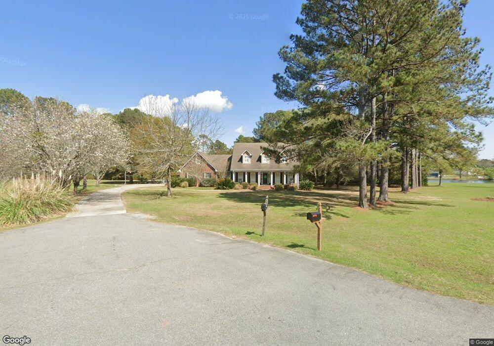
126 Robin Ridge Fitzgerald, GA 31750
Estimated Value: $360,392 - $460,000
4
Beds
3
Baths
3,400
Sq Ft
$120/Sq Ft
Est. Value
About This Home
This home is located at 126 Robin Ridge, Fitzgerald, GA 31750 and is currently estimated at $409,131, approximately $120 per square foot. 126 Robin Ridge is a home located in Ben Hill County with nearby schools including Ben Hill County Primary School, Ben Hill Elementary School, and Ben Hill County Middle School.
Ownership History
Date
Name
Owned For
Owner Type
Purchase Details
Closed on
Jan 30, 2018
Sold by
Benoit Charles E
Bought by
Dawson Rodney Paul
Current Estimated Value
Home Financials for this Owner
Home Financials are based on the most recent Mortgage that was taken out on this home.
Original Mortgage
$179,500
Outstanding Balance
$127,382
Interest Rate
3.95%
Mortgage Type
New Conventional
Estimated Equity
$281,749
Purchase Details
Closed on
Apr 24, 1995
Sold by
Harper Ii Charles M
Bought by
Benoit Charles E
Purchase Details
Closed on
Jan 5, 1990
Bought by
Harper Ii Charles M
Create a Home Valuation Report for This Property
The Home Valuation Report is an in-depth analysis detailing your home's value as well as a comparison with similar homes in the area
Home Values in the Area
Average Home Value in this Area
Purchase History
| Date | Buyer | Sale Price | Title Company |
|---|---|---|---|
| Dawson Rodney Paul | $279,500 | -- | |
| Benoit Charles E | $150,000 | -- | |
| Harper Ii Charles M | $13,500 | -- |
Source: Public Records
Mortgage History
| Date | Status | Borrower | Loan Amount |
|---|---|---|---|
| Open | Dawson Rodney Paul | $179,500 |
Source: Public Records
Tax History Compared to Growth
Tax History
| Year | Tax Paid | Tax Assessment Tax Assessment Total Assessment is a certain percentage of the fair market value that is determined by local assessors to be the total taxable value of land and additions on the property. | Land | Improvement |
|---|---|---|---|---|
| 2024 | $3,618 | $124,002 | $12,800 | $111,202 |
| 2023 | $2,968 | $120,783 | $12,800 | $107,983 |
| 2022 | $3,557 | $113,567 | $12,800 | $100,767 |
| 2021 | $3,555 | $109,480 | $12,800 | $96,680 |
| 2020 | $3,555 | $108,274 | $12,800 | $95,474 |
| 2019 | $3,541 | $108,274 | $12,800 | $95,474 |
| 2018 | $3,288 | $99,383 | $12,800 | $86,583 |
| 2017 | $2,696 | $83,488 | $12,800 | $70,688 |
| 2016 | $2,576 | $83,488 | $12,800 | $70,688 |
| 2015 | -- | $83,488 | $12,800 | $70,688 |
| 2014 | -- | $82,106 | $12,800 | $69,306 |
Source: Public Records
Map
Nearby Homes
- 178 Burnside Rd
- 225 Meadowlark Ln
- 117 Meadowlark Ln
- 152 David Dr
- 141 Wenona Way
- 0 Benjamin H Hill Dr Unit 21545626
- 1171 W Roanoke Dr Ext None
- 160 Lakeview Dr
- 277 Lincoln Ave
- 271 Lincoln Ave
- 650 Benjamin H Hill Dr
- 114 Creole Ct
- 138 Azalea Ln
- 249 Lincoln Ave
- 0 Irwinville Hwy
- 0 Lincoln Ave
- 112 Manor Dr
- 650 Benjamin H Hill Dr W
- 697 Benjamin H Hill Dr
- 105 Halsey St
- 127 Robin Ridge
- 124 Robin Ridge
- 125 Robin Ridge
- 191 Burnside Rd
- 118 Robin Ridge
- 187 Burnside Rd
- 195 Burnside Rd
- 117 Robin Ridge
- 179 Burnside Rd Unit 5
- 204 Meadowlark Ln
- 112 Robin Ridge
- 183 Burnside Rd
- 111 Robin Ridge
- 200 Burnside Rd
- Lot 12 Brunside Raod
- 131 Burnside Rd
- 188 Burnside Rd
- 194 Meadowlark Ln
- 129 Burnside Rd
- 290 Burnside Rd