Estimated Value: $204,231
--
Bed
--
Bath
4,320
Sq Ft
$47/Sq Ft
Est. Value
About This Home
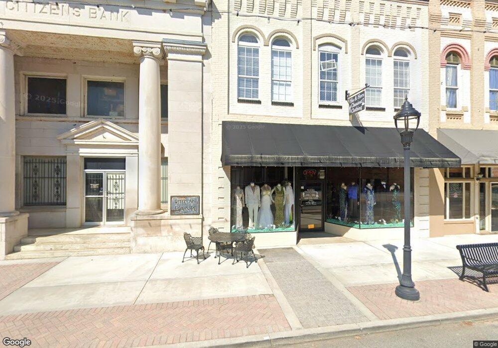
This home is located at 126 S Broad St, Cairo, GA 39828 and is currently priced at $204,231, approximately $47 per square foot. 126 S Broad St is a home located in Grady County with nearby schools including Cairo High School.
Ownership History
Date
Name
Owned For
Owner Type
Purchase Details
Closed on
Jan 18, 2022
Sold by
Mills Hazel R
Bought by
Plath Barry and Plath Kimberly
Current Estimated Value
Home Financials for this Owner
Home Financials are based on the most recent Mortgage that was taken out on this home.
Original Mortgage
$231,767
Interest Rate
3.45%
Mortgage Type
Cash
Purchase Details
Closed on
Dec 28, 2010
Sold by
Farmers & Merchants Bank
Bought by
Mills Hazel R
Purchase Details
Closed on
Oct 5, 2010
Sold by
Rocuant Albert
Bought by
Farmers & Merchants Bank
Purchase Details
Closed on
Apr 18, 2006
Sold by
Rocuant Albert
Bought by
Rocuant Albert
Purchase Details
Closed on
Feb 16, 2006
Sold by
Rocuant Albert
Bought by
Rocuant Albert and Rocuant Debra
Purchase Details
Closed on
Dec 19, 2005
Sold by
Thompson Dewey A
Bought by
Rocuant Albert
Purchase Details
Closed on
Jan 8, 1999
Sold by
Porter'S
Bought by
Thompson Dewey A
Purchase Details
Closed on
Jul 31, 1970
Bought by
Porter'S
Create a Home Valuation Report for This Property
The Home Valuation Report is an in-depth analysis detailing your home's value as well as a comparison with similar homes in the area
Home Values in the Area
Average Home Value in this Area
Purchase History
| Date | Buyer | Sale Price | Title Company |
|---|---|---|---|
| Plath Barry | $175,000 | -- | |
| Mills Hazel R | $60,000 | -- | |
| Farmers & Merchants Bank | -- | -- | |
| Rocuant Albert | -- | -- | |
| Rocuant Albert | -- | -- | |
| Rocuant Albert | $75,000 | -- | |
| Thompson Dewey A | $55,000 | -- | |
| Porter'S | -- | -- |
Source: Public Records
Mortgage History
| Date | Status | Borrower | Loan Amount |
|---|---|---|---|
| Closed | Plath Barry | $231,767 |
Source: Public Records
Tax History Compared to Growth
Tax History
| Year | Tax Paid | Tax Assessment Tax Assessment Total Assessment is a certain percentage of the fair market value that is determined by local assessors to be the total taxable value of land and additions on the property. | Land | Improvement |
|---|---|---|---|---|
| 2024 | $3,000 | $76,029 | $4,181 | $71,848 |
| 2023 | $1,663 | $44,928 | $5,152 | $39,776 |
| 2022 | $1,730 | $44,928 | $5,152 | $39,776 |
| 2021 | $1,734 | $44,928 | $5,152 | $39,776 |
| 2020 | $1,739 | $44,928 | $5,152 | $39,776 |
| 2019 | $1,739 | $44,928 | $5,152 | $39,776 |
| 2018 | $1,653 | $44,928 | $5,152 | $39,776 |
| 2017 | $1,590 | $44,928 | $5,152 | $39,776 |
| 2016 | $1,625 | $44,928 | $5,152 | $39,776 |
| 2015 | $1,609 | $44,928 | $5,152 | $39,776 |
| 2014 | $1,610 | $44,928 | $5,152 | $39,776 |
| 2013 | -- | $44,927 | $5,152 | $39,775 |
Source: Public Records
Map
Nearby Homes
- X 1st St
- 00 Hwy 111 South Tract 1
- 316,322 NW 1st St + Lot
- 0 1st St
- 4761 Hadley Ferry Rd
- 309 3rd St SE
- 000 S Broad St
- 000 Hwy 111 South 20 59 Acres
- 40 5th Ave SW
- 125 6th Ave NW
- Lot #15, 3 64 Acres Oakbend Cir
- 00 00 Hwy 111 South Tract 2
- 117 6th St SW
- 471 4th St SE
- 481 4th St SE
- 27 6th Ave SW
- 460 2nd St SW
- 602 4th St SE
- 720 1st St SW
- 711 2nd Ave NE
- 124 S Broad St
- 128 S Broad St
- 7 1st St
- 7 1st Ave SW
- 2.5ACR Long Leaf Lane (Parcel0094a006001)
- 146 S Broad St Unit 1
- 146 S Broad St
- N Georgia 111
- 137 S Broad St
- 139 S Broad St
- 141 S Broad St
- 4 S Broad St
- 00 1st Ave NE
- 2 N Broad St
- 22 1st Ave NE
- 21 Martin Luther King Junior Ave Unit 11
- 21 Martin Luther King Junior Ave Unit 21
- 21 Martin Luther King Junior Ave Unit 15
- 21 Martin Luther King Junior Ave
- 21 Martin Luther King Junior Ave Unit 17