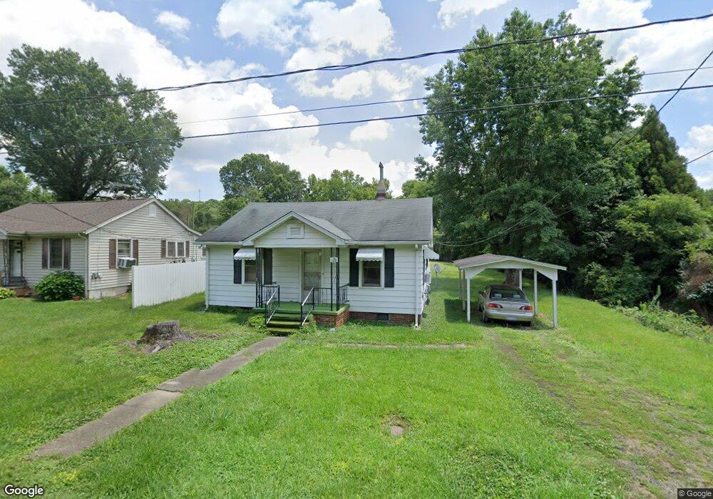
126 Spring St Unit 2272488-61591 Denton, NC 27239
Estimated Value: $115,798 - $169,000
2
Beds
3
Baths
818
Sq Ft
$189/Sq Ft
Est. Value
About This Home
This home is located at 126 Spring St Unit 2272488-61591, Denton, NC 27239 and is currently estimated at $154,450, approximately $188 per square foot. 126 Spring St Unit 2272488-61591 is a home located in Davidson County with nearby schools including Denton Elementary School and South Davidson Middle and High School.
Ownership History
Date
Name
Owned For
Owner Type
Purchase Details
Closed on
May 5, 2025
Sold by
K & P Holdings Llc
Bought by
Furr Austin R and Swanson Carlton C
Current Estimated Value
Home Financials for this Owner
Home Financials are based on the most recent Mortgage that was taken out on this home.
Original Mortgage
$167,000
Outstanding Balance
$166,349
Interest Rate
6.15%
Mortgage Type
New Conventional
Estimated Equity
-$11,899
Purchase Details
Closed on
Mar 6, 2023
Sold by
Ball Davin J
Bought by
K & P Holdings Llc and Saki Investments Llc
Purchase Details
Closed on
Dec 6, 2017
Sold by
Kearns Vernon and Kearns Shirley
Bought by
Ball Davin J
Purchase Details
Closed on
Mar 1, 1979
Create a Home Valuation Report for This Property
The Home Valuation Report is an in-depth analysis detailing your home's value as well as a comparison with similar homes in the area
Home Values in the Area
Average Home Value in this Area
Purchase History
| Date | Buyer | Sale Price | Title Company |
|---|---|---|---|
| Furr Austin R | $165,000 | None Listed On Document | |
| Furr Austin R | $165,000 | None Listed On Document | |
| K & P Holdings Llc | $180,000 | -- | |
| Ball Davin J | -- | None Available | |
| -- | $9,500 | -- |
Source: Public Records
Mortgage History
| Date | Status | Borrower | Loan Amount |
|---|---|---|---|
| Open | Furr Austin R | $167,000 | |
| Closed | Furr Austin R | $167,000 |
Source: Public Records
Tax History Compared to Growth
Tax History
| Year | Tax Paid | Tax Assessment Tax Assessment Total Assessment is a certain percentage of the fair market value that is determined by local assessors to be the total taxable value of land and additions on the property. | Land | Improvement |
|---|---|---|---|---|
| 2025 | $630 | $56,110 | $0 | $0 |
| 2024 | $630 | $56,110 | $0 | $0 |
| 2023 | $640 | $56,110 | $0 | $0 |
| 2022 | $630 | $56,110 | $0 | $0 |
| 2021 | $630 | $56,110 | $0 | $0 |
| 2020 | $552 | $49,140 | $0 | $0 |
| 2019 | $560 | $49,140 | $0 | $0 |
| 2018 | $560 | $49,140 | $0 | $0 |
| 2017 | $560 | $49,140 | $0 | $0 |
| 2016 | $560 | $49,140 | $0 | $0 |
| 2015 | $536 | $49,140 | $0 | $0 |
| 2014 | $566 | $51,900 | $0 | $0 |
Source: Public Records
Map
Nearby Homes
- 148 Garner St
- 162 E 3rd St
- 00 N Carolina 47
- 61 Haywood St
- 00 3rd St
- 434 E Salisbury St
- 240 Anderson St
- 0 Jones St
- 249 Farmbrook Dr
- 320 Forest Park Dr
- 278 Forest Park Dr
- 539 W Salisbury St
- 491 W Peacock Ave
- 572 Bombay Rd
- 191 Howell Dr
- 0000 Bombay Rd
- 149 Seeley Dr
- 219 Dot St
- 952 Flat Swamp Rd
- 997 Yates Rd