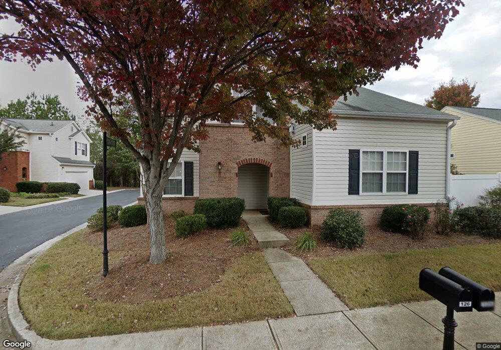
126 Swanee Ln Unit 1B Woodstock, GA 30188
Estimated Value: $347,000 - $368,343
3
Beds
3
Baths
1,604
Sq Ft
$223/Sq Ft
Est. Value
About This Home
This home is located at 126 Swanee Ln Unit 1B, Woodstock, GA 30188 and is currently estimated at $357,672, approximately $222 per square foot. 126 Swanee Ln Unit 1B is a home located in Cherokee County with nearby schools including Woodstock Elementary School, Woodstock Middle School, and Woodstock High School.
Ownership History
Date
Name
Owned For
Owner Type
Purchase Details
Closed on
Aug 22, 2003
Sold by
Colony Homes Llc
Bought by
Tucker Kimberly C
Current Estimated Value
Home Financials for this Owner
Home Financials are based on the most recent Mortgage that was taken out on this home.
Original Mortgage
$141,045
Outstanding Balance
$63,881
Interest Rate
6.13%
Mortgage Type
FHA
Estimated Equity
$293,791
Create a Home Valuation Report for This Property
The Home Valuation Report is an in-depth analysis detailing your home's value as well as a comparison with similar homes in the area
Home Values in the Area
Average Home Value in this Area
Purchase History
| Date | Buyer | Sale Price | Title Company |
|---|---|---|---|
| Tucker Kimberly C | $141,200 | -- |
Source: Public Records
Mortgage History
| Date | Status | Borrower | Loan Amount |
|---|---|---|---|
| Open | Tucker Kimberly C | $141,045 |
Source: Public Records
Tax History Compared to Growth
Tax History
| Year | Tax Paid | Tax Assessment Tax Assessment Total Assessment is a certain percentage of the fair market value that is determined by local assessors to be the total taxable value of land and additions on the property. | Land | Improvement |
|---|---|---|---|---|
| 2025 | $3,158 | $143,176 | $26,000 | $117,176 |
| 2024 | $3,069 | $138,784 | $26,000 | $112,784 |
| 2023 | $261 | $140,872 | $26,000 | $114,872 |
| 2022 | $2,704 | $113,884 | $21,600 | $92,284 |
| 2021 | $2,023 | $89,332 | $17,400 | $71,932 |
| 2020 | $2,355 | $80,780 | $15,600 | $65,180 |
| 2019 | $1,714 | $73,800 | $14,400 | $59,400 |
| 2018 | $1,635 | $69,400 | $13,200 | $56,200 |
| 2017 | $1,533 | $159,300 | $11,200 | $52,520 |
| 2016 | $1,469 | $150,000 | $11,200 | $48,800 |
| 2015 | $1,399 | $141,200 | $9,000 | $47,480 |
| 2014 | $1,086 | $110,800 | $9,000 | $35,320 |
Source: Public Records
Map
Nearby Homes
- 702 Barberry Dr
- 212 Hiawassee Dr
- 530 Georgia Way
- 363 Hiawassee Dr
- 184 Swanee Ln Unit 1C
- 544 Ridge View Crossing
- 208 Etowah Way
- 643 N Rope Mill Rd Unit 634
- 643 N Rope Mill Rd
- 1557 River Park Blvd
- 490 Payne Rd
- 635 Stately Dr
- 414 Ruths Blvd
- 391 Lincoln St
- 501 Ruths Dr
- 145 Archie Way
- 149 Archie Way
- 5541 Old Highway 5
- 515 Evans Ln
- 2295 Ansley Ct
- 124 Swanee Ln
- 130 Swanee Ln
- 122 Swanee Ln
- 128 Swanee Ln Unit 4
- 128 Swanee Ln Unit 1B
- 120 Swanee Ln
- 134 Swanee Ln
- 705 Barberry Dr
- 118 Swanee Ln Unit 1A
- 132 Swanee Ln
- 137 Swanee Ln
- 137 Swanee Ln
- 116 Swanee Ln
- 703 Barberry Dr
- 131 Swanee Ln
- 701 Barberry Dr
- 139 Swanee Ln
- 149 Swanee Ln
- 604 Tanners Crossing
- 114 Swanee Ln Unit 1A