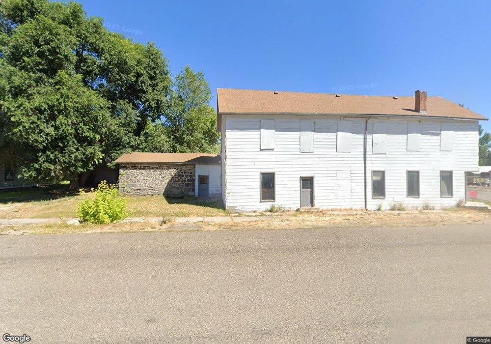
126 W Market St Albion, ID 83311
Estimated Value: $295,000 - $414,000
--
Bed
3
Baths
2,274
Sq Ft
$154/Sq Ft
Est. Value
About This Home
This home is located at 126 W Market St, Albion, ID 83311 and is currently estimated at $350,413, approximately $154 per square foot. 126 W Market St is a home with nearby schools including Albion Elementary School, Declo Junior High School, and Declo Senior High School.
Ownership History
Date
Name
Owned For
Owner Type
Purchase Details
Closed on
Sep 23, 2019
Sold by
Brackenbury Brian
Bought by
Holman Lance and Holman Sarah
Current Estimated Value
Home Financials for this Owner
Home Financials are based on the most recent Mortgage that was taken out on this home.
Original Mortgage
$128,000
Outstanding Balance
$112,118
Interest Rate
3.6%
Mortgage Type
New Conventional
Estimated Equity
$238,295
Purchase Details
Closed on
Apr 22, 2016
Sold by
Keller Sue Ellen B and Keller Sue Ellen
Bought by
Brackenbury Brian
Home Financials for this Owner
Home Financials are based on the most recent Mortgage that was taken out on this home.
Original Mortgage
$89,992
Interest Rate
3.68%
Mortgage Type
Commercial
Create a Home Valuation Report for This Property
The Home Valuation Report is an in-depth analysis detailing your home's value as well as a comparison with similar homes in the area
Home Values in the Area
Average Home Value in this Area
Purchase History
| Date | Buyer | Sale Price | Title Company |
|---|---|---|---|
| Holman Lance | -- | Title One | |
| Brackenbury Brian | -- | Titleone A Title & Escrow Co |
Source: Public Records
Mortgage History
| Date | Status | Borrower | Loan Amount |
|---|---|---|---|
| Open | Holman Lance | $128,000 | |
| Previous Owner | Brackenbury Brian | $89,992 |
Source: Public Records
Tax History Compared to Growth
Tax History
| Year | Tax Paid | Tax Assessment Tax Assessment Total Assessment is a certain percentage of the fair market value that is determined by local assessors to be the total taxable value of land and additions on the property. | Land | Improvement |
|---|---|---|---|---|
| 2024 | $475 | $164,011 | $13,142 | $150,869 |
| 2023 | $500 | $164,011 | $13,142 | $150,869 |
| 2022 | $549 | $140,997 | $13,142 | $127,855 |
| 2021 | $543 | $115,614 | $13,142 | $102,472 |
| 2020 | $436 | $83,198 | $9,735 | $73,463 |
Source: Public Records
Map
Nearby Homes
- 249 W North St
- 263 Whitman St
- 327 Whitman St
- 515 School St
- 1000 E 900 S
- TBD Marsh Creek Rd
- 992 E 900 S
- 1200 Lands Creek Rd
- 1200 S Lands Creek Rd
- Marsh Creek Rd
- 497 S 650 E
- 106 W 3rd St
- 0 E Highway 81
- 60 850 E
- 1005 E 00 S
- 605 E Highway 81
- 394 E 300 Rd S
- Lot 8 E Island Ct
- Lot 9 E Island Ct
- Lot 4 E Island Ct
- 136/138 W Market St
- 136 W Market St
- L3 B1 Henry's N 40
- 00 Tba
- TBA S Hwy 77
- TBD Harper
- 125 West St
- 137 W Market St
- 135 West St
- 186 West St
- 136 West St
- 111 West St
- 111 W Main St
- 201 W Market St
- 251 W North St Unit AKA: Sage Mountain G
- 210 West St
- TBD S Main St
- 1250 E 750 S Parcel 2&3 (10 Acres)
- 1250 E 750 S Parcel 1(4 2 Acres)
- 210 W Market St