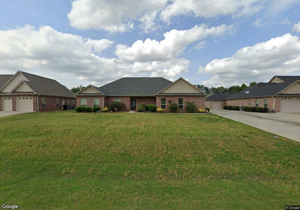
126 W Starlite Dr Texarkana, TX 75501
Estimated Value: $335,000 - $408,000
--
Bed
--
Bath
2,314
Sq Ft
$158/Sq Ft
Est. Value
About This Home
This home is located at 126 W Starlite Dr, Texarkana, TX 75501 and is currently estimated at $365,937, approximately $158 per square foot. 126 W Starlite Dr is a home located in Bowie County with nearby schools including Liberty-Eylau Early Childhood Center, Liberty-Eylau Primary School, and Liberty-Eylau C.K. Bender Elementary Campus.
Ownership History
Date
Name
Owned For
Owner Type
Purchase Details
Closed on
Jan 27, 2010
Sold by
Cbsc Inc
Bought by
Nelson Sylvester L and Nelson Sarah
Current Estimated Value
Home Financials for this Owner
Home Financials are based on the most recent Mortgage that was taken out on this home.
Original Mortgage
$223,500
Outstanding Balance
$146,592
Interest Rate
4.93%
Mortgage Type
VA
Estimated Equity
$219,345
Create a Home Valuation Report for This Property
The Home Valuation Report is an in-depth analysis detailing your home's value as well as a comparison with similar homes in the area
Home Values in the Area
Average Home Value in this Area
Purchase History
| Date | Buyer | Sale Price | Title Company |
|---|---|---|---|
| Nelson Sylvester L | -- | None Available |
Source: Public Records
Mortgage History
| Date | Status | Borrower | Loan Amount |
|---|---|---|---|
| Open | Nelson Sylvester L | $223,500 |
Source: Public Records
Tax History Compared to Growth
Tax History
| Year | Tax Paid | Tax Assessment Tax Assessment Total Assessment is a certain percentage of the fair market value that is determined by local assessors to be the total taxable value of land and additions on the property. | Land | Improvement |
|---|---|---|---|---|
| 2025 | -- | $412,158 | -- | -- |
| 2024 | $5,535 | $374,689 | $21,500 | $409,591 |
| 2023 | $5,090 | $340,626 | $0 | $0 |
| 2022 | $5,336 | $367,747 | $21,500 | $346,247 |
| 2021 | $5,158 | $281,509 | $20,000 | $261,509 |
| 2020 | $4,970 | $269,250 | $20,000 | $249,250 |
| 2019 | $5,003 | $257,565 | $20,000 | $237,565 |
| 2018 | $4,828 | $248,560 | $20,000 | $228,560 |
| 2017 | $4,815 | $248,835 | $20,000 | $228,835 |
| 2016 | $4,815 | $248,835 | $20,000 | $228,835 |
| 2015 | -- | $246,637 | $20,000 | $226,637 |
| 2014 | -- | $223,009 | $20,000 | $203,009 |
Source: Public Records
Map
Nearby Homes
- 194 W Starlite Dr
- 280 Patriot Way
- 101 Redwood Dr
- 6 Southridge St
- 6514 Buchanan Loop Rd
- 7689 Us-59
- 403 Brookfield St
- 7685 State Highway 59
- 6606 Us-59
- 6606 Us Highway 59 S
- 144 Joe Tyl Rd
- 6815 Buchanan Loop Rd
- 2043 Randall Rd
- 206 Fm 3244
- lot15 B2 Quail Brook
- lot15 B1 Quail Brook
- lot14 B2 Quail Brook
- Lot 1 B2 Quail Brook
- 39 Quail Brook Dr
- 0 Randall Rd
- 118 W Starlite Dr
- 150 W Starlite Dr
- 175 Patriot Way
- 155 Patriot Way
- 104 W Starlite Dr
- 172 W Starlite Dr
- 135 Patriot Way
- 319 W Starlite Dr
- 0 W Starlite Dr
- 195 Patriot Way
- 131 W Starlite Dr
- 115 W Starlite Dr
- 153 W Starlite Dr
- 215 Patriot Way
- 101 W Starlite Dr
- 175 W Starlite Dr
- 180 Patriot Way
- 160 Patriot Way
- 140 Patriot Way
- 214 W Starlite Dr