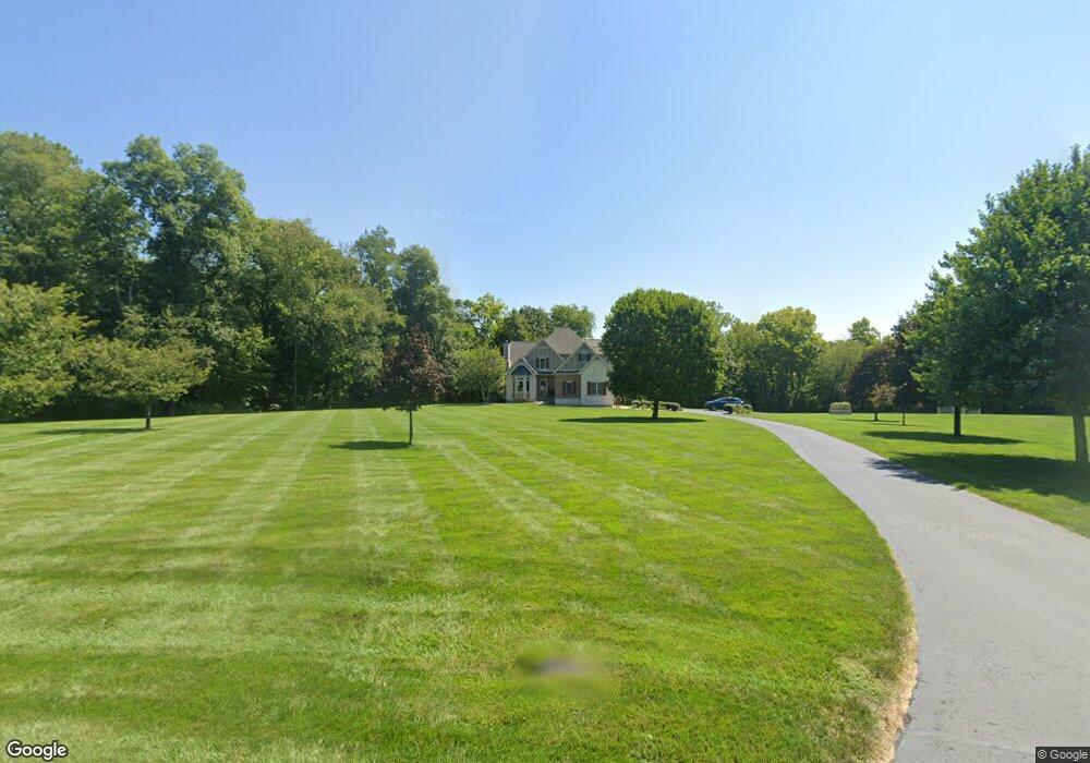
126 Wesley Way Wilmington, OH 45177
Estimated Value: $568,000 - $649,692
3
Beds
3
Baths
4,286
Sq Ft
$144/Sq Ft
Est. Value
About This Home
This home is located at 126 Wesley Way, Wilmington, OH 45177 and is currently estimated at $616,673, approximately $143 per square foot. 126 Wesley Way is a home located in Clinton County with nearby schools including East End Elementary School, Roy E. Holmes Elementary School, and Denver Place Elementary School.
Ownership History
Date
Name
Owned For
Owner Type
Purchase Details
Closed on
Aug 5, 1999
Sold by
Borton Jeffrey A
Bought by
Stromberg Christopher D and Stromberg Christine L
Current Estimated Value
Home Financials for this Owner
Home Financials are based on the most recent Mortgage that was taken out on this home.
Original Mortgage
$220,000
Interest Rate
7.68%
Mortgage Type
Balloon
Purchase Details
Closed on
Jan 29, 1999
Sold by
Borton James D
Bought by
Borton Jeffrey A and Borton Jill L
Purchase Details
Closed on
Jan 1, 1990
Bought by
Borton James D
Create a Home Valuation Report for This Property
The Home Valuation Report is an in-depth analysis detailing your home's value as well as a comparison with similar homes in the area
Home Values in the Area
Average Home Value in this Area
Purchase History
| Date | Buyer | Sale Price | Title Company |
|---|---|---|---|
| Stromberg Christopher D | $275,000 | -- | |
| Borton Jeffrey A | $30,100 | -- | |
| Borton James D | -- | -- |
Source: Public Records
Mortgage History
| Date | Status | Borrower | Loan Amount |
|---|---|---|---|
| Previous Owner | Stromberg Christopher D | $220,000 |
Source: Public Records
Tax History Compared to Growth
Tax History
| Year | Tax Paid | Tax Assessment Tax Assessment Total Assessment is a certain percentage of the fair market value that is determined by local assessors to be the total taxable value of land and additions on the property. | Land | Improvement |
|---|---|---|---|---|
| 2024 | $6,075 | $193,800 | $23,140 | $170,660 |
| 2023 | $6,075 | $193,800 | $23,140 | $170,660 |
| 2022 | $5,301 | $158,650 | $10,220 | $148,430 |
| 2021 | $5,362 | $158,650 | $10,220 | $148,430 |
| 2020 | $5,181 | $158,650 | $10,220 | $148,430 |
| 2019 | $4,421 | $124,640 | $10,380 | $114,260 |
| 2018 | $4,462 | $124,640 | $10,380 | $114,260 |
| 2017 | $4,338 | $124,640 | $10,380 | $114,260 |
| 2016 | $3,229 | $92,040 | $19,660 | $72,380 |
| 2015 | $3,228 | $92,040 | $19,660 | $72,380 |
| 2013 | $3,506 | $96,610 | $17,090 | $79,520 |
Source: Public Records
Map
Nearby Homes
- 52 Maple Point Ct
- 2536 Wayne Rd
- 987 N Nelson Ave
- 1697 Oglesbee Rd
- 1685 N Webb Rd
- 493 Mitchell Rd
- 307 Hawthorne Dr
- 1253 Us Route 68
- 0 US Route 68 Unit 1792385
- 0 US Route 68 Unit 1831183
- 629 Oakridge Dr
- 585 Silverado Dr
- 1247 Peggy Ln
- 1706 Woodside Dr
- 588 John Chambers Dr
- 1351 Mayfair Dr
- 1244 Mayfair Dr
- 241 Raycon Dr
- 328 A St
- 584 Howard St
- 110 Wesley Way
- 2216 Mitchell Rd
- 130 Wesley Way
- 82 Wesley Way
- 162 Wesley Way
- 194 Wesley Way
- 34 Wesley Way
- 31 Mitchell Rd
- 2344 Mitchell Rd
- 2472 Mitchell Rd
- 2312 Mitchell Rd
- 2312 Mitchell Rd
- 2530 Mitchell Rd
- 2518 Mitchell Rd
- 2389 Mitchell Rd
- 2429 Mitchell Rd
- 27 Mitchell Hill Rd
- 2469 Mitchell Rd
- 20 Mitchell Hill Rd
- 2640 Mitchell Rd