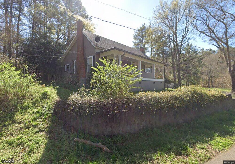
1260 Adams Rd Cedartown, GA 30125
Estimated Value: $206,000 - $244,000
2
Beds
2
Baths
1,284
Sq Ft
$178/Sq Ft
Est. Value
About This Home
This home is located at 1260 Adams Rd, Cedartown, GA 30125 and is currently estimated at $229,026, approximately $178 per square foot. 1260 Adams Rd is a home located in Polk County with nearby schools including Vineyard Harvester Christian Academy.
Ownership History
Date
Name
Owned For
Owner Type
Purchase Details
Closed on
Jun 30, 2008
Sold by
Not Provided
Bought by
Hines William A and Hines Trusteeshines
Current Estimated Value
Purchase Details
Closed on
Mar 20, 2008
Sold by
Not Provided
Bought by
Hines William A and Hines Trusteeshines
Purchase Details
Closed on
Feb 4, 1987
Sold by
Wood Roger
Bought by
Hines Elizabeth M
Purchase Details
Closed on
Nov 1, 1986
Sold by
Wood Roger
Bought by
Hines Elizabeth M
Purchase Details
Closed on
Aug 1, 1983
Bought by
Hines Elizabeth M
Create a Home Valuation Report for This Property
The Home Valuation Report is an in-depth analysis detailing your home's value as well as a comparison with similar homes in the area
Home Values in the Area
Average Home Value in this Area
Purchase History
| Date | Buyer | Sale Price | Title Company |
|---|---|---|---|
| Hines William A | -- | -- | |
| Hines William A | -- | -- | |
| Hines William A | -- | -- | |
| Hines William A | -- | -- | |
| Hines Elizabeth M | $13,000 | -- | |
| Hines Elizabeth M | -- | -- | |
| Hines Elizabeth M | -- | -- |
Source: Public Records
Tax History Compared to Growth
Tax History
| Year | Tax Paid | Tax Assessment Tax Assessment Total Assessment is a certain percentage of the fair market value that is determined by local assessors to be the total taxable value of land and additions on the property. | Land | Improvement |
|---|---|---|---|---|
| 2024 | $1,539 | $73,614 | $3,545 | $70,069 |
| 2023 | $1,190 | $50,139 | $3,545 | $46,594 |
| 2022 | $1,022 | $43,043 | $2,363 | $40,680 |
| 2021 | $1,035 | $43,043 | $2,363 | $40,680 |
| 2020 | $1,037 | $43,043 | $2,363 | $40,680 |
| 2019 | $830 | $30,909 | $2,363 | $28,546 |
| 2018 | $835 | $30,301 | $2,363 | $27,938 |
| 2017 | $825 | $30,301 | $2,363 | $27,938 |
| 2016 | $812 | $29,856 | $3,316 | $26,539 |
| 2015 | $838 | $30,707 | $3,316 | $27,390 |
| 2014 | $844 | $30,707 | $3,316 | $27,390 |
Source: Public Records
Map
Nearby Homes
- 1250 Adams Rd
- 0 Collins Rd Unit 10627302
- 5866 Hwy 27 S
- 90 W Meadow Lakes Blvd
- 5854 Cedartown Hwy SW
- 0 Booger Hollow Rd
- 113 Cherokee Estates Dr
- 88 Sequoyah Ct
- 31 Meadow Lakes Terrace
- TRACT3 Drummond Rd
- Tract2 Drummond Rd
- 2236 Rome Hwy
- 1170 Lake Creek Rd
- 600 Miller Rd
- 110 Mulberry Ln
- 0 Colquitt Rd Unit 25175705
- 0 Colquitt Rd Unit 7661475
- 0 Colquitt Rd Unit 10623944
- 2129 Lake Creek Rd
- 0 Rome Hwy Unit 10521649