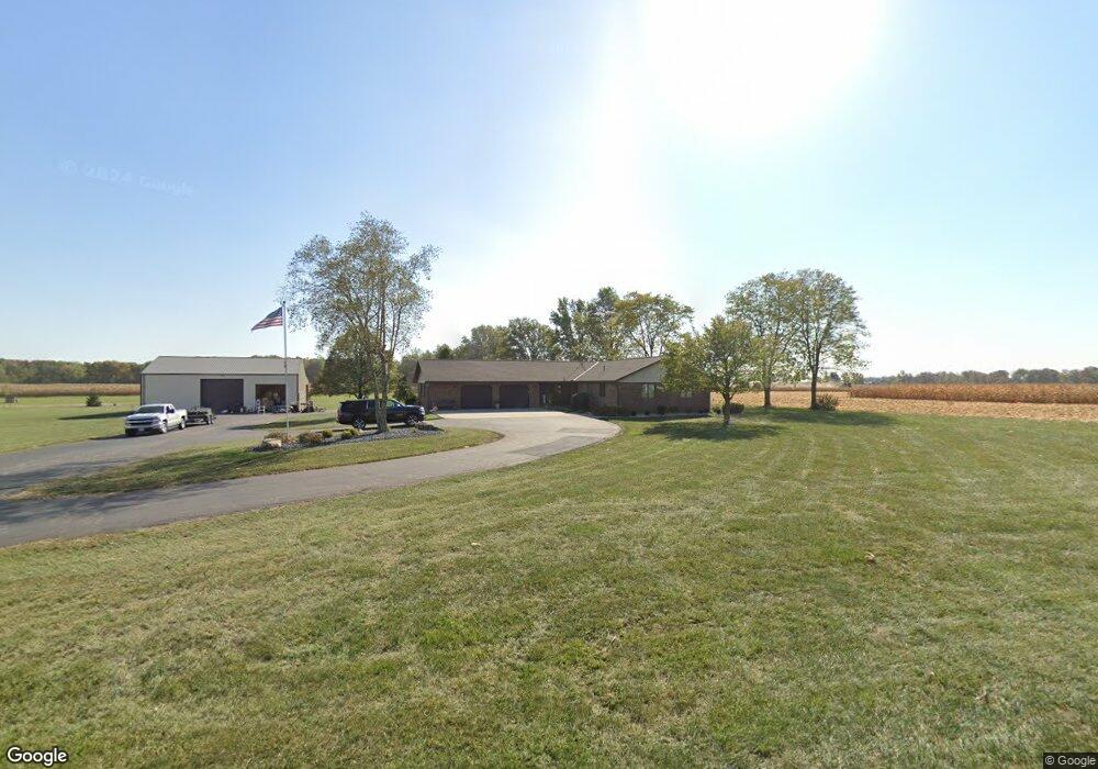
1260 Fort Recovery Minster Rd Fort Recovery, OH 45846
Estimated Value: $271,000 - $518,000
3
Beds
3
Baths
2,008
Sq Ft
$213/Sq Ft
Est. Value
About This Home
This home is located at 1260 Fort Recovery Minster Rd, Fort Recovery, OH 45846 and is currently estimated at $427,201, approximately $212 per square foot. 1260 Fort Recovery Minster Rd is a home located in Mercer County with nearby schools including Fort Recovery Elementary School, Fort Recovery Middle School, and Fort Recovery High School.
Ownership History
Date
Name
Owned For
Owner Type
Purchase Details
Closed on
Jan 10, 2024
Sold by
Juite Douglas E
Bought by
Fortkamp Nathan and Fortkamp Jamie
Current Estimated Value
Purchase Details
Closed on
Dec 3, 2019
Sold by
Borger Virginia and Grube Barbara
Bought by
Kaiser Timothy L and Kaiser Julia A
Home Financials for this Owner
Home Financials are based on the most recent Mortgage that was taken out on this home.
Original Mortgage
$180,000
Interest Rate
3.6%
Mortgage Type
New Conventional
Purchase Details
Closed on
Jan 25, 2000
Bought by
Bergman Family Trust
Create a Home Valuation Report for This Property
The Home Valuation Report is an in-depth analysis detailing your home's value as well as a comparison with similar homes in the area
Home Values in the Area
Average Home Value in this Area
Purchase History
| Date | Buyer | Sale Price | Title Company |
|---|---|---|---|
| Fortkamp Nathan | $1,701,133 | None Listed On Document | |
| Kaiser Timothy L | $350,000 | None Available | |
| Bergman Family Trust | -- | -- |
Source: Public Records
Mortgage History
| Date | Status | Borrower | Loan Amount |
|---|---|---|---|
| Previous Owner | Kaiser Timothy L | $180,000 |
Source: Public Records
Tax History Compared to Growth
Tax History
| Year | Tax Paid | Tax Assessment Tax Assessment Total Assessment is a certain percentage of the fair market value that is determined by local assessors to be the total taxable value of land and additions on the property. | Land | Improvement |
|---|---|---|---|---|
| 2024 | $3,424 | $122,020 | $15,090 | $106,930 |
| 2023 | $3,424 | $122,020 | $15,090 | $106,930 |
| 2022 | $2,816 | $89,920 | $11,760 | $78,160 |
| 2021 | $2,825 | $89,920 | $11,760 | $78,160 |
| 2020 | $2,819 | $89,920 | $11,760 | $78,160 |
| 2019 | $2,293 | $79,000 | $10,400 | $68,600 |
| 2018 | $2,377 | $79,000 | $10,400 | $68,600 |
| 2017 | $2,344 | $79,000 | $10,400 | $68,600 |
| 2016 | $2,293 | $77,740 | $10,470 | $67,270 |
| 2015 | $2,201 | $77,740 | $10,470 | $67,270 |
| 2014 | $2,237 | $77,740 | $10,470 | $67,270 |
| 2013 | $2,204 | $73,360 | $9,870 | $63,490 |
Source: Public Records
Map
Nearby Homes
- 207 W Butler St
- 0 Ohio 118
- 4475 Ohio 705
- 820 Mary Ln
- 821 Butler St
- 420 S 1st St
- 311 E Main St
- 408 E Main St
- 501 N 2nd St
- 309 E Vine St
- 12734 State Route 49
- 2332 State Route 29
- 3709 Rossburg-Lightsville Rd
- 1610 E Division Rd
- 6699 Gause Rd
- 1096 E 26 Hwy
- 0 Anderson Lots 10 11 & 12 Ln Unit 1037885
- 0 Springer 1-6 & Roadway 14-16 Unit 1037883
- 1083 Washington Rd
- 0 Anderson 13&14 & Roadway 12&13 Unit 1037886
- 1284 Fort Recovery Minster Rd
- 1215 Fort Recovery Minster Rd
- 1195 Fort Recovery Minster Rd
- 1181 Fort Recovery Minster Rd
- 1140 Fort Recovery Minster Rd
- 1130 Fort Recovery Minster Rd
- 1053 Fort Recovery Minster Rd
- 1053 Fort Recovery Minster Rd
- 1971 Saint Peter Rd
- 1035 Fort Recovery Minster Rd
- 1088 State Route 119
- 1038 State Route 119
- 808 Blue Jacket Dr
- 806A Blue Jacket Dr
- 1951 Flaler Rd
- 1961 Flaler Rd
- 1002 State Route 119
- 2135 Saint Peter Rd
- 1899 Flaler Rd
- 1881 Flaler Rd