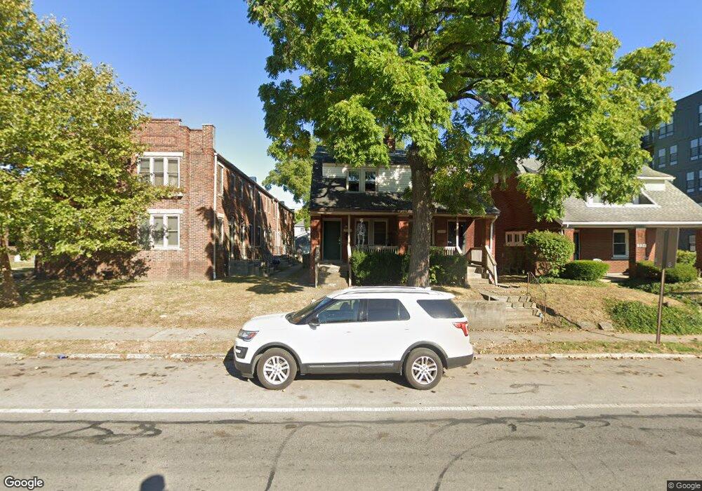
1260 N 4th St Unit 20 Columbus, OH 43201
Weinland Park NeighborhoodEstimated Value: $122,399 - $509,000
3
Beds
2
Baths
1,664
Sq Ft
$157/Sq Ft
Est. Value
About This Home
This home is located at 1260 N 4th St Unit 20, Columbus, OH 43201 and is currently estimated at $261,466, approximately $157 per square foot. 1260 N 4th St Unit 20 is a home located in Franklin County with nearby schools including Weinland Park Elementary School, Dominion Middle School, and Whetstone High School.
Ownership History
Date
Name
Owned For
Owner Type
Purchase Details
Closed on
Nov 16, 2022
Sold by
Watkins Elizabeth
Bought by
Madrid Kevin A Espino and Bahena Ana Lilia
Current Estimated Value
Purchase Details
Closed on
Aug 29, 2012
Sold by
Fannie Mae
Bought by
Watkins Elizabeth
Purchase Details
Closed on
Jan 27, 2012
Sold by
Conner Beverly J
Bought by
Fannie Mae and Federal National Mortgage Association
Purchase Details
Closed on
Nov 18, 2009
Sold by
Corner Beverly J
Bought by
Bank Of America and Wholesale Lender Countrywide Funding Cor
Purchase Details
Closed on
Jul 1, 1991
Bought by
Corner Beverly J
Purchase Details
Closed on
Jan 9, 1989
Purchase Details
Closed on
Sep 13, 1988
Create a Home Valuation Report for This Property
The Home Valuation Report is an in-depth analysis detailing your home's value as well as a comparison with similar homes in the area
Home Values in the Area
Average Home Value in this Area
Purchase History
| Date | Buyer | Sale Price | Title Company |
|---|---|---|---|
| Madrid Kevin A Espino | $60,000 | Northwest Advantage Title Agen | |
| Watkins Elizabeth | $1,000 | None Available | |
| Fannie Mae | $8,000 | Attorney | |
| Bank Of America | -- | Attorney | |
| Corner Beverly J | $33,500 | -- | |
| -- | -- | -- | |
| -- | -- | -- |
Source: Public Records
Tax History Compared to Growth
Tax History
| Year | Tax Paid | Tax Assessment Tax Assessment Total Assessment is a certain percentage of the fair market value that is determined by local assessors to be the total taxable value of land and additions on the property. | Land | Improvement |
|---|---|---|---|---|
| 2024 | $403 | $8,790 | $5,320 | $3,470 |
| 2023 | $417 | $8,790 | $5,320 | $3,470 |
| 2022 | $1,848 | $4,620 | $2,660 | $1,960 |
| 2021 | $462 | $4,620 | $2,660 | $1,960 |
| 2020 | $436 | $4,620 | $2,660 | $1,960 |
| 2019 | $348 | $3,860 | $2,210 | $1,650 |
| 2018 | $376 | $3,860 | $2,210 | $1,650 |
| 2017 | $583 | $3,860 | $2,210 | $1,650 |
| 2016 | $1,180 | $4,940 | $3,010 | $1,930 |
| 2015 | $456 | $4,940 | $3,010 | $1,930 |
| 2014 | $306 | $4,940 | $3,010 | $1,930 |
| 2013 | $409 | $11,725 | $3,325 | $8,400 |
Source: Public Records
Map
Nearby Homes
- 1322 N 5th St
- 1337 N 5th St
- 1342 Hamlet St Unit 344
- 1214 Hamlet St
- 126 E 6th Ave Unit 26
- 1250 N Grant Ave
- 1248 N Grant Ave
- 1239 Cromartie Ln
- 1233 Cromartie Ln
- 1444 Hamlet St Unit 446
- 249 E Greenwood Ave
- 1404 Indianola Ave
- 1325 Indianola Ave Unit 325
- 1410 Indianola Ave
- 236 E 4th Ave
- 1429 N 6th St Unit 431
- 1152 Summit St
- 156 E 4th Ave
- 1413 N Grant Ave
- 1140 Summit St
- 1258 N 4th St Unit 260
- 1274 N 4th St Unit 20
- 1254 N 4th St
- 1268 N 4th St Unit 20
- 1280 Summit St
- 1288 N 4th St
- 1286-1288 N 4th St
- 1286 N 4th St Unit 288
- 1235 N 4th St
- 1237 N 4th St Unit 20
- 1249 N 5th St
- 1253 N 5th St
- 1253 N 5th St Unit 55
- 1267 N 5th St Unit 269
- 1267-1269 N 5th St
- 1271 N 5th St
- 1263 N 5th St
- 1292 N 4th St
- 1292 N 4th St Unit 294
- 1292 N 4th St Unit 294