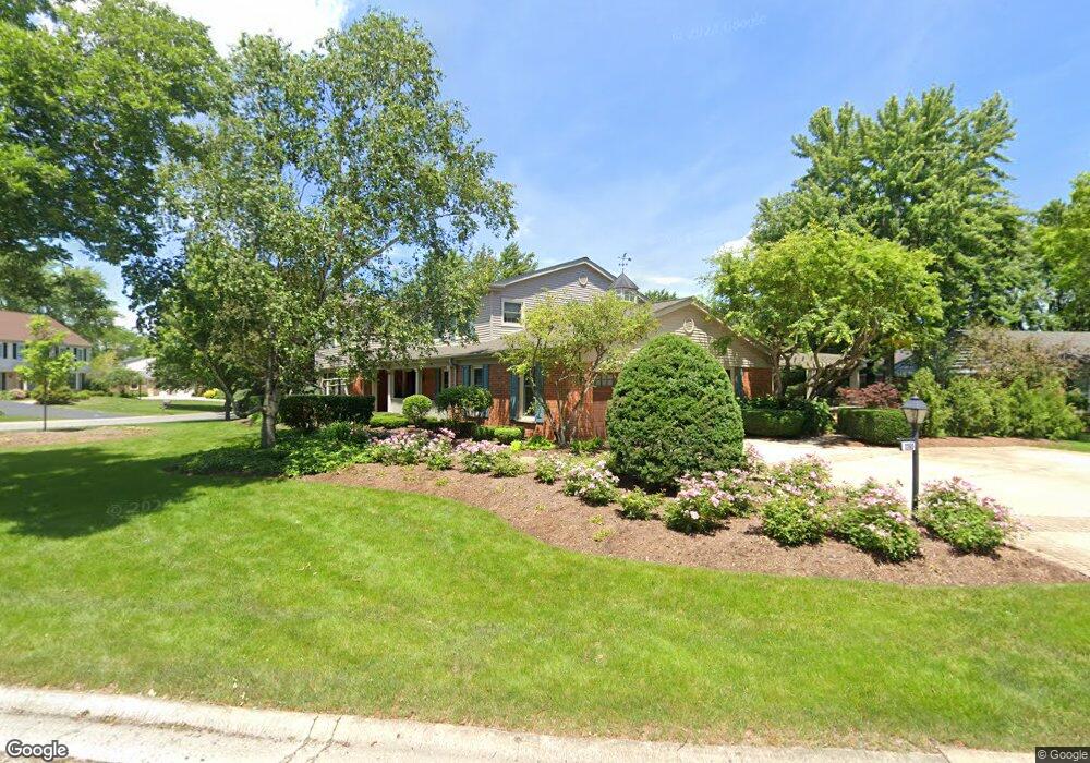
1260 Oak Ridge Rd Barrington, IL 60010
South Barrington NeighborhoodEstimated Value: $850,000 - $1,258,000
6
Beds
4
Baths
3,317
Sq Ft
$292/Sq Ft
Est. Value
About This Home
This home is located at 1260 Oak Ridge Rd, Barrington, IL 60010 and is currently estimated at $969,629, approximately $292 per square foot. 1260 Oak Ridge Rd is a home located in Cook County with nearby schools including Arnett C. Lines Elementary School, Barrington Middle School Station Campus, and Barrington High School.
Ownership History
Date
Name
Owned For
Owner Type
Purchase Details
Closed on
Apr 30, 2004
Sold by
Malia Thomas C and Malia Mary P
Bought by
Malia Thomas C and Malia Mary P
Current Estimated Value
Home Financials for this Owner
Home Financials are based on the most recent Mortgage that was taken out on this home.
Original Mortgage
$393,000
Interest Rate
4.12%
Mortgage Type
Unknown
Purchase Details
Closed on
Apr 23, 2004
Sold by
Malia Thomas C and Malia Mary P
Bought by
Malia Thomas C and Malia Mary P
Home Financials for this Owner
Home Financials are based on the most recent Mortgage that was taken out on this home.
Original Mortgage
$393,000
Interest Rate
4.12%
Mortgage Type
Unknown
Purchase Details
Closed on
Apr 23, 1998
Sold by
Malia Thomas C and Malia Mary P
Bought by
Malia Thomas C and Malia Mary P
Create a Home Valuation Report for This Property
The Home Valuation Report is an in-depth analysis detailing your home's value as well as a comparison with similar homes in the area
Home Values in the Area
Average Home Value in this Area
Purchase History
| Date | Buyer | Sale Price | Title Company |
|---|---|---|---|
| Malia Thomas C | -- | -- | |
| Malia Thomas C | -- | Lawyers | |
| Malia Thomas C | -- | -- |
Source: Public Records
Mortgage History
| Date | Status | Borrower | Loan Amount |
|---|---|---|---|
| Closed | Malia Thomas C | $393,000 |
Source: Public Records
Tax History Compared to Growth
Tax History
| Year | Tax Paid | Tax Assessment Tax Assessment Total Assessment is a certain percentage of the fair market value that is determined by local assessors to be the total taxable value of land and additions on the property. | Land | Improvement |
|---|---|---|---|---|
| 2024 | $13,994 | $68,000 | $8,222 | $59,778 |
| 2023 | $13,644 | $68,000 | $8,222 | $59,778 |
| 2022 | $13,644 | $68,000 | $8,222 | $59,778 |
| 2021 | $11,125 | $50,525 | $5,024 | $45,501 |
| 2020 | $10,836 | $50,525 | $5,024 | $45,501 |
| 2019 | $10,621 | $55,953 | $5,024 | $50,929 |
| 2018 | $11,837 | $59,446 | $4,567 | $54,879 |
| 2017 | $12,212 | $59,446 | $4,567 | $54,879 |
| 2016 | $11,809 | $59,446 | $4,567 | $54,879 |
| 2015 | $10,536 | $49,527 | $4,110 | $45,417 |
| 2014 | $10,430 | $49,527 | $4,110 | $45,417 |
| 2013 | $9,978 | $49,527 | $4,110 | $45,417 |
Source: Public Records
Map
Nearby Homes
- 104 Howe Terrace
- 101 Surrey Ln
- 185 Cold Spring Rd
- 117 Beverly Rd
- 1010 Oakland Dr
- 175 Hilltop Ave
- 336 Eastern Ave Unit C4
- 216 Beverly Rd
- 319 S Glendale Ave Unit 204
- 290 Cold Spring Rd
- 248 Beverly Rd
- 721 Concord Ln
- 432 Whitney Dr
- 110 Tudor Dr
- 534 E Main St
- 1288 The Point St
- 1312 Lake Shore Dr N Unit 7
- 733 Prairie Ave
- 345 E Russell St
- 755 Division St
- 1290 Oak Ridge Rd
- 375 Red Barn Ln
- 370 Red Barn Ln
- 1261 Oak Ridge Rd
- 1310 Oak Ridge Rd
- 1281 Oak Ridge Rd
- 355 Red Barn Ln
- 445 Red Barn Ln
- 1311 Oak Ridge Rd
- 350 S Valley Rd
- 430 Red Barn Ln Unit 5
- 330 S Valley Rd
- 1230 Oak Ridge Cir Unit 5
- 350 Red Barn Ln
- 1350 Oak Ridge Rd
- 315 Red Barn Ln
- 1351 Oak Ridge Rd
- 485 Red Barn Ln
- 505 Red Barn Ln
- 465 Red Barn Ln