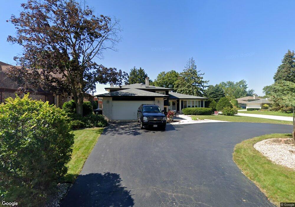
12600 E Navajo Dr Palos Heights, IL 60463
Navajo Hills NeighborhoodEstimated Value: $413,379 - $493,000
4
Beds
3
Baths
1,591
Sq Ft
$282/Sq Ft
Est. Value
About This Home
This home is located at 12600 E Navajo Dr, Palos Heights, IL 60463 and is currently estimated at $448,845, approximately $282 per square foot. 12600 E Navajo Dr is a home located in Cook County with nearby schools including Navajo Heights Elementary School, Chippewa Elementary School, and Independence Jr High School.
Ownership History
Date
Name
Owned For
Owner Type
Purchase Details
Closed on
Sep 5, 2025
Sold by
Obrien John F and Haworth Linda S
Bought by
John F Obrien Jr And Linda S Obrien Land Trus and Obrien
Current Estimated Value
Purchase Details
Closed on
Jul 15, 2002
Sold by
Standard Bank & Trust Company
Bought by
Obrien John F and Haworth Linda S
Home Financials for this Owner
Home Financials are based on the most recent Mortgage that was taken out on this home.
Original Mortgage
$210,000
Interest Rate
6.63%
Create a Home Valuation Report for This Property
The Home Valuation Report is an in-depth analysis detailing your home's value as well as a comparison with similar homes in the area
Home Values in the Area
Average Home Value in this Area
Purchase History
| Date | Buyer | Sale Price | Title Company |
|---|---|---|---|
| John F Obrien Jr And Linda S Obrien Land Trus | -- | None Listed On Document | |
| Obrien John F | $305,000 | -- |
Source: Public Records
Mortgage History
| Date | Status | Borrower | Loan Amount |
|---|---|---|---|
| Previous Owner | Obrien John F | $210,000 | |
| Closed | Obrien John F | $64,500 |
Source: Public Records
Tax History Compared to Growth
Tax History
| Year | Tax Paid | Tax Assessment Tax Assessment Total Assessment is a certain percentage of the fair market value that is determined by local assessors to be the total taxable value of land and additions on the property. | Land | Improvement |
|---|---|---|---|---|
| 2024 | $7,855 | $31,915 | $7,079 | $24,836 |
| 2023 | $7,510 | $31,915 | $7,079 | $24,836 |
| 2022 | $7,510 | $26,955 | $6,230 | $20,725 |
| 2021 | $7,226 | $26,954 | $6,229 | $20,725 |
| 2020 | $7,228 | $26,954 | $6,229 | $20,725 |
| 2019 | $6,261 | $25,073 | $5,663 | $19,410 |
| 2018 | $5,925 | $25,073 | $5,663 | $19,410 |
| 2017 | $7,488 | $27,269 | $5,663 | $21,606 |
| 2016 | $5,988 | $20,723 | $4,813 | $15,910 |
| 2015 | $6,734 | $23,555 | $4,813 | $18,742 |
| 2014 | $7,453 | $26,429 | $4,813 | $21,616 |
| 2013 | $6,183 | $24,016 | $4,813 | $19,203 |
Source: Public Records
Map
Nearby Homes
- 12611 Natoma Ave
- 6519 W 126th Place
- 6711 W Shiawassie Dr
- 12753 S Oak Park Ave
- 6839 W 127th St
- 6840 W Evergreen Ave
- 12646 S 69th Ct
- 12718 S 69th Ct
- 12722 S 69th Ct
- 12246 S Nagle Ave
- 13007 S Oak Park Ave
- 6150 W 124th St
- 12501 S 71st Ct
- 430 Shadow Creek Dr
- 6052 W 128th St
- 12815 S Seneca Rd
- 7309 W Palos Ave
- 12513 S Mcvickers Ave
- 13097 Laurel Glen Ct Unit 202
- 6052 W 129th Place
- 12606 E Navajo Dr
- 6631 W Wyandot Dr
- 12538 E Navajo Dr
- 6624 E Navajo Dr
- 6626 W Wyandot Dr
- 6637 W Wyandot Dr
- 12549 E Navajo Dr
- 12601 E Navajo Dr
- 6632 W Wyandot Dr
- 6632 E Navajo Dr
- 12543 E Navajo Dr
- 12607 E Navajo Dr
- 6638 W Wyandot Dr
- 6641 W Wyandot Dr
- 12537 E Navajo Dr
- 6640 E Navajo Dr
- 12615 E Navajo Dr
- 12528 E Navajo Dr
- 6627 W Shiawassie Dr
- 6642 W Wyandot Dr