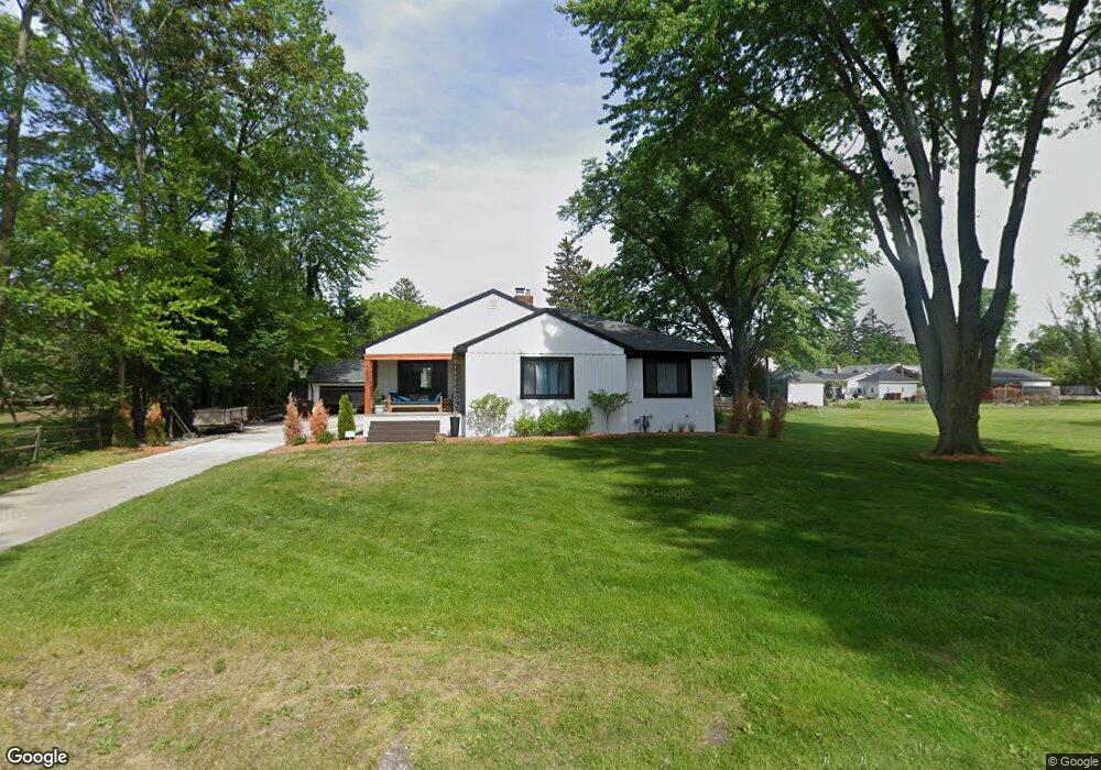
12600 Porter St Carleton, MI 48117
Estimated Value: $246,000 - $334,000
Studio
--
Bath
--
Sq Ft
7,841
Sq Ft
About This Home
This home is located at 12600 Porter St, Carleton, MI 48117 and is currently estimated at $279,459. 12600 Porter St is a home located in Monroe County with nearby schools including Airport Senior High School and Carleton Community Baptist.
Ownership History
Date
Name
Owned For
Owner Type
Purchase Details
Closed on
Nov 13, 2023
Sold by
Andrews Kenneth
Bought by
Andrews Properties Holding Company Llc
Current Estimated Value
Purchase Details
Closed on
Nov 3, 2023
Sold by
Andrews Properties Holding Company Llc
Bought by
Mirabitur Alicia
Purchase Details
Closed on
Oct 23, 2020
Sold by
Weimer Janet S and Estate Of Melvin B Cochenour
Bought by
Andrews Kenneth
Home Financials for this Owner
Home Financials are based on the most recent Mortgage that was taken out on this home.
Original Mortgage
$147,283
Interest Rate
2.8%
Mortgage Type
FHA
Purchase Details
Closed on
May 18, 2016
Sold by
Cochenour Melvin B
Bought by
Cochenour Melvin B and Melvin B Cochenour Declaration Of Trust
Purchase Details
Closed on
May 16, 2016
Sold by
Weimer Janet S and Cochenour Montie K
Bought by
Cochenour Melvin B
Purchase Details
Closed on
May 15, 1993
Sold by
Cochenour Garnett
Bought by
Cochenour Garnett Trust
Create a Home Valuation Report for This Property
The Home Valuation Report is an in-depth analysis detailing your home's value as well as a comparison with similar homes in the area
Home Values in the Area
Average Home Value in this Area
Purchase History
| Date | Buyer | Sale Price | Title Company |
|---|---|---|---|
| Andrews Properties Holding Company Llc | -- | Michigan Title Insurance Agenc | |
| Mirabitur Alicia | -- | Michigan Title Insurance Agenc | |
| Andrews Kenneth | $150,000 | Lawyers Title | |
| Cochenour Melvin B | -- | None Available | |
| Cochenour Melvin B | $95,000 | Attorney | |
| Cochenour Garnett Trust | -- | -- |
Source: Public Records
Mortgage History
| Date | Status | Borrower | Loan Amount |
|---|---|---|---|
| Previous Owner | Andrews Kenneth | $147,283 |
Source: Public Records
Tax History
| Year | Tax Paid | Tax Assessment Tax Assessment Total Assessment is a certain percentage of the fair market value that is determined by local assessors to be the total taxable value of land and additions on the property. | Land | Improvement |
|---|---|---|---|---|
| 2025 | $1,223 | $112,200 | $112,200 | $0 |
| 2024 | $2,272 | $110,200 | $0 | $0 |
| 2023 | $1,603 | $76,400 | $0 | $0 |
| 2022 | $2,676 | $76,400 | $0 | $0 |
| 2021 | $2,582 | $74,200 | $0 | $0 |
| 2020 | $1,589 | $64,500 | $0 | $0 |
| 2019 | $1,563 | $64,500 | $0 | $0 |
| 2018 | $1,067 | $61,600 | $0 | $0 |
| 2017 | $1,461 | $61,600 | $0 | $0 |
| 2016 | $1,448 | $57,500 | $0 | $0 |
| 2015 | $955 | $49,200 | $0 | $0 |
| 2014 | $1,339 | $49,200 | $0 | $0 |
| 2013 | -- | $42,900 | $0 | $0 |
Source: Public Records
Map
Nearby Homes
- 12464 Maxwell Rd
- 12361 Spencer Ln
- 12259 Eldora St
- 12850 Crane St
- 1405 Cedarcrest Dr
- 12751 Jones St
- 13498 Exeter Rd
- 49 James Dr
- 0 Oakville Waltz Rd Unit G50038710
- 1980 Oakville Waltz Rd
- 28503 Margaret Ln Unit 1
- VACANT Oakville Waltz Rd
- 36505 Bismark Rd
- 28264 Waltz Rd
- 0000 Carleton Rockwood Rd
- 27750 Bell Rd
- 9601 Exeter Rd
- 27125 Delos Rd
- 13680 Martinsville Rd
- 26744 Canterbury Cir Unit 4
- 12600 Porter St
- 12600 Porter St
- 12600 Porter St
- 12620 Porter St
- 12620 Porter St Unit 241
- 12601 Porter St
- 12601 Harris St
- 12611 Harris St
- 12621 Porter St
- 12621 Porter St
- 12545 Harris St
- 12545 Porter St
- 12535 Harris St
- 1733 Monroe St
- 1721 Monroe St
- 12521 Harris St
- 1732 Center St
- 12623 Harris St
- 1811 Monroe St
- 1814 Center St
Your Personal Tour Guide
Ask me questions while you tour the home.