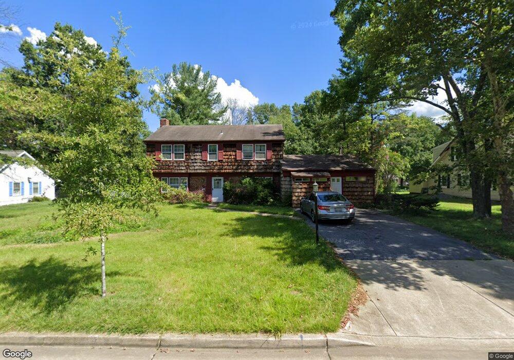
12601 Cedarbrook Ln Laurel, MD 20708
South Laurel NeighborhoodEstimated Value: $525,515 - $599,000
Studio
3
Baths
2,433
Sq Ft
$230/Sq Ft
Est. Value
About This Home
This home is located at 12601 Cedarbrook Ln, Laurel, MD 20708 and is currently estimated at $560,379, approximately $230 per square foot. 12601 Cedarbrook Ln is a home located in Prince George's County with nearby schools including Deerfield Run Elementary School, Dwight D. Eisenhower Middle School, and Laurel High School.
Ownership History
Date
Name
Owned For
Owner Type
Purchase Details
Closed on
Nov 29, 2006
Sold by
Levan Robert H
Bought by
Azu Azu E
Current Estimated Value
Home Financials for this Owner
Home Financials are based on the most recent Mortgage that was taken out on this home.
Original Mortgage
$84,000
Outstanding Balance
$49,847
Interest Rate
6.36%
Mortgage Type
Stand Alone Second
Estimated Equity
$510,532
Purchase Details
Closed on
Nov 14, 2006
Sold by
Levan Robert H
Bought by
Azu Azu E
Home Financials for this Owner
Home Financials are based on the most recent Mortgage that was taken out on this home.
Original Mortgage
$84,000
Outstanding Balance
$49,847
Interest Rate
6.36%
Mortgage Type
Stand Alone Second
Estimated Equity
$510,532
Create a Home Valuation Report for This Property
The Home Valuation Report is an in-depth analysis detailing your home's value as well as a comparison with similar homes in the area
Home Values in the Area
Average Home Value in this Area
Purchase History
| Date | Buyer | Sale Price | Title Company |
|---|---|---|---|
| Azu Azu E | $420,000 | -- | |
| Azu Azu E | $420,000 | -- |
Source: Public Records
Mortgage History
| Date | Status | Borrower | Loan Amount |
|---|---|---|---|
| Open | Azu Azu E | $84,000 | |
| Open | Azu Azu E | $336,000 | |
| Closed | Azu Azu E | $84,000 | |
| Closed | Azu Azu E | $336,000 |
Source: Public Records
Tax History
| Year | Tax Paid | Tax Assessment Tax Assessment Total Assessment is a certain percentage of the fair market value that is determined by local assessors to be the total taxable value of land and additions on the property. | Land | Improvement |
|---|---|---|---|---|
| 2025 | $5,973 | $434,400 | $127,900 | $306,500 |
| 2024 | $5,973 | $419,267 | -- | -- |
| 2023 | $5,795 | $404,133 | $0 | $0 |
| 2022 | $5,558 | $389,000 | $102,900 | $286,100 |
| 2021 | $5,311 | $370,133 | $0 | $0 |
| 2020 | $5,188 | $351,267 | $0 | $0 |
| 2019 | $5,036 | $332,400 | $101,400 | $231,000 |
| 2018 | $4,871 | $316,567 | $0 | $0 |
| 2017 | $4,737 | $300,733 | $0 | $0 |
| 2016 | -- | $284,900 | $0 | $0 |
| 2015 | $4,441 | $284,900 | $0 | $0 |
| 2014 | $4,441 | $284,900 | $0 | $0 |
Source: Public Records
Map
Nearby Homes
- 12600 Cedarbrook Ln
- 8904 Royal Ridge Ln
- 8908 Eastbourne Ln
- 8714 Granite Ln
- 12201 Mount Pleasant Dr
- 9303 Ispahan Loop
- 12122 Running Bull Way
- 12124 Running Bull Way
- 12513 Laurel Bowie Rd
- 8479 Imperial Dr
- 12128 Running Bull Way
- 12017 Apache Tears Cir
- 12109 Spirit Ave
- 12107 Spirit Ave
- 12105 Spirit Ave
- 12103 Spirit Ave
- 12101 Spirit Ave
- 8415 Snowden Oaks Place
- 8307 Snowden Oaks Place
- 9102 Erfurt Ct
- 12509 Cedarbrook Ln
- 12603 Cedarbrook Ln
- 12504 Silverbirch Ln
- 12506 Silverbirch Ln
- 12502 Silverbirch Ln
- 12507 Cedarbrook Ln
- 12605 Cedarbrook Ln
- 12508 Silverbirch Ln
- 12604 Cedarbrook Ln
- 12500 Silverbirch Ln
- 12510 Silverbirch Ln
- 12506 Cedarbrook Ln
- 12505 Cedarbrook Ln
- 12606 Cedarbrook Ln
- 12603 Ivystone Ln
- 12607 Cedarbrook Ln
- 12412 Silverbirch Ln
- 12600 Silverbirch Ln
- 12503 Silverbirch Ln
- 12420 Eastgate Ln
Your Personal Tour Guide
Ask me questions while you tour the home.