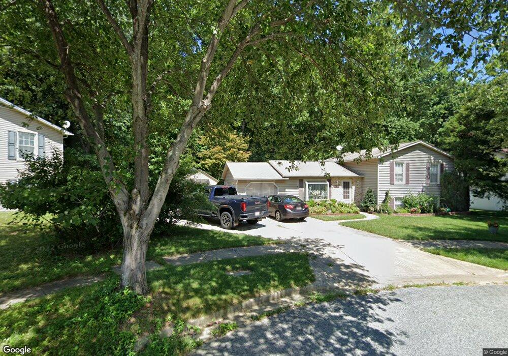
12607 Carland Place Laurel, MD 20708
South Laurel NeighborhoodEstimated Value: $520,741 - $605,000
--
Bed
3
Baths
1,968
Sq Ft
$278/Sq Ft
Est. Value
About This Home
This home is located at 12607 Carland Place, Laurel, MD 20708 and is currently estimated at $547,685, approximately $278 per square foot. 12607 Carland Place is a home located in Prince George's County with nearby schools including Montpelier Elementary School, Laurel High School, and Chesapeake Math and IT Academy.
Ownership History
Date
Name
Owned For
Owner Type
Purchase Details
Closed on
May 16, 2023
Sold by
Livingstone Joseph A and Young Hui
Bought by
Joseph And Young Livingstone Family Trust and Livingstone
Current Estimated Value
Purchase Details
Closed on
Aug 12, 2004
Sold by
Mcwilliams Robert A
Bought by
Livingstone Joseph A
Purchase Details
Closed on
Nov 9, 1983
Sold by
Atlantic Mortgage
Bought by
Mcwilliams Robert A and Mcwilliams Janice M
Create a Home Valuation Report for This Property
The Home Valuation Report is an in-depth analysis detailing your home's value as well as a comparison with similar homes in the area
Home Values in the Area
Average Home Value in this Area
Purchase History
| Date | Buyer | Sale Price | Title Company |
|---|---|---|---|
| Joseph And Young Livingstone Family Trust | -- | None Listed On Document | |
| Joseph And Young Livingstone Family Trust | -- | None Listed On Document | |
| Livingstone Joseph A | $285,500 | -- | |
| Mcwilliams Robert A | $96,500 | -- |
Source: Public Records
Tax History Compared to Growth
Tax History
| Year | Tax Paid | Tax Assessment Tax Assessment Total Assessment is a certain percentage of the fair market value that is determined by local assessors to be the total taxable value of land and additions on the property. | Land | Improvement |
|---|---|---|---|---|
| 2025 | $5,551 | $440,800 | $126,000 | $314,800 |
| 2024 | $5,551 | $415,967 | $0 | $0 |
| 2023 | $5,338 | $391,133 | $0 | $0 |
| 2022 | $5,073 | $366,300 | $101,000 | $265,300 |
| 2021 | $4,835 | $345,733 | $0 | $0 |
| 2020 | $4,708 | $325,167 | $0 | $0 |
| 2019 | $4,554 | $304,600 | $100,500 | $204,100 |
| 2018 | $4,402 | $289,233 | $0 | $0 |
| 2017 | $4,276 | $273,867 | $0 | $0 |
| 2016 | -- | $258,500 | $0 | $0 |
| 2015 | $4,242 | $253,133 | $0 | $0 |
| 2014 | $4,242 | $247,767 | $0 | $0 |
Source: Public Records
Map
Nearby Homes
- 12608 Carland Place
- 8493 Snowden Oaks Place
- 8424 Oak Stream Dr
- 0 Larchdale Rd Unit MDPG2054450
- 13100 Golden Oak Dr
- 7709 Loughborough Place
- 12900 Claxton Dr
- 11905 Ellington Dr
- 8604 Imperial Dr
- 12912 Brickyard Blvd
- 12710 Rustic Rock Ln
- 8908 Eastbourne Ln
- 12825 Brickyard Blvd
- 7205 Barrberry Ln
- 12811 Brickyard Blvd
- 7338 Calico Rock Lndg Rd
- 7207 Maisson Ridge Cir
- 13400 Oaklands Manor Dr
- 7202 Silver Thorn Way
- 12503 Rustic Rock Ln
- 12605 Carland Place
- 12609 Carland Place
- 12603 Carland Place
- 12610 Carland Place
- 12606 Carland Place
- 12604 Carland Place
- 12601 Carland Place
- 8206 Joshua Ct
- 12517 Carland Place
- 8204 Joshua Ct
- 8202 Joshua Ct
- 12515 Carland Place
- 8207 Joshua Ct
- 12513 Carland Place
- 8200 Joshua Ct
- 8205 Joshua Ct
- 12512 Carland Place
- 12511 Carland Place
- 8201 Joshua Ct
- 8203 Joshua Ct