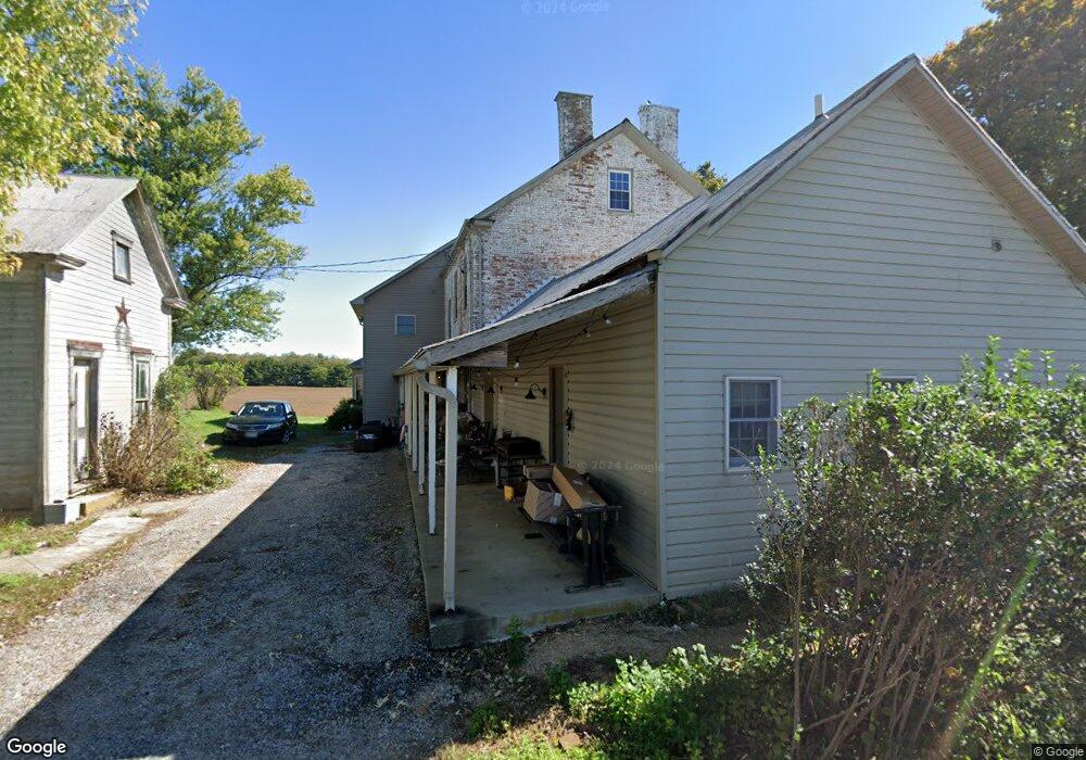
12607 Cohill Rd Clear Spring, MD 21722
Estimated Value: $366,000 - $668,000
Studio
2
Baths
4,140
Sq Ft
$122/Sq Ft
Est. Value
About This Home
This home is located at 12607 Cohill Rd, Clear Spring, MD 21722 and is currently estimated at $505,433, approximately $122 per square foot. 12607 Cohill Rd is a home located in Washington County with nearby schools including Clear Spring Elementary School, Clear Spring Middle School, and Clear Spring High School.
Ownership History
Date
Name
Owned For
Owner Type
Purchase Details
Closed on
May 30, 1996
Sold by
Rolf Depre
Bought by
Lynn Weaver Ralph and Lee Cheryl
Current Estimated Value
Purchase Details
Closed on
Jan 12, 1990
Sold by
Depre Rolf
Bought by
Depre Rolf
Home Financials for this Owner
Home Financials are based on the most recent Mortgage that was taken out on this home.
Original Mortgage
$7,119
Interest Rate
9.8%
Purchase Details
Closed on
Dec 16, 1986
Sold by
Seibert Susie C
Bought by
Depre Rolf
Home Financials for this Owner
Home Financials are based on the most recent Mortgage that was taken out on this home.
Original Mortgage
$45,000
Interest Rate
9.35%
Create a Home Valuation Report for This Property
The Home Valuation Report is an in-depth analysis detailing your home's value as well as a comparison with similar homes in the area
Purchase History
| Date | Buyer | Sale Price | Title Company |
|---|---|---|---|
| Lynn Weaver Ralph | $51,500 | -- | |
| Depre Rolf | $9,200 | -- | |
| Depre Rolf | $60,000 | -- |
Source: Public Records
Mortgage History
| Date | Status | Borrower | Loan Amount |
|---|---|---|---|
| Previous Owner | Depre Rolf | $7,119 | |
| Previous Owner | Depre Rolf | $45,000 | |
| Closed | Lynn Weaver Ralph | -- |
Source: Public Records
Tax History
| Year | Tax Paid | Tax Assessment Tax Assessment Total Assessment is a certain percentage of the fair market value that is determined by local assessors to be the total taxable value of land and additions on the property. | Land | Improvement |
|---|---|---|---|---|
| 2025 | $2,753 | $372,267 | $0 | $0 |
| 2024 | $2,753 | $315,633 | $0 | $0 |
| 2023 | $2,611 | $259,000 | $75,000 | $184,000 |
| 2022 | $2,491 | $248,033 | $0 | $0 |
| 2021 | $2,309 | $237,067 | $0 | $0 |
| 2020 | $2,309 | $226,100 | $75,000 | $151,100 |
| 2019 | $2,223 | $226,100 | $75,000 | $151,100 |
| 2018 | $2,132 | $226,100 | $75,000 | $151,100 |
| 2017 | $2,046 | $226,700 | $0 | $0 |
| 2016 | -- | $210,467 | $0 | $0 |
| 2015 | $1,430 | $194,233 | $0 | $0 |
| 2014 | $1,430 | $178,000 | $0 | $0 |
Source: Public Records
Map
Nearby Homes
- 13407 Rhodes Ct
- 13100 Saint Paul Rd
- 11717 Ashton Rd
- 11705 Ashton Rd
- 11868 National Pike
- 14906 Clear Spring Rd
- 14910 Clear Spring Rd
- Block 87 Lot 4 Pikers Peak Dr
- Block 139 Lot 56 Boo Blvd
- Block 7 Lot 30 & 31 Campfire Blvd
- Block 8 Lot 16 & 17 Campfire Blvd
- Block 11 Lot 14 Hot Springs Ave
- Block 1 Lot 27 Boo Blvd
- Block 1 Lot 35 Boo Blvd
- 0 Block 10 Lot 2 Deadwood Dr Unit WVBE2040636
- Block 1 Lot 36 Boo Blvd
- 15024 Clear Spring Rd
- Block 5 lots 6 and 7 Poison Oak
- Block 90 Lot 8 Ranger Rd
- Block 1 Lot 42 Boo Blvd
- 13607 National Pike
- 13613 National Pike
- 12620 Cohill Rd
- 13549 National Pike
- 13540 National Pike
- 13545 National Pike
- 12536 Ashton Rd
- 12537 Ashton Rd
- 12533 Ashton Rd
- 13534 National Pike
- 13629 National Pike
- 13625 National Pike
- 12616 Shady Bower Ln
- 12526 Ashton Rd
- 13530 National Pike
- 12525 Ashton Rd
- 12520 Ashton Rd
- 13703 National Pike
- 12604 Shady Bower Ln
- 12513 Ashton Rd
Your Personal Tour Guide
Ask me questions while you tour the home.