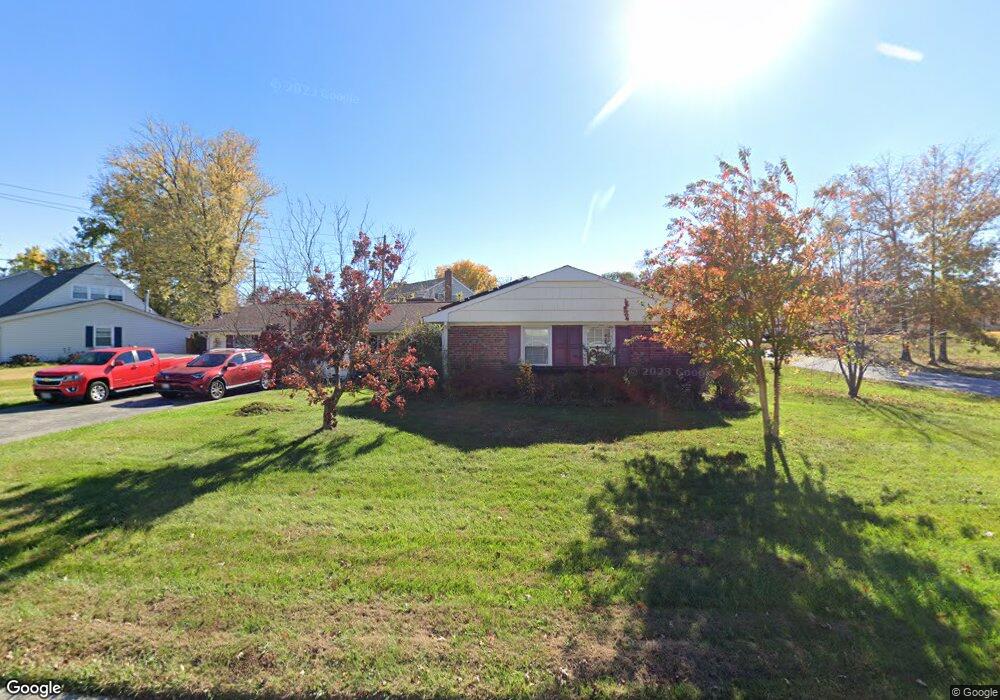
12609 Milburn Ln Bowie, MD 20715
Meadowbrook NeighborhoodEstimated Value: $472,238 - $517,000
3
Beds
2
Baths
1,849
Sq Ft
$269/Sq Ft
Est. Value
About This Home
This home is located at 12609 Milburn Ln, Bowie, MD 20715 and is currently estimated at $497,060, approximately $268 per square foot. 12609 Milburn Ln is a home located in Prince George's County with nearby schools including Whitehall Elementary School, Samuel Ogle Middle School, and Bowie High School.
Ownership History
Date
Name
Owned For
Owner Type
Purchase Details
Closed on
Sep 23, 2016
Bought by
Coliton James
Current Estimated Value
Home Financials for this Owner
Home Financials are based on the most recent Mortgage that was taken out on this home.
Original Mortgage
$250,666
Outstanding Balance
$200,544
Interest Rate
3.48%
Estimated Equity
$296,517
Purchase Details
Closed on
Aug 19, 2010
Sold by
Kim John and Kim Suzette
Bought by
Coliton James D and Coliton Gloria A
Home Financials for this Owner
Home Financials are based on the most recent Mortgage that was taken out on this home.
Original Mortgage
$145,195
Interest Rate
5.5%
Mortgage Type
FHA
Purchase Details
Closed on
Nov 13, 1972
Sold by
Gould Donald S
Bought by
Kim John and Kim Suzette
Create a Home Valuation Report for This Property
The Home Valuation Report is an in-depth analysis detailing your home's value as well as a comparison with similar homes in the area
Home Values in the Area
Average Home Value in this Area
Purchase History
| Date | Buyer | Sale Price | Title Company |
|---|---|---|---|
| Coliton James | -- | -- | |
| Coliton James D | $267,000 | -- | |
| Kim John | $44,500 | -- |
Source: Public Records
Mortgage History
| Date | Status | Borrower | Loan Amount |
|---|---|---|---|
| Open | Coliton James | $250,666 | |
| Closed | Coliton James | -- | |
| Previous Owner | Coliton James D | $145,195 |
Source: Public Records
Tax History Compared to Growth
Tax History
| Year | Tax Paid | Tax Assessment Tax Assessment Total Assessment is a certain percentage of the fair market value that is determined by local assessors to be the total taxable value of land and additions on the property. | Land | Improvement |
|---|---|---|---|---|
| 2025 | $5,741 | $375,100 | $102,300 | $272,800 |
| 2024 | $5,741 | $360,400 | $0 | $0 |
| 2023 | $5,521 | $345,700 | $0 | $0 |
| 2022 | $5,244 | $331,000 | $102,300 | $228,700 |
| 2021 | $4,983 | $315,900 | $0 | $0 |
| 2020 | $4,824 | $300,800 | $0 | $0 |
| 2019 | $4,667 | $285,700 | $101,100 | $184,600 |
| 2018 | $4,526 | $275,400 | $0 | $0 |
| 2017 | $4,417 | $265,100 | $0 | $0 |
| 2016 | -- | $254,800 | $0 | $0 |
| 2015 | $3,973 | $250,667 | $0 | $0 |
| 2014 | $3,973 | $246,533 | $0 | $0 |
Source: Public Records
Map
Nearby Homes
- 12702 Midwood Ln
- 12409 Melody Turn
- 3900 Chapel Forge Dr
- 12904 Cherrywood Ln
- 12909 Cherrywood Ln
- 3900 Corbin Place
- 4020 Chelmont Ln
- 12312 Melling Ln
- 4025 Chelmont Ln
- 4027 Chelmont Ln
- 12319 Tilbury Ln
- 13032 Silver Maple Ct
- 13419 Idlewild Dr
- 3902 Wakefield Ln
- 3220 Scarlet Oak Terrace
- 3913 York Ln
- 4004 Welsley Ln
- 3115 Teal Ln
- 3414 Morlock Ln
- 12400 Shadow Ln
- 12611 Milburn Ln
- 3517 Mullin Ln
- 3520 Mullin Ln
- 12613 Milburn Ln
- 12608 Milburn Ln
- 12606 Milburn Ln
- 3518 Mullin Ln
- 12610 Milburn Ln
- 12612 Milburn Ln
- 3513 Mullin Ln
- 12604 Milburn Ln
- 3516 Mullin Ln
- 12615 Milburn Ln
- 12614 Milburn Ln
- 3514 Mullin Ln
- 12602 Milburn Ln
- 12614 Millstream Dr
- 3511 Mullin Ln
- 12609 Memory Ln
- 12616 Millstream Dr