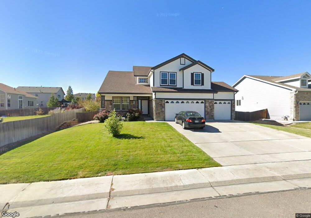
12615 Locust Way Thornton, CO 80602
Estimated Value: $675,000 - $704,000
4
Beds
3
Baths
4,676
Sq Ft
$147/Sq Ft
Est. Value
About This Home
This home is located at 12615 Locust Way, Thornton, CO 80602 and is currently estimated at $686,797, approximately $146 per square foot. 12615 Locust Way is a home located in Adams County with nearby schools including West Ridge Elementary School, Rodger Quist Middle School, and Riverdale Ridge High School.
Ownership History
Date
Name
Owned For
Owner Type
Purchase Details
Closed on
Oct 30, 2009
Sold by
Vang Souzana
Bought by
Vue Somxai
Current Estimated Value
Purchase Details
Closed on
Dec 29, 2005
Sold by
Centex Homes
Bought by
Vue Somxai and Vang Souzana
Home Financials for this Owner
Home Financials are based on the most recent Mortgage that was taken out on this home.
Original Mortgage
$299,358
Interest Rate
6.51%
Mortgage Type
Fannie Mae Freddie Mac
Create a Home Valuation Report for This Property
The Home Valuation Report is an in-depth analysis detailing your home's value as well as a comparison with similar homes in the area
Purchase History
| Date | Buyer | Sale Price | Title Company |
|---|---|---|---|
| Vue Somxai | -- | None Available | |
| Vue Somxai | $374,198 | Commerce Title |
Source: Public Records
Mortgage History
| Date | Status | Borrower | Loan Amount |
|---|---|---|---|
| Previous Owner | Vue Somxai | $299,358 |
Source: Public Records
Tax History
| Year | Tax Paid | Tax Assessment Tax Assessment Total Assessment is a certain percentage of the fair market value that is determined by local assessors to be the total taxable value of land and additions on the property. | Land | Improvement |
|---|---|---|---|---|
| 2025 | $4,374 | $46,650 | $8,640 | $38,010 |
| 2024 | $4,374 | $42,880 | $7,940 | $34,940 |
| 2023 | $4,353 | $48,570 | $7,100 | $41,470 |
| 2022 | $3,365 | $34,310 | $7,300 | $27,010 |
| 2021 | $3,242 | $34,310 | $7,300 | $27,010 |
| 2020 | $3,146 | $34,750 | $7,510 | $27,240 |
| 2019 | $3,149 | $34,750 | $7,510 | $27,240 |
| 2018 | $2,972 | $32,780 | $6,840 | $25,940 |
| 2017 | $2,968 | $32,780 | $6,840 | $25,940 |
| 2016 | $2,559 | $28,160 | $4,620 | $23,540 |
| 2015 | $2,553 | $28,160 | $4,620 | $23,540 |
| 2014 | $2,204 | $24,700 | $3,780 | $20,920 |
Source: Public Records
Map
Nearby Homes
- 12655 Jersey Cir E
- 12710 Jasmine St Unit B
- 12450 Kearney Cir
- 12774 Leyden St Unit D
- 5805 E 124th Way
- 12754 Leyden St Unit E
- 12774 Jasmine Ct
- 5740 E 127th Place
- 12292 Krameria St
- 12822 Jasmine St Unit E
- 12741 Ivanhoe St
- 12768 Ivanhoe St
- 12770 Ivanhoe St
- 6672 Monaco Way
- 12761 Ivanhoe St
- 12557 Hudson Ct
- 12856 Jasmine St Unit B
- 6264 E 122nd Ave
- 12814 Newport Way
- 12876 Jasmine St Unit E
- 12619 Locust Way
- 6343 E 126th Place
- 6314 E 127th Place
- 6333 E 126th Place
- 12610 Locust Way
- 6323 E 126th Place
- 12618 Locust Way
- 6304 E 127th Place
- 6335 E 127th Place
- 6325 E 127th Place
- 6313 E 126th Place
- 12626 Locust Way
- 12598 Locust Way
- 6342 E 126th Place
- 6305 E 127th Place
- 6332 E 126th Place
- 6303 E 126th Place
- 12645 Locust Way
- 12632 Locust Way
- 6322 E 126th Place
Your Personal Tour Guide
Ask me questions while you tour the home.