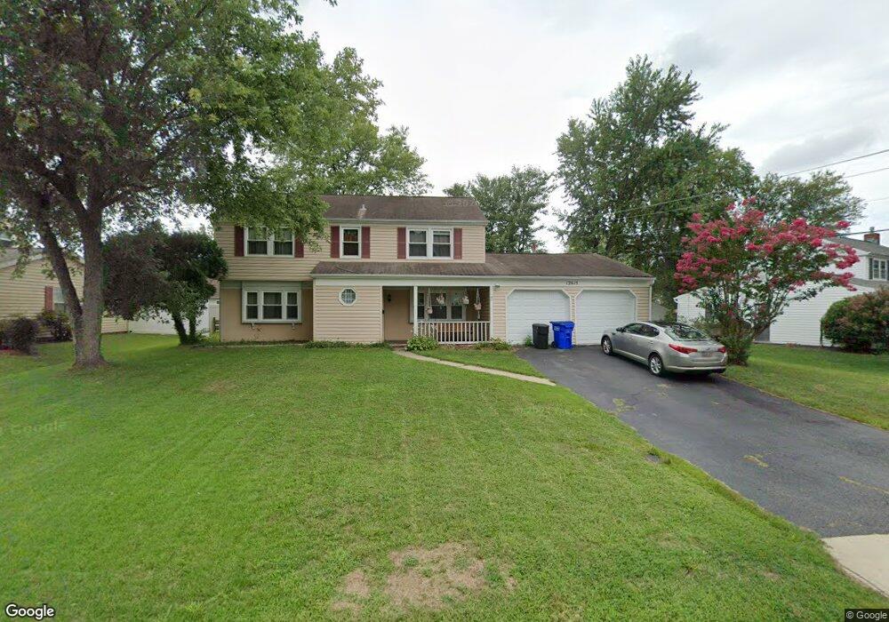
12615 Memory Ln Bowie, MD 20715
Meadowbrook NeighborhoodEstimated Value: $492,000 - $546,270
Studio
3
Baths
2,454
Sq Ft
$212/Sq Ft
Est. Value
About This Home
This home is located at 12615 Memory Ln, Bowie, MD 20715 and is currently estimated at $520,568, approximately $212 per square foot. 12615 Memory Ln is a home located in Prince George's County with nearby schools including Whitehall Elementary School, Samuel Ogle Middle School, and Bowie High School.
Ownership History
Date
Name
Owned For
Owner Type
Purchase Details
Closed on
Mar 15, 2006
Sold by
Garosi Guido
Bought by
Giwa Toyin B
Current Estimated Value
Home Financials for this Owner
Home Financials are based on the most recent Mortgage that was taken out on this home.
Original Mortgage
$75,000
Interest Rate
6.16%
Mortgage Type
Unknown
Purchase Details
Closed on
Feb 15, 2006
Sold by
Garosi Guido
Bought by
Giwa Toyin B
Home Financials for this Owner
Home Financials are based on the most recent Mortgage that was taken out on this home.
Original Mortgage
$75,000
Interest Rate
6.16%
Mortgage Type
Unknown
Purchase Details
Closed on
Sep 16, 1983
Sold by
Freeman Charles S
Bought by
Garosi Guido and Garosi Catherine T
Create a Home Valuation Report for This Property
The Home Valuation Report is an in-depth analysis detailing your home's value as well as a comparison with similar homes in the area
Home Values in the Area
Average Home Value in this Area
Purchase History
| Date | Buyer | Sale Price | Title Company |
|---|---|---|---|
| Giwa Toyin B | $375,000 | -- | |
| Giwa Toyin B | $375,000 | -- | |
| Garosi Guido | $87,500 | -- |
Source: Public Records
Mortgage History
| Date | Status | Borrower | Loan Amount |
|---|---|---|---|
| Closed | Giwa Toyin B | $75,000 | |
| Open | Giwa Toyin B | $300,000 | |
| Closed | Giwa Toyin B | $300,000 |
Source: Public Records
Tax History
| Year | Tax Paid | Tax Assessment Tax Assessment Total Assessment is a certain percentage of the fair market value that is determined by local assessors to be the total taxable value of land and additions on the property. | Land | Improvement |
|---|---|---|---|---|
| 2025 | $7,335 | $446,900 | $101,100 | $345,800 |
| 2024 | $7,335 | $428,900 | -- | -- |
| 2023 | $7,003 | $410,900 | $0 | $0 |
| 2022 | $6,659 | $392,900 | $101,100 | $291,800 |
| 2021 | $6,365 | $376,833 | $0 | $0 |
| 2020 | $6,081 | $360,767 | $0 | $0 |
| 2019 | $5,825 | $344,700 | $100,500 | $244,200 |
| 2018 | $5,619 | $331,633 | $0 | $0 |
| 2017 | $5,425 | $318,567 | $0 | $0 |
| 2016 | -- | $305,500 | $0 | $0 |
| 2015 | $4,723 | $299,867 | $0 | $0 |
| 2014 | $4,723 | $294,233 | $0 | $0 |
Source: Public Records
Map
Nearby Homes
- 3512 Majestic Ln
- 13003 Cheswood Ln
- 12714 Midwood Ln
- 12409 Melody Turn
- 12515 Canfield Ln
- 3808 Yellowstone Place
- 12409 Chalford Ln
- 12316 Melling Ln
- 3905 Wakefield Ln
- 3715 Idolstone Ln
- 13032 Silver Maple Ct
- 3223 Scarlet Oak Terrace
- 12432 Shadow Ln
- 3115 Teal Ln
- 12304 Tilbury Ln
- 12222 Wynmore Ln
- 3404 Morlock Ln
- 4003 Woodrow Ln
- 12402 Sarah Ln
- 12302 Stafford Ln
- 12617 Memory Ln
- 12611 Memory Ln
- 12610 Milburn Ln
- 12612 Milburn Ln
- 12619 Memory Ln
- 12609 Memory Ln
- 12608 Milburn Ln
- 12614 Memory Ln
- 12616 Memory Ln
- 12612 Memory Ln
- 12614 Milburn Ln
- 12618 Memory Ln
- 12610 Memory Ln
- 12621 Memory Ln
- 12607 Memory Ln
- 12606 Milburn Ln
- 12620 Memory Ln
- 12608 Memory Ln
- 12616 Milburn Ln
- 12611 Milburn Ln
Your Personal Tour Guide
Ask me questions while you tour the home.