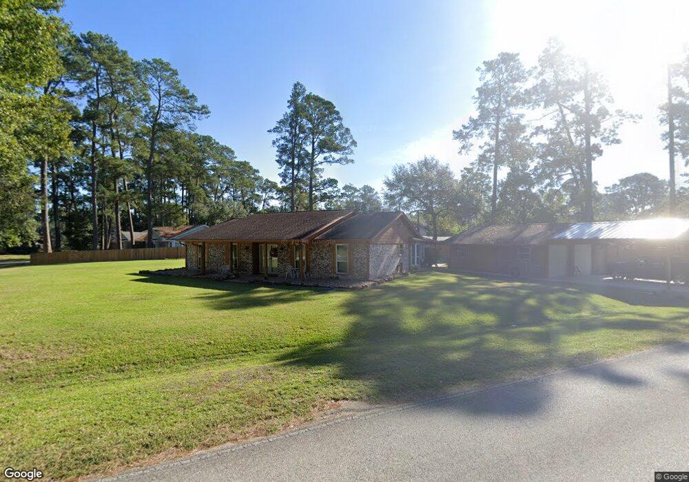
12615 Pirate Cove Dr Tomball, TX 77377
Estimated Value: $311,738 - $468,000
3
Beds
2
Baths
1,928
Sq Ft
$192/Sq Ft
Est. Value
About This Home
This home is located at 12615 Pirate Cove Dr, Tomball, TX 77377 and is currently estimated at $370,685, approximately $192 per square foot. 12615 Pirate Cove Dr is a home located in Harris County with nearby schools including Lakewood Elementary School, Willow Wood Junior High School, and Northpointe Intermediate School.
Ownership History
Date
Name
Owned For
Owner Type
Purchase Details
Closed on
Nov 5, 2018
Sold by
Andrus Billy N
Bought by
Andrus Patricia Ann and Rowell Patricia Ann
Current Estimated Value
Purchase Details
Closed on
Feb 12, 2010
Sold by
Boley Lerah Faye
Bought by
Rowell Robert D and Rowell Patricia A
Home Financials for this Owner
Home Financials are based on the most recent Mortgage that was taken out on this home.
Original Mortgage
$100,000
Outstanding Balance
$66,447
Interest Rate
5.11%
Mortgage Type
New Conventional
Estimated Equity
$304,238
Create a Home Valuation Report for This Property
The Home Valuation Report is an in-depth analysis detailing your home's value as well as a comparison with similar homes in the area
Home Values in the Area
Average Home Value in this Area
Purchase History
| Date | Buyer | Sale Price | Title Company |
|---|---|---|---|
| Andrus Patricia Ann | -- | Stewart Title | |
| Rowell Robert D | -- | Stewart Title Houston Div |
Source: Public Records
Mortgage History
| Date | Status | Borrower | Loan Amount |
|---|---|---|---|
| Open | Rowell Robert D | $100,000 |
Source: Public Records
Tax History Compared to Growth
Tax History
| Year | Tax Paid | Tax Assessment Tax Assessment Total Assessment is a certain percentage of the fair market value that is determined by local assessors to be the total taxable value of land and additions on the property. | Land | Improvement |
|---|---|---|---|---|
| 2025 | $334 | $271,625 | $55,475 | $216,150 |
| 2024 | $334 | $275,653 | $55,475 | $220,178 |
| 2023 | $334 | $275,653 | $55,475 | $220,178 |
| 2022 | $4,999 | $264,742 | $55,475 | $209,267 |
| 2021 | $4,727 | $227,854 | $45,389 | $182,465 |
| 2020 | $4,678 | $217,681 | $45,389 | $172,292 |
| 2019 | $4,628 | $217,681 | $45,389 | $172,292 |
| 2018 | $1,198 | $189,616 | $34,294 | $155,322 |
| 2017 | $4,199 | $189,616 | $34,294 | $155,322 |
| 2016 | $4,199 | $189,616 | $34,294 | $155,322 |
| 2015 | $1,487 | $189,616 | $34,294 | $155,322 |
| 2014 | $1,487 | $181,321 | $26,225 | $155,096 |
Source: Public Records
Map
Nearby Homes
- 16723 Chewton Glen St
- 12810 Wondering Forest Dr
- 12943 Spring Cypress Rd
- 16610 Avenfield Rd
- 12502 Pavilion Ct
- 12515 Pavilion Ct
- 14311 Lakepointe Bend Ln
- 17302 Holsberry Ct
- 12427 Pedder Way Dr
- 12730 Holsberry Ct
- 12411 Exbury Ct
- 12319 Hamsfield Ct
- 13210 Chriswood Dr
- 12502 Wealdstone Dr
- 13206 Chriswood Dr
- 13307 Cypress Pond Dr
- 12611 Wandering Streams Dr
- 12422 Hammersmith Dr
- 12407 Wealdstone Dr
- 13330 Cypress Palms Ct
- 12611 Pirate Cove Dr
- 12614 High Sea Dr
- 12606 High Sea Dr
- 12702 High Sea Dr
- 12614 Pirate Cove Dr
- 12607 Pirate Cove Dr
- 16915 Pitcairn Dr
- 12719 High Sea Dr
- 12701 Spring Cypress Rd
- 12602 High Sea Dr
- 12603 Pirate Cove Dr
- 12615 High Sea Dr
- 12611 High Sea Dr
- 12619 Spring Cypress Rd
- 16811 Chewton Glen St
- 12715 High Sea Dr
- 16807 Chewton Glen St
- 12607 High Sea Dr
- 16815 Chewton Glen St
- 12707 High Sea Dr