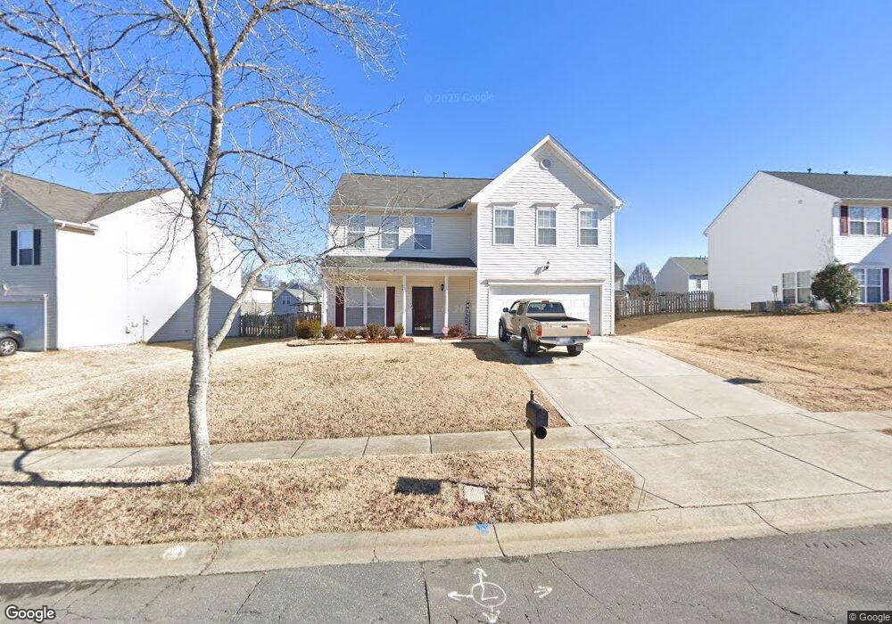
12615 Walking Stick Dr Charlotte, NC 28278
Steele Creek NeighborhoodEstimated Value: $401,000 - $420,000
3
Beds
3
Baths
2,248
Sq Ft
$182/Sq Ft
Est. Value
About This Home
This home is located at 12615 Walking Stick Dr, Charlotte, NC 28278 and is currently estimated at $409,951, approximately $182 per square foot. 12615 Walking Stick Dr is a home located in Mecklenburg County with nearby schools including Winget Park Elementary, Southwest Middle School, and Unity Classical Charter School.
Ownership History
Date
Name
Owned For
Owner Type
Purchase Details
Closed on
Feb 23, 2004
Sold by
Jones Keshawna S Lowery and Lowery Keshawna S
Bought by
Jones Keshawna S Lowery and Jones Kelcey D
Current Estimated Value
Purchase Details
Closed on
Aug 28, 2003
Sold by
The New Fortis Corp
Bought by
Jones Kelcey D and Lowery Keshawna S
Home Financials for this Owner
Home Financials are based on the most recent Mortgage that was taken out on this home.
Original Mortgage
$161,800
Outstanding Balance
$72,365
Interest Rate
5.72%
Mortgage Type
FHA
Estimated Equity
$337,586
Purchase Details
Closed on
Dec 6, 2002
Sold by
Planters Walk Llc
Bought by
The New Fortis Corp
Create a Home Valuation Report for This Property
The Home Valuation Report is an in-depth analysis detailing your home's value as well as a comparison with similar homes in the area
Home Values in the Area
Average Home Value in this Area
Purchase History
| Date | Buyer | Sale Price | Title Company |
|---|---|---|---|
| Jones Keshawna S Lowery | -- | -- | |
| Jones Kelcey D | $163,500 | -- | |
| The New Fortis Corp | $171,000 | -- |
Source: Public Records
Mortgage History
| Date | Status | Borrower | Loan Amount |
|---|---|---|---|
| Open | Jones Kelcey D | $161,800 |
Source: Public Records
Tax History Compared to Growth
Tax History
| Year | Tax Paid | Tax Assessment Tax Assessment Total Assessment is a certain percentage of the fair market value that is determined by local assessors to be the total taxable value of land and additions on the property. | Land | Improvement |
|---|---|---|---|---|
| 2025 | $3,095 | $388,400 | $80,000 | $308,400 |
| 2024 | $3,095 | $388,400 | $80,000 | $308,400 |
| 2023 | $2,988 | $388,400 | $80,000 | $308,400 |
| 2022 | $2,402 | $235,900 | $45,000 | $190,900 |
| 2021 | $2,391 | $235,900 | $45,000 | $190,900 |
| 2020 | $2,384 | $235,900 | $45,000 | $190,900 |
| 2019 | $2,368 | $235,900 | $45,000 | $190,900 |
| 2018 | $2,140 | $157,500 | $33,300 | $124,200 |
| 2017 | $2,102 | $157,500 | $33,300 | $124,200 |
| 2016 | $2,092 | $157,500 | $33,300 | $124,200 |
| 2015 | $2,081 | $157,500 | $33,300 | $124,200 |
| 2014 | $2,085 | $157,500 | $33,300 | $124,200 |
Source: Public Records
Map
Nearby Homes
- 13409 Planters Row Dr
- 13546 Planters Row Dr
- 10026 Orchard Grass Ct
- 11719 Withers Mill Dr
- 12824 Harvest Time Ct
- 10202 Orchard Grass Ct
- 3915 Planters Watch Dr
- 13623 Sunrise View Dr
- 13716 Sunrise View Dr Unit 55
- 7021 W Row Ave
- 12124 Avienmore Dr
- 12113 Avienmore Dr
- 12117 Avienmore Dr
- 3119 Middle St
- 3119 Middle St Unit 94
- 3103 Middle St Unit 92
- 13943 Penbury Ln Unit 376
- 13939 Penbury Ln Unit 377
- 13935 Penbury Ln Unit 378
- 13936 Penbury Ln Unit 401
- 12623 Walking Stick Dr
- 12609 Walking Stick Dr
- 12610 Beddingfield Dr
- 12629 Walking Stick Dr
- 12601 Walking Stick Dr
- 12614 Beddingfield Dr
- 13437 Planters Row Dr
- 13502 Plowstone Ct
- 13503 Plowstone Ct
- 12618 Beddingfield Dr
- 13505 Planters Row Dr
- 13431 Planters Row Dr
- 12705 Walking Stick Dr
- 13510 Plowstone Ct
- 13509 Plowstone Ct
- 12622 Beddingfield Dr
- 12702 Walking Stick Dr
- 13511 Planters Row Dr
- 12709 Walking Stick Dr
- 12706 Walking Stick Dr