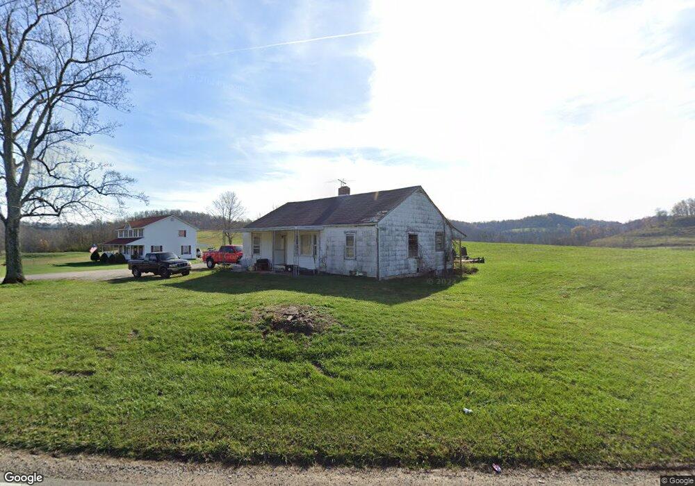
12616 State Route 243 Chesapeake, OH 45619
Estimated Value: $89,445 - $176,000
3
Beds
1
Bath
1,108
Sq Ft
$129/Sq Ft
Est. Value
About This Home
This home is located at 12616 State Route 243, Chesapeake, OH 45619 and is currently estimated at $142,611, approximately $128 per square foot. 12616 State Route 243 is a home located in Lawrence County with nearby schools including Chesapeake Elementary School, Chesapeake Middle School, and Chesapeake High School.
Ownership History
Date
Name
Owned For
Owner Type
Purchase Details
Closed on
Nov 14, 2005
Sold by
Smith James T and Smith Bonnie Joyce
Bought by
Smith David A and Smith Tammy
Current Estimated Value
Purchase Details
Closed on
Aug 5, 1999
Sold by
Smith James and Smith Bonnie
Bought by
Smith James and Smith Bonnie
Purchase Details
Closed on
Feb 23, 1999
Sold by
Lang Thelma S
Bought by
Smith James and Smith Bonnie
Purchase Details
Closed on
Feb 2, 1990
Sold by
Lang Herbert and Lang Thelma
Bought by
Lang Thelma S
Create a Home Valuation Report for This Property
The Home Valuation Report is an in-depth analysis detailing your home's value as well as a comparison with similar homes in the area
Home Values in the Area
Average Home Value in this Area
Purchase History
| Date | Buyer | Sale Price | Title Company |
|---|---|---|---|
| Smith David A | -- | None Available | |
| Smith James | -- | -- | |
| Smith James | $12,000 | -- | |
| Lang Thelma S | -- | -- |
Source: Public Records
Tax History Compared to Growth
Tax History
| Year | Tax Paid | Tax Assessment Tax Assessment Total Assessment is a certain percentage of the fair market value that is determined by local assessors to be the total taxable value of land and additions on the property. | Land | Improvement |
|---|---|---|---|---|
| 2024 | -- | $8,560 | $1,330 | $7,230 |
| 2023 | $259 | $8,560 | $1,330 | $7,230 |
| 2022 | $257 | $8,560 | $1,330 | $7,230 |
| 2021 | $256 | $8,560 | $1,330 | $7,230 |
| 2020 | $272 | $8,560 | $1,330 | $7,230 |
| 2019 | $271 | $8,560 | $1,330 | $7,230 |
| 2018 | $273 | $8,560 | $1,330 | $7,230 |
| 2017 | $273 | $8,560 | $1,330 | $7,230 |
| 2016 | $252 | $8,560 | $1,330 | $7,230 |
| 2015 | $251 | $8,480 | $800 | $7,680 |
| 2014 | $251 | $8,480 | $800 | $7,680 |
| 2013 | $251 | $8,480 | $800 | $7,680 |
Source: Public Records
Map
Nearby Homes
- 253 Township Road 1357
- 14 Township Road 1356
- 275 Township Road 118
- 3493 County Road 31
- 3171 County Road 31
- 135 Township Road 85 E
- 152 Township Road 1483
- 101 Township Road 1119
- 983 County Road 104
- 1666 County Road 31
- 66 Township Road 1523
- 1334 McKinney Creek-Hesson Hollow Rd N
- 1334 Township Road 214th N
- 81 Township Road 158
- 301 Township Road 158
- 6757 County Road 15
- 6897 County Road 15
- 00 Township Road 219 N
- 101 Township Road 1199
- 30 Township Road 1482
- 12642 State Route 243
- 12621 State Route 243
- 12621 State Route 243
- 12731 State Route 243
- 19 Township Road 354
- 35 Township Road 354
- 85 Township Road 354
- 12789 State Route 243
- 105 Township Road 354
- 60 State Route 243
- 119 Township Road 354
- 0 Township Road 354
- 44 Township Road 354
- 76 Township Road 354
- 154 Township Road 354
- 130 Township Road 354
- 77 Township Road 84 S
- 12867 State Route 243
- 161 Township Road 354
- 124 Township Road 84 S