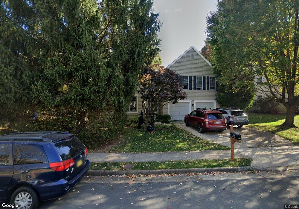
12618 Rock Ridge Rd Herndon, VA 20170
Estimated Value: $747,353 - $812,000
4
Beds
3
Baths
1,708
Sq Ft
$455/Sq Ft
Est. Value
About This Home
This home is located at 12618 Rock Ridge Rd, Herndon, VA 20170 and is currently estimated at $776,338, approximately $454 per square foot. 12618 Rock Ridge Rd is a home located in Fairfax County with nearby schools including Dranesville Elementary, Herndon Middle School, and Herndon High School.
Ownership History
Date
Name
Owned For
Owner Type
Purchase Details
Closed on
Mar 28, 2007
Sold by
Candace P Blanquet Truste
Bought by
Repak Mark A and D'Agostino,Angela R
Current Estimated Value
Home Financials for this Owner
Home Financials are based on the most recent Mortgage that was taken out on this home.
Original Mortgage
$375,900
Outstanding Balance
$229,521
Interest Rate
6.33%
Mortgage Type
New Conventional
Estimated Equity
$546,817
Create a Home Valuation Report for This Property
The Home Valuation Report is an in-depth analysis detailing your home's value as well as a comparison with similar homes in the area
Home Values in the Area
Average Home Value in this Area
Purchase History
| Date | Buyer | Sale Price | Title Company |
|---|---|---|---|
| Repak Mark A | $469,900 | -- |
Source: Public Records
Mortgage History
| Date | Status | Borrower | Loan Amount |
|---|---|---|---|
| Open | Repak Mark A | $375,900 |
Source: Public Records
Tax History Compared to Growth
Tax History
| Year | Tax Paid | Tax Assessment Tax Assessment Total Assessment is a certain percentage of the fair market value that is determined by local assessors to be the total taxable value of land and additions on the property. | Land | Improvement |
|---|---|---|---|---|
| 2025 | $7,995 | $708,460 | $244,000 | $464,460 |
| 2024 | $7,995 | $690,090 | $244,000 | $446,090 |
| 2023 | $7,592 | $672,760 | $239,000 | $433,760 |
| 2022 | $7,049 | $616,430 | $239,000 | $377,430 |
| 2021 | $6,384 | $544,030 | $204,000 | $340,030 |
| 2020 | $6,241 | $527,360 | $194,000 | $333,360 |
| 2019 | $6,151 | $519,740 | $189,000 | $330,740 |
| 2018 | $5,696 | $495,340 | $184,000 | $311,340 |
| 2017 | $5,799 | $499,520 | $184,000 | $315,520 |
| 2016 | $5,711 | $492,950 | $184,000 | $308,950 |
| 2015 | $5,302 | $475,080 | $184,000 | $291,080 |
| 2014 | $5,005 | $449,450 | $184,000 | $265,450 |
Source: Public Records
Map
Nearby Homes
- 12592 Rock Ridge Rd
- 2007 Jonathan Dr
- 509 Cindy Ct
- 1551 Brownsville Dr
- 12535 Misty Water Dr
- 1407 Skyhaven Ct
- 400 Gary Ct
- 1314 E Holly Ave
- 12703 Longleaf Ln
- 1402 Bakers Creek Ct
- 1307 E Holly Ave
- 1305 E Maple Ave
- 11 Butternut Way
- 1377 Rock Chapel Rd
- 19 Butternut Way
- 113 N Harrison Rd
- 1372 Dominion Ridge Ln
- 316 Hanford Ct
- 104 N Garfield Rd
- 131 N Garfield Rd
- 12612 Rock Ridge Rd
- 12620 Rock Ridge Rd
- 1436 Millikens Bend Rd
- 1434 Millikens Bend Rd
- 12610 Rock Ridge Rd
- 12622 Rock Ridge Rd
- 12617 Rock Ridge Rd
- 12615 Rock Ridge Rd
- 1438 Millikens Bend Rd
- 12619 Rock Ridge Rd
- 12624 Terrymill Dr
- 12613 Rock Ridge Rd
- 12621 Rock Ridge Rd
- 12608 Rock Ridge Rd
- 1435 Millikens Bend Rd
- 12611 Rock Ridge Rd
- 1440 Millikens Bend Rd
- 12626 Terrymill Dr
- 12618 Terrymill Dr
- 2615 Stone Mountain Ct