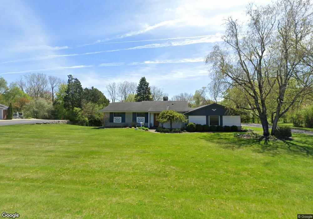
1262 Ashover Dr Bloomfield Hills, MI 48304
Estimated Value: $352,000 - $437,597
3
Beds
2
Baths
1,707
Sq Ft
$237/Sq Ft
Est. Value
About This Home
This home is located at 1262 Ashover Dr, Bloomfield Hills, MI 48304 and is currently estimated at $404,399, approximately $236 per square foot. 1262 Ashover Dr is a home located in Oakland County with nearby schools including R. Grant Graham Elementary School, Avondale Middle School, and Avondale High School.
Ownership History
Date
Name
Owned For
Owner Type
Purchase Details
Closed on
Feb 22, 2000
Sold by
Carlson Joanne
Bought by
Joanne Carlson Tr
Current Estimated Value
Purchase Details
Closed on
Dec 8, 1995
Sold by
Carlson John Richard
Bought by
Carlson J Richard
Home Financials for this Owner
Home Financials are based on the most recent Mortgage that was taken out on this home.
Original Mortgage
$100,000
Interest Rate
7.28%
Create a Home Valuation Report for This Property
The Home Valuation Report is an in-depth analysis detailing your home's value as well as a comparison with similar homes in the area
Home Values in the Area
Average Home Value in this Area
Purchase History
| Date | Buyer | Sale Price | Title Company |
|---|---|---|---|
| Joanne Carlson Tr | -- | -- | |
| Carlson J Richard | -- | -- |
Source: Public Records
Mortgage History
| Date | Status | Borrower | Loan Amount |
|---|---|---|---|
| Previous Owner | Carlson J Richard | $100,000 |
Source: Public Records
Tax History Compared to Growth
Tax History
| Year | Tax Paid | Tax Assessment Tax Assessment Total Assessment is a certain percentage of the fair market value that is determined by local assessors to be the total taxable value of land and additions on the property. | Land | Improvement |
|---|---|---|---|---|
| 2024 | $1,983 | $206,300 | $0 | $0 |
| 2023 | $1,892 | $190,280 | $0 | $0 |
| 2022 | $3,526 | $168,430 | $0 | $0 |
| 2021 | $3,441 | $159,590 | $0 | $0 |
| 2020 | $1,733 | $148,860 | $0 | $0 |
| 2019 | $3,358 | $131,580 | $0 | $0 |
| 2018 | $3,296 | $130,780 | $0 | $0 |
| 2017 | $3,245 | $128,710 | $0 | $0 |
| 2016 | $3,240 | $118,620 | $0 | $0 |
| 2015 | -- | $104,050 | $0 | $0 |
| 2014 | -- | $93,190 | $0 | $0 |
| 2011 | -- | $97,440 | $0 | $0 |
Source: Public Records
Map
Nearby Homes
- 1299 Winchcombe Dr
- 6965 N Adams Rd
- 1204 S Timberview Trail Unit E 23
- 1289 Greenglen Ct
- 1285 Greenglen Ct
- 1470 Timberview Trail
- 1339 Knollcrest Cir
- 1105 Ivyglen Cir
- 624 Slocum Dr
- 1926 Hickory Bark Ln
- 3072 Henrydale St
- 3164 Bessie St
- 3221 Bessie St
- 1916 Squirrel Valley Dr
- 3443 Nichols Rd
- 1717 Brandywine Dr
- 6950 Killarney Dr
- 825 Huntclub Blvd
- 870 Huntclub Blvd
- 1525 S Hill Blvd
- 1254 Ashover Dr
- 1270 Ashover Dr
- 1261 Ashover Dr
- 1253 Ashover Dr
- 1269 Ashover Dr
- 1641 Fairford Dr
- 1278 Ashover Dr
- 1262 Winchcombe Dr
- 1277 Ashover Dr
- 1238 Ashover Dr
- 1250 Winchcombe Dr
- 1667 Fairford Dr
- 1274 Winchcombe Dr
- 1241 Peveril Rd
- 1239 Ashover Dr
- 1286 Ashover Dr
- 1286 Winchcombe Dr
- 1285 Ashover Dr
- 1693 Fairford Dr
- 1240 Winchcombe Dr