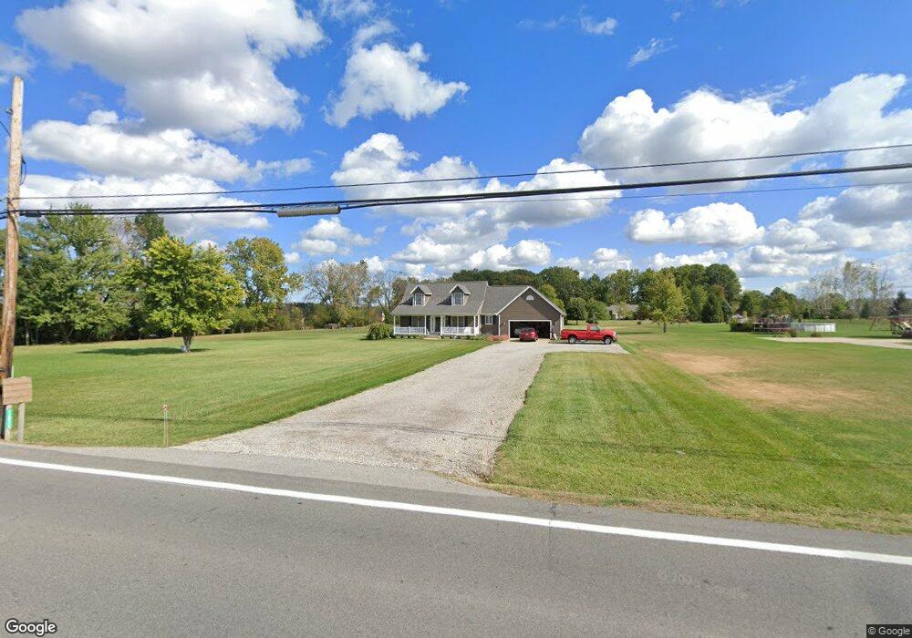
12623 State Route 301 Lagrange, OH 44050
Estimated Value: $407,920 - $548,000
3
Beds
3
Baths
2,023
Sq Ft
$233/Sq Ft
Est. Value
About This Home
This home is located at 12623 State Route 301, Lagrange, OH 44050 and is currently estimated at $471,230, approximately $232 per square foot. 12623 State Route 301 is a home located in Lorain County with nearby schools including Keystone Elementary School, Keystone Middle School, and Keystone High School.
Ownership History
Date
Name
Owned For
Owner Type
Purchase Details
Closed on
Aug 1, 2000
Sold by
Colony Mtg Corp
Bought by
Davis Graylyn D and Davis Beverly A
Current Estimated Value
Home Financials for this Owner
Home Financials are based on the most recent Mortgage that was taken out on this home.
Original Mortgage
$139,000
Outstanding Balance
$50,293
Interest Rate
8.19%
Mortgage Type
Construction
Estimated Equity
$420,937
Purchase Details
Closed on
Jun 21, 2000
Sold by
Colony Mtg Corp
Bought by
Colony Mtg Corp
Home Financials for this Owner
Home Financials are based on the most recent Mortgage that was taken out on this home.
Original Mortgage
$139,000
Outstanding Balance
$50,293
Interest Rate
8.19%
Mortgage Type
Construction
Estimated Equity
$420,937
Create a Home Valuation Report for This Property
The Home Valuation Report is an in-depth analysis detailing your home's value as well as a comparison with similar homes in the area
Purchase History
| Date | Buyer | Sale Price | Title Company |
|---|---|---|---|
| Davis Graylyn D | $46,900 | -- | |
| Colony Mtg Corp | -- | -- |
Source: Public Records
Mortgage History
| Date | Status | Borrower | Loan Amount |
|---|---|---|---|
| Open | Davis Graylyn D | $139,000 |
Source: Public Records
Tax History
| Year | Tax Paid | Tax Assessment Tax Assessment Total Assessment is a certain percentage of the fair market value that is determined by local assessors to be the total taxable value of land and additions on the property. | Land | Improvement |
|---|---|---|---|---|
| 2024 | $4,508 | $111,822 | $24,836 | $86,986 |
| 2023 | $4,101 | $83,895 | $24,091 | $59,805 |
| 2022 | $4,071 | $83,895 | $24,091 | $59,805 |
| 2021 | $4,071 | $83,895 | $24,091 | $59,805 |
| 2020 | $4,101 | $76,550 | $21,980 | $54,570 |
| 2019 | $4,074 | $76,550 | $21,980 | $54,570 |
| 2018 | $4,092 | $76,550 | $21,980 | $54,570 |
| 2017 | $3,900 | $68,170 | $18,460 | $49,710 |
| 2016 | $3,872 | $68,170 | $18,460 | $49,710 |
| 2015 | $3,808 | $68,170 | $18,460 | $49,710 |
| 2014 | $3,319 | $68,170 | $18,460 | $49,710 |
| 2013 | $3,167 | $68,170 | $18,460 | $49,710 |
Source: Public Records
Map
Nearby Homes
- 41341 Ravines Edge Way
- 40163 Banks Rd
- 40175 Banks Rd
- 11861 Indian Hollow Rd
- 13301 Indian Hollow Rd
- 39535 Butternut Ridge Rd
- 114 River Run Dr
- 39277 Butternut Ridge Rd
- 502 Cedarwood Trail
- 437 Pheasant Run
- 40000 Myrtle Ct
- 421 Pheasant Run
- 430 Pheasant Run
- 246 River Run Dr
- 221 River Run Dr
- 426 Pheasant Run
- 10832 Indian Hollow Rd
- 229 River Run Dr
- 413 Pheasant Run
- 422 Pheasant Run
- 12771 State Route 301
- 12597 State Route 301
- 12597 Lagrange Rd
- 12579 State Route 301
- 41000 Slife Rd
- 12700 Cissell Ln
- 40950 Slife Rd
- 12690 Cissell Ln
- 12750 Cissell Ln
- 12551 State Route 301
- 40900 Slife Rd
- 40850 Slife Rd
- 12531 State Route 301
- 12930 Lagrange Rd
- 40999 Slife Rd
- 40957 Slife Rd
- 40903 Slife Rd
- 12751 Cissell Ln
- 12701 Cissell Ln
- 40955 Ohio 301
Your Personal Tour Guide
Ask me questions while you tour the home.