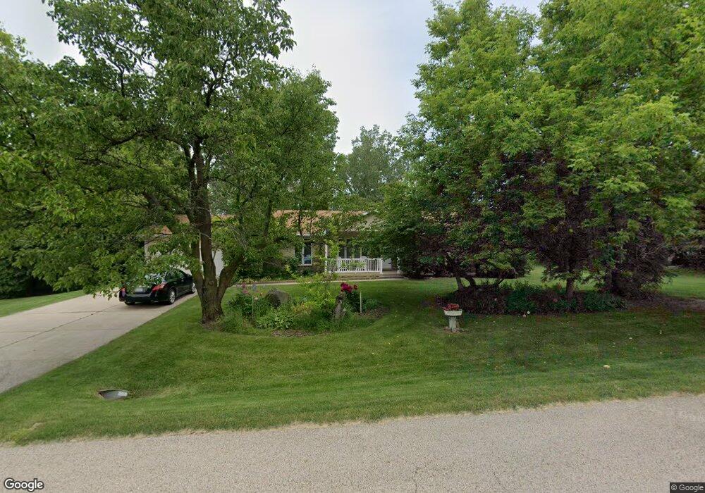
12626 W 28th Place Beach Park, IL 60099
Estimated Value: $341,000 - $417,000
3
Beds
3
Baths
1,594
Sq Ft
$228/Sq Ft
Est. Value
About This Home
This home is located at 12626 W 28th Place, Beach Park, IL 60099 and is currently estimated at $363,818, approximately $228 per square foot. 12626 W 28th Place is a home located in Lake County with nearby schools including Kenneth Murphy School, Beach Park Middle School, and Zion-Benton Township High School.
Ownership History
Date
Name
Owned For
Owner Type
Purchase Details
Closed on
May 22, 2019
Sold by
Mcbride Raymond E and Mcbride Penny
Bought by
The Raymond & Penny Mcbride Trust
Current Estimated Value
Purchase Details
Closed on
Oct 16, 1998
Sold by
Lynch Victoria
Bought by
Mcbride Raymond E and Mcbride Penny
Home Financials for this Owner
Home Financials are based on the most recent Mortgage that was taken out on this home.
Original Mortgage
$90,000
Interest Rate
6.78%
Create a Home Valuation Report for This Property
The Home Valuation Report is an in-depth analysis detailing your home's value as well as a comparison with similar homes in the area
Home Values in the Area
Average Home Value in this Area
Purchase History
| Date | Buyer | Sale Price | Title Company |
|---|---|---|---|
| The Raymond & Penny Mcbride Trust | -- | Attorney | |
| Mcbride Raymond E | $146,000 | -- |
Source: Public Records
Mortgage History
| Date | Status | Borrower | Loan Amount |
|---|---|---|---|
| Closed | Mcbride Raymond E | $90,000 |
Source: Public Records
Tax History Compared to Growth
Tax History
| Year | Tax Paid | Tax Assessment Tax Assessment Total Assessment is a certain percentage of the fair market value that is determined by local assessors to be the total taxable value of land and additions on the property. | Land | Improvement |
|---|---|---|---|---|
| 2024 | $9,334 | $104,443 | $11,455 | $92,988 |
| 2023 | $9,566 | $94,315 | $11,058 | $83,257 |
| 2022 | $9,566 | $85,404 | $10,817 | $74,587 |
| 2021 | $8,871 | $74,305 | $10,542 | $63,763 |
| 2020 | $8,707 | $70,908 | $10,060 | $60,848 |
| 2019 | $8,128 | $67,276 | $9,545 | $57,731 |
| 2018 | $8,344 | $66,748 | $11,655 | $55,093 |
| 2017 | $8,197 | $62,792 | $10,964 | $51,828 |
| 2016 | $7,986 | $59,779 | $10,438 | $49,341 |
| 2015 | $6,064 | $54,823 | $9,573 | $45,250 |
| 2014 | $4,854 | $48,242 | $5,152 | $43,090 |
| 2012 | $5,530 | $50,132 | $5,354 | $44,778 |
Source: Public Records
Map
Nearby Homes
- 13051 Bucksburn Ct
- 39520 N Green Bay Rd
- 2414 Phillip Dr
- 2407 Phillip Dr
- 2407 Miriam Ave
- 2413 Michael Ave
- 39401 N Green Bay Rd
- 39787 Torry Ln
- 42334 N Heritage Lot 7 Trail
- 13129 W Shannon Dr
- 13154 W Sheffield Ln
- 39631 N Warren Ln Unit 4625
- 39616 N Warren Ln Unit 4824
- 13661 W Adams Rd
- 13551 W Adams Rd
- 3404 Sarah Dr
- 2031 Dawn Ln
- 39113 N Green Bay Rd
- 13428 Victoria Ln
- 12640 W Wadsworth Rd
- 12660 W 28th Place
- 12665 W 28th Place
- 40128 N Green Bay Rd
- 12683 W 28th St
- 12692 W 28th Place
- 12681 W 28th Place
- 12721 W 28th Place
- 12712 W 28th St
- 12737 W 28th St
- 12651 W 29th St
- 12714 W 29th St
- 12675 W 29th St
- 12737 W 28th Place
- 40155 N Adelphi Ave
- 40015 N Adelphi Ave
- 12668 Maplewood Rd
- 12705 W 29th St
- 40222 N Green Bay Rd
- 12774 W 28th Place
- 12731 W 29th St