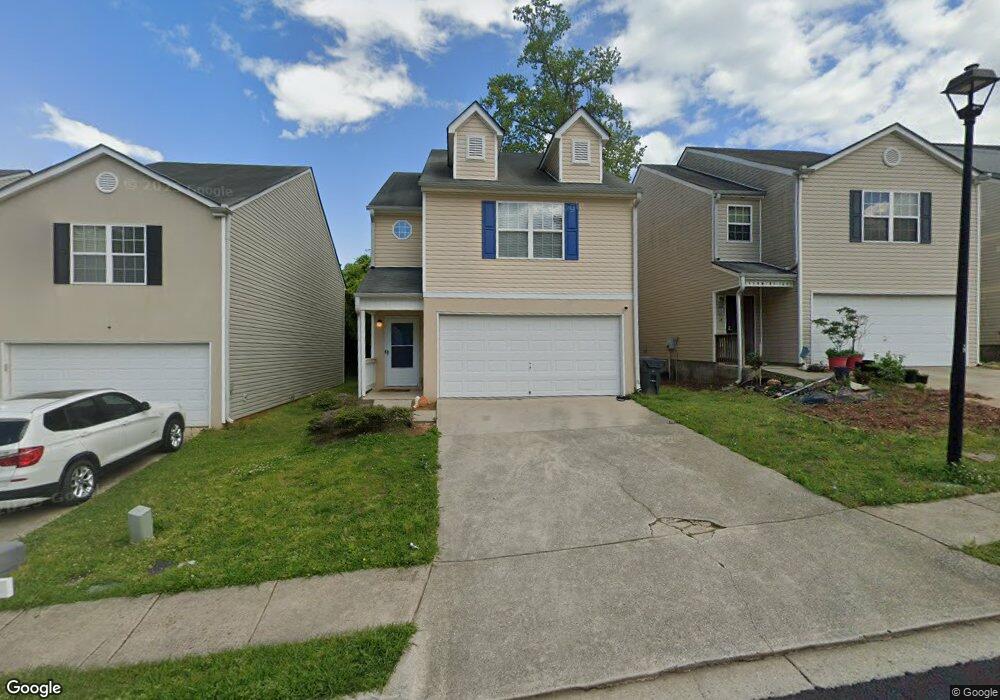
1263 Brookstone Rd Unit 9 Atlanta, GA 30349
Estimated Value: $249,000 - $283,848
3
Beds
3
Baths
1,902
Sq Ft
$140/Sq Ft
Est. Value
About This Home
This home is located at 1263 Brookstone Rd Unit 9, Atlanta, GA 30349 and is currently estimated at $266,712, approximately $140 per square foot. 1263 Brookstone Rd Unit 9 is a home located in Clayton County with nearby schools including West Clayton Elementary School, North Clayton Middle School, and North Clayton High School.
Ownership History
Date
Name
Owned For
Owner Type
Purchase Details
Closed on
Mar 12, 2021
Sold by
Good Brothers Holdings Llc
Bought by
Robinson Demetrius L
Current Estimated Value
Home Financials for this Owner
Home Financials are based on the most recent Mortgage that was taken out on this home.
Original Mortgage
$211,105
Outstanding Balance
$189,337
Interest Rate
2.73%
Mortgage Type
FHA
Estimated Equity
$77,375
Purchase Details
Closed on
Aug 31, 2020
Sold by
Michael Joseph Llc
Bought by
Good Brothers Holdings Llc
Home Financials for this Owner
Home Financials are based on the most recent Mortgage that was taken out on this home.
Original Mortgage
$117,000
Interest Rate
2.9%
Mortgage Type
New Conventional
Purchase Details
Closed on
Feb 10, 2006
Sold by
Tradewinds Communities Inc
Bought by
Watson Stacy L
Home Financials for this Owner
Home Financials are based on the most recent Mortgage that was taken out on this home.
Original Mortgage
$143,009
Interest Rate
6.14%
Mortgage Type
FHA
Create a Home Valuation Report for This Property
The Home Valuation Report is an in-depth analysis detailing your home's value as well as a comparison with similar homes in the area
Home Values in the Area
Average Home Value in this Area
Purchase History
| Date | Buyer | Sale Price | Title Company |
|---|---|---|---|
| Robinson Demetrius L | $215,000 | -- | |
| Good Brothers Holdings Llc | -- | -- | |
| Michael Joseph Llc | -- | -- | |
| Watson Stacy L | $144,200 | -- |
Source: Public Records
Mortgage History
| Date | Status | Borrower | Loan Amount |
|---|---|---|---|
| Open | Robinson Demetrius L | $211,105 | |
| Previous Owner | Michael Joseph Llc | $117,000 | |
| Previous Owner | Watson Stacy L | $143,009 |
Source: Public Records
Tax History Compared to Growth
Tax History
| Year | Tax Paid | Tax Assessment Tax Assessment Total Assessment is a certain percentage of the fair market value that is determined by local assessors to be the total taxable value of land and additions on the property. | Land | Improvement |
|---|---|---|---|---|
| 2024 | $4,122 | $104,680 | $7,200 | $97,480 |
| 2023 | $3,527 | $96,640 | $7,200 | $89,440 |
| 2022 | $3,198 | $80,520 | $7,200 | $73,320 |
| 2021 | $2,144 | $53,320 | $7,200 | $46,120 |
| 2020 | $1,546 | $47,711 | $7,200 | $40,511 |
| 2019 | $1,169 | $37,849 | $6,400 | $31,449 |
| 2018 | $1,078 | $35,630 | $6,400 | $29,230 |
| 2017 | $842 | $29,748 | $6,400 | $23,348 |
| 2016 | $1,258 | $29,991 | $6,400 | $23,591 |
| 2015 | $1,238 | $0 | $0 | $0 |
| 2014 | $1,163 | $28,279 | $6,400 | $21,879 |
Source: Public Records
Map
Nearby Homes
- 1267 Brookstone Rd
- 5446 Waterfall Ct
- 1145 Brookstone Rd
- 5405 Glen Haven Dr
- 5407 Glen Haven Dr
- 1114 Summer Brook Rd
- 5426 Glen Haven Dr
- 5428 Glen Haven Dr
- 1292 Crystal Lake Rd
- 5289 Brentwood Rd
- 5549 Pine Gate Dr
- 5229 Kirk Dr
- 5312 Heather Ln
- 1103 Hidden Brook Trail
- 5575 Pine Gate Dr
- 5220 Kirk Dr
- 1263 Shoreham Dr
- 0 Stoneham Ct Unit 7498130
- 1263 Brookstone Rd
- 1259 Brookstone Rd
- 1271 Brookstone Rd
- 1255 Brookstone Rd
- 1255 Brookstone Rd Unit 1255
- 1178 Summer Brook Rd
- 1251 Brookstone Rd
- 1275 Brookstone Rd
- 1176 Summer Brook Rd Unit 1176
- 1176 Summer Brook Rd Unit 3
- 1176 Summer Brook Rd
- 1247 Brookstone Rd
- 1279 Brookstone Rd
- 1162 Summer Brook Rd
- 1266 Brookstone Rd
- 1266 Brookstone Rd
- 1266 Brookstone Rd Unit 72
- 1262 Brookstone Rd
- 1270 Brookstone Rd
- 5421 Waterfall Ct