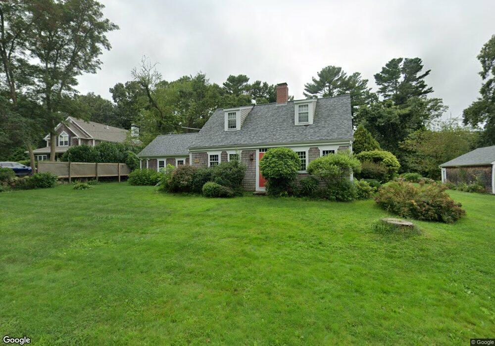
1263 Drift Rd Unit WINTER Westport, MA 02790
Westport Point NeighborhoodEstimated Value: $904,000 - $1,143,000
3
Beds
2
Baths
1,950
Sq Ft
$501/Sq Ft
Est. Value
About This Home
This home is located at 1263 Drift Rd Unit WINTER, Westport, MA 02790 and is currently estimated at $977,015, approximately $501 per square foot. 1263 Drift Rd Unit WINTER is a home located in Bristol County with nearby schools including Alice A. Macomber Primary School, Westport Elementary School, and Westport Middle-High School.
Ownership History
Date
Name
Owned For
Owner Type
Purchase Details
Closed on
Sep 29, 2003
Sold by
Es Schoene Elizabeth R and Schoene M Gay
Bought by
Paquin Elizabeth and Paquin Jean-Francois
Current Estimated Value
Home Financials for this Owner
Home Financials are based on the most recent Mortgage that was taken out on this home.
Original Mortgage
$250,000
Interest Rate
6.29%
Mortgage Type
Purchase Money Mortgage
Purchase Details
Closed on
Jun 15, 1987
Sold by
Manchester Kenneth
Bought by
Schoene Elizabeth R
Create a Home Valuation Report for This Property
The Home Valuation Report is an in-depth analysis detailing your home's value as well as a comparison with similar homes in the area
Home Values in the Area
Average Home Value in this Area
Purchase History
| Date | Buyer | Sale Price | Title Company |
|---|---|---|---|
| Paquin Elizabeth | $420,000 | -- | |
| Schoene Elizabeth R | $210,000 | -- |
Source: Public Records
Mortgage History
| Date | Status | Borrower | Loan Amount |
|---|---|---|---|
| Open | Schoene Elizabeth R | $200,000 | |
| Closed | Schoene Elizabeth R | $250,000 | |
| Previous Owner | Schoene Elizabeth R | $75,000 |
Source: Public Records
Tax History Compared to Growth
Tax History
| Year | Tax Paid | Tax Assessment Tax Assessment Total Assessment is a certain percentage of the fair market value that is determined by local assessors to be the total taxable value of land and additions on the property. | Land | Improvement |
|---|---|---|---|---|
| 2025 | $5,447 | $731,200 | $381,500 | $349,700 |
| 2024 | $5,384 | $696,500 | $353,500 | $343,000 |
| 2023 | $5,382 | $659,600 | $336,600 | $323,000 |
| 2022 | $5,366 | $632,800 | $336,600 | $296,200 |
| 2021 | $4,135 | $479,700 | $254,100 | $225,600 |
| 2020 | $3,958 | $469,500 | $243,900 | $225,600 |
| 2019 | $4,203 | $508,200 | $288,200 | $220,000 |
| 2018 | $3,324 | $406,800 | $217,800 | $189,000 |
| 2017 | $3,404 | $427,100 | $235,700 | $191,400 |
| 2016 | $3,481 | $440,100 | $255,900 | $184,200 |
| 2015 | $3,297 | $415,800 | $238,100 | $177,700 |
Source: Public Records
Map
Nearby Homes
- 225 Hixbridge Rd
- 920 Drift Rd
- 1346 Main Rd Unit B
- 99 Sylvia Ln
- 1580 Main Rd
- 101 Adamsville Rd
- 837 Main Road & Lot 2
- 837 Main Rd
- 1702J Drift Rd
- 1702 Drift Rd
- 8 Village Way
- 7 Village Way
- 15 Village Way
- 1881 Main Rd
- 332 Division Rd
- 2 Slades Farm Ln
- 17 Quail Trail
- 73 White Oak Run
- 8 Strawberry Ln
- 118 Charlotte White Rd Extension