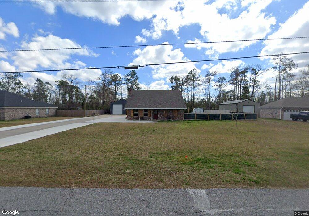
1263 Tomahawk Dr Lake Charles, LA 70611
Moss Bluff NeighborhoodEstimated Value: $277,000 - $309,000
3
Beds
2
Baths
1,750
Sq Ft
$166/Sq Ft
Est. Value
About This Home
This home is located at 1263 Tomahawk Dr, Lake Charles, LA 70611 and is currently estimated at $290,646, approximately $166 per square foot. 1263 Tomahawk Dr is a home located in Calcasieu Parish with nearby schools including Graham & Parks Alternative Public School, Moss Bluff Elementary School, and Putnam Avenue Upper School.
Ownership History
Date
Name
Owned For
Owner Type
Purchase Details
Closed on
Aug 5, 2022
Sold by
Michelle Edwards Randie
Bought by
Edwards Brian Wayne and Edwards Randie Michelle
Current Estimated Value
Home Financials for this Owner
Home Financials are based on the most recent Mortgage that was taken out on this home.
Original Mortgage
$237,500
Outstanding Balance
$201,840
Interest Rate
4.92%
Mortgage Type
New Conventional
Estimated Equity
$88,806
Purchase Details
Closed on
Aug 3, 2021
Sold by
Meyer Melinda Duhon
Bought by
Edwards Randie Michelle
Create a Home Valuation Report for This Property
The Home Valuation Report is an in-depth analysis detailing your home's value as well as a comparison with similar homes in the area
Home Values in the Area
Average Home Value in this Area
Purchase History
| Date | Buyer | Sale Price | Title Company |
|---|---|---|---|
| Edwards Brian Wayne | $250,000 | None Listed On Document | |
| Edwards Randie Michelle | -- | None Available | |
| Edwards Randie Michelle | $200,000 | None Listed On Document |
Source: Public Records
Mortgage History
| Date | Status | Borrower | Loan Amount |
|---|---|---|---|
| Open | Edwards Brian Wayne | $237,500 |
Source: Public Records
Tax History Compared to Growth
Tax History
| Year | Tax Paid | Tax Assessment Tax Assessment Total Assessment is a certain percentage of the fair market value that is determined by local assessors to be the total taxable value of land and additions on the property. | Land | Improvement |
|---|---|---|---|---|
| 2024 | $1,555 | $21,740 | $3,240 | $18,500 |
| 2023 | $1,531 | $16,780 | $3,240 | $13,540 |
| 2022 | $981 | $16,780 | $3,240 | $13,540 |
| 2021 | $1,233 | $11,120 | $3,000 | $8,120 |
| 2020 | $1,109 | $10,190 | $2,880 | $7,310 |
| 2019 | $1,215 | $11,120 | $3,000 | $8,120 |
| 2018 | $396 | $11,120 | $3,000 | $8,120 |
| 2017 | $1,234 | $11,120 | $3,000 | $8,120 |
| 2016 | $1,242 | $11,120 | $3,000 | $8,120 |
| 2015 | $1,242 | $11,120 | $3,000 | $8,120 |
Source: Public Records
Map
Nearby Homes
- 959 Southern Meadows Dr
- 0 Park Rd
- 0 Park Rd Unit SWL25002774
- 1492 Becky St
- 1003 New Castle Dr
- 751 N Perkins Ferry Rd
- 1706 Heard Rd
- 1731 Marlin Rd
- 568 Parkwood Dr
- 1630 Hollow Cove Ln
- TBD Tan Tara Cir
- 1647 Hollow Cove
- 986 Hollyvale Dr
- 1152 Park Rd
- 1032 Tan Tara Cir
- 1107 Idlebrook Dr
- 1563 Noelie St
- 0 Sam Houston Jones Pkwy Unit 145953
- 863 Cooley Rd
- 833 N Huval Dr
- 1241 Tomahawk Dr
- 1285 Tomahawk Dr
- 0 Tomahawk Dr
- 1305 Tomahawk Dr
- 1264 Tomahawk Dr
- 1286 Tomahawk Dr
- 1221 Tomahawk Dr
- 682 Raymond Powell Rd
- 703 Chay Dr
- 1201 Tomahawk Dr
- 1325 Tomahawk Dr
- 711 Chay Dr
- 1326 Tomahawk Dr
- 641 Raymond Powell Rd
- 1285 Muskhogean Dr
- 1181 Tomahawk Dr
- 1198 Tomahawk Dr
- 1303 Muskhogean Dr
- 715 Chay Dr
- 710 Chay Dr