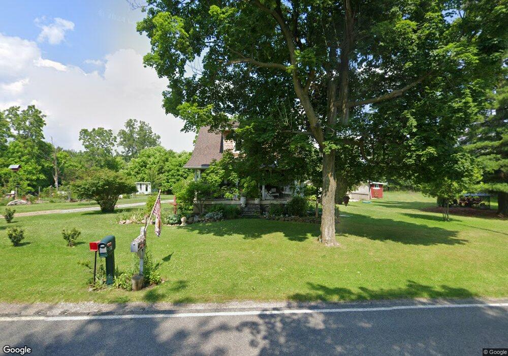
1263 Vandekarr Rd Owosso, MI 48867
Estimated Value: $216,000 - $281,000
3
Beds
2
Baths
1,727
Sq Ft
$149/Sq Ft
Est. Value
About This Home
This home is located at 1263 Vandekarr Rd, Owosso, MI 48867 and is currently estimated at $258,078, approximately $149 per square foot. 1263 Vandekarr Rd is a home with nearby schools including Owosso High School, Salem Lutheran School, and St. Paul School.
Ownership History
Date
Name
Owned For
Owner Type
Purchase Details
Closed on
Sep 25, 2025
Sold by
Beilfuss John A and Beilfuss Morgan L
Bought by
Beilfuss John A and Beilfuss Morgan L
Current Estimated Value
Purchase Details
Closed on
Nov 9, 2023
Sold by
Beilfuss John and Beilfuss Morgan L
Bought by
Beilfuss John and Beilfuss John
Purchase Details
Closed on
Apr 8, 2016
Sold by
Pajtas E Robert E and Pajtas Robert
Bought by
Wernert Alan J and Wernert Judith L
Home Financials for this Owner
Home Financials are based on the most recent Mortgage that was taken out on this home.
Original Mortgage
$150,000
Interest Rate
3.64%
Mortgage Type
New Conventional
Create a Home Valuation Report for This Property
The Home Valuation Report is an in-depth analysis detailing your home's value as well as a comparison with similar homes in the area
Home Values in the Area
Average Home Value in this Area
Purchase History
| Date | Buyer | Sale Price | Title Company |
|---|---|---|---|
| Beilfuss John A | -- | None Listed On Document | |
| Beilfuss John | -- | None Listed On Document | |
| Wernert Alan J | $207,000 | -- |
Source: Public Records
Mortgage History
| Date | Status | Borrower | Loan Amount |
|---|---|---|---|
| Previous Owner | Wernert Alan J | $150,000 |
Source: Public Records
Tax History Compared to Growth
Tax History
| Year | Tax Paid | Tax Assessment Tax Assessment Total Assessment is a certain percentage of the fair market value that is determined by local assessors to be the total taxable value of land and additions on the property. | Land | Improvement |
|---|---|---|---|---|
| 2025 | $1,568 | $131,800 | $0 | $0 |
| 2024 | $1,568 | $117,300 | $0 | $0 |
| 2023 | $619 | $105,600 | $0 | $0 |
| 2022 | $878 | $98,100 | $0 | $0 |
| 2021 | $1,384 | $93,500 | $0 | $0 |
| 2020 | $804 | $85,200 | $0 | $0 |
| 2019 | $1,047 | $83,600 | $0 | $0 |
| 2018 | $1,362 | $80,800 | $0 | $0 |
| 2017 | $1,081 | $83,400 | $0 | $0 |
| 2016 | -- | $83,400 | $0 | $0 |
| 2015 | -- | $76,700 | $0 | $0 |
| 2014 | -- | $76,100 | $0 | $0 |
Source: Public Records
Map
Nearby Homes
- 702 Glenwood Ave
- 755 Woodlawn Ave
- 827 Lingle Ave
- 809 Grand Ave
- 942 Division St
- 609 Broadway Ave
- 808 Division St
- 808 Corunna Ave
- 915 Corunna Ave
- 1150 S Shiawassee St
- Parcel A Aiken Rd
- 209 W Stewart St
- 619 Huron St
- 1434 S Pearce St
- 1605 Corunna Ave
- 405 Huron St
- 1300 S Pearce St
- 1560 S M 52
- 1046 S Pearce St
- 1627 Michigan 52