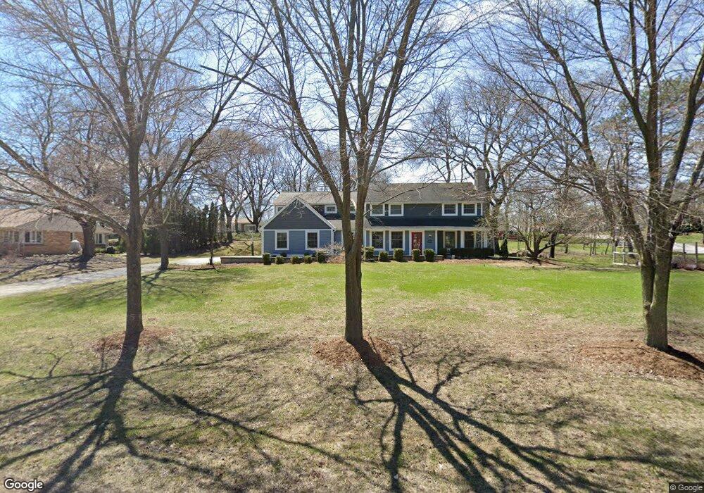
12635 Elmhurst Pkwy Elm Grove, WI 53122
Estimated Value: $592,000 - $778,000
4
Beds
1
Bath
2,168
Sq Ft
$309/Sq Ft
Est. Value
About This Home
This home is located at 12635 Elmhurst Pkwy, Elm Grove, WI 53122 and is currently estimated at $668,992, approximately $308 per square foot. 12635 Elmhurst Pkwy is a home located in Waukesha County with nearby schools including Tonawanda Elementary School, Pilgrim Park Middle School, and Brookfield East High School.
Ownership History
Date
Name
Owned For
Owner Type
Purchase Details
Closed on
Sep 18, 2007
Sold by
Us Bank Na
Bought by
Thew Michael J and Thew Margaret E
Current Estimated Value
Home Financials for this Owner
Home Financials are based on the most recent Mortgage that was taken out on this home.
Original Mortgage
$223,250
Outstanding Balance
$141,202
Interest Rate
6.55%
Mortgage Type
Purchase Money Mortgage
Estimated Equity
$527,790
Purchase Details
Closed on
Feb 7, 2007
Sold by
Murphy Glen J
Bought by
Us Bank Na
Purchase Details
Closed on
May 2, 1997
Sold by
Murphy Colleen A
Bought by
Murphy Glen J
Home Financials for this Owner
Home Financials are based on the most recent Mortgage that was taken out on this home.
Original Mortgage
$192,000
Interest Rate
6.75%
Mortgage Type
Purchase Money Mortgage
Create a Home Valuation Report for This Property
The Home Valuation Report is an in-depth analysis detailing your home's value as well as a comparison with similar homes in the area
Home Values in the Area
Average Home Value in this Area
Purchase History
| Date | Buyer | Sale Price | Title Company |
|---|---|---|---|
| Thew Michael J | $235,000 | None Available | |
| Us Bank Na | $370,864 | None Available | |
| Murphy Glen J | -- | -- |
Source: Public Records
Mortgage History
| Date | Status | Borrower | Loan Amount |
|---|---|---|---|
| Open | Thew Michael J | $223,250 | |
| Previous Owner | Murphy Glen J | $192,000 |
Source: Public Records
Tax History Compared to Growth
Tax History
| Year | Tax Paid | Tax Assessment Tax Assessment Total Assessment is a certain percentage of the fair market value that is determined by local assessors to be the total taxable value of land and additions on the property. | Land | Improvement |
|---|---|---|---|---|
| 2024 | $8,423 | $641,800 | $144,700 | $497,100 |
| 2023 | $8,035 | $562,700 | $135,000 | $427,700 |
| 2022 | $8,437 | $562,700 | $135,000 | $427,700 |
| 2021 | $8,456 | $498,800 | $135,000 | $363,800 |
| 2020 | $8,784 | $498,800 | $135,000 | $363,800 |
| 2019 | $8,434 | $456,800 | $138,700 | $318,100 |
| 2018 | $8,007 | $456,800 | $138,700 | $318,100 |
| 2017 | $8,535 | $455,000 | $138,000 | $317,000 |
| 2016 | $8,470 | $455,000 | $138,000 | $317,000 |
| 2015 | $6,365 | $337,000 | $138,000 | $199,000 |
| 2014 | $4,751 | $290,900 | $109,200 | $181,700 |
| 2013 | $4,751 | $258,800 | $114,700 | $144,100 |
Source: Public Records
Map
Nearby Homes
- 12855 Stephen Place
- 1239 N 122nd St
- 13130 Watertown Plank Rd Unit 312
- 1660 Lindhurst Ct
- 1920 Fairhaven Blvd
- 1409 N 116th St
- 12675 W North Ave
- 11722 W Diane Dr
- 13050 W Bluemound Rd Unit 303
- 12990 W Bluemound Rd Unit 205
- 14220 Hillside Rd
- 13485 Braemar Dr
- 12207 W Bluemound Rd
- 12000 W Bluemound Rd Unit 111
- 744 N 115th St
- 11510 W Wisconsin Ave
- 333 N 120th St
- 12455 W Center St
- 14625 Club Dr
- 328 N 115th St
- 1530 Fairhaven Blvd
- 12605 Elmhurst Pkwy
- 1545 Longwood Ave
- 1510 Fairhaven Blvd
- 12805 Elmhurst Pkwy
- 1505 Longwood Ave
- 12650 Elmhurst Pkwy
- 12600 Elmhurst Pkwy
- 1525 Fairhaven Blvd
- 1500 Fairhaven Blvd
- 1475 Longwood Ave
- 1550 Longwood Ave
- 12825 Elmhurst Pkwy
- 1515 Fairhaven Blvd
- 1610 Fairhaven Blvd
- 1530 Longwood Ave
- 1615 Longwood Ave
- 1460 Fairhaven Blvd
- 12800 Elmhurst Pkwy
- 1600 Longwood Ave