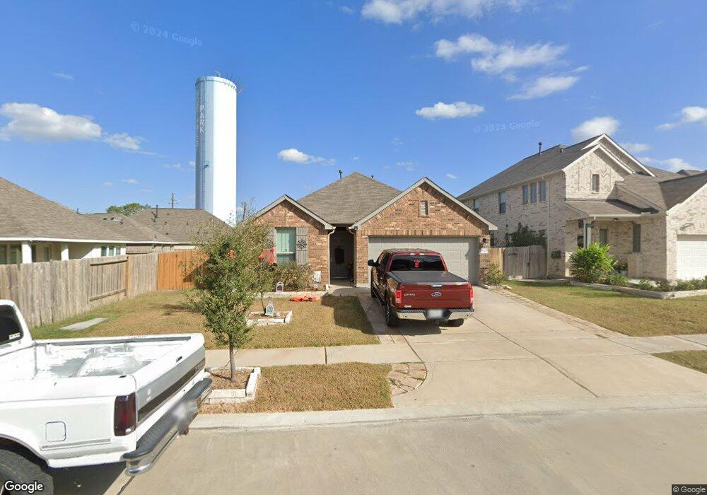
12638 Broussard Brook Ln Houston, TX 77086
Northwest Park NeighborhoodEstimated Value: $256,474 - $292,000
4
Beds
2
Baths
1,721
Sq Ft
$161/Sq Ft
Est. Value
About This Home
This home is located at 12638 Broussard Brook Ln, Houston, TX 77086 and is currently estimated at $277,369, approximately $161 per square foot. 12638 Broussard Brook Ln is a home with nearby schools including Epps Island Elementary School, Klein Intermediate School, and Klein Forest High School.
Ownership History
Date
Name
Owned For
Owner Type
Purchase Details
Closed on
Feb 19, 2020
Sold by
Mhi Partnership Ltd
Bought by
Sisavath Mike Outhai and Sisavath Sone
Current Estimated Value
Home Financials for this Owner
Home Financials are based on the most recent Mortgage that was taken out on this home.
Original Mortgage
$183,600
Outstanding Balance
$162,565
Interest Rate
3.6%
Mortgage Type
New Conventional
Estimated Equity
$114,804
Create a Home Valuation Report for This Property
The Home Valuation Report is an in-depth analysis detailing your home's value as well as a comparison with similar homes in the area
Home Values in the Area
Average Home Value in this Area
Purchase History
| Date | Buyer | Sale Price | Title Company |
|---|---|---|---|
| Sisavath Mike Outhai | -- | Millennium Title Company | |
| Sisavath Mike Outhai | -- | Millennium Title Company |
Source: Public Records
Mortgage History
| Date | Status | Borrower | Loan Amount |
|---|---|---|---|
| Open | Sisavath Mike Outhai | $183,600 | |
| Closed | Sisavath Mike Outhai | $183,600 |
Source: Public Records
Tax History Compared to Growth
Tax History
| Year | Tax Paid | Tax Assessment Tax Assessment Total Assessment is a certain percentage of the fair market value that is determined by local assessors to be the total taxable value of land and additions on the property. | Land | Improvement |
|---|---|---|---|---|
| 2025 | $6,153 | $266,190 | $36,777 | $229,413 |
| 2024 | $6,153 | $268,630 | $36,777 | $231,853 |
| 2023 | $6,153 | $271,071 | $36,777 | $234,294 |
| 2022 | $5,995 | $245,449 | $36,777 | $208,672 |
| 2021 | $5,087 | $206,640 | $31,523 | $175,117 |
| 2020 | $3,858 | $142,227 | $31,523 | $110,704 |
| 2019 | $662 | $23,642 | $23,642 | $0 |
Source: Public Records
Map
Nearby Homes
- 12610 Twilight Bend Ct
- 0 Tomball Pkwy
- 6622 Sutton Meadows Dr
- 7011 Lower Arrow Dr
- 6411 Halstead Meadows Cir
- 6706 Redding Springs Ln
- 7510 Bubbling Spring Ln
- 7407 Water Park Ln
- 9815 Lonsford Dr
- 10730 Antoine Dr
- 00 Romona Blvd
- 9611 Camrose Ct
- 6830 Desert Rose Ln
- 7602 Smiling Wood Ln
- 7602 Silent Wood Ln
- 5715 & 5721 Spindle Dr
- 5624 Spindle Dr
- 9707 Rapid River Ln
- 6703 Deer Ridge Ln
- 9406 Jolly Wood Ct
- 12634 Broussard Brook Ln
- 7019 Whitlow Wonder Ln
- 7015 Whitlow Wonder Ln
- 12630 Broussard Brook Ln
- 12639 Twilight Bend Ct
- 7011 Whitlow Wonder Ln
- 12639 Broussard Brook Ln
- 12635 Twilight Bend Ct
- 7007 Whitlow Wonder Ln
- 12626 Broussard Brook Ln
- 12643 Broussard Brook Ln
- 12635 Broussard Brook Ln
- 12647 Broussard Brook Ln
- 12631 Twilight Bend Ct
- 12631 Broussard Brook Ln
- 12622 Broussard Brook Ln
- 12627 Twilight Bend Ct
- 12627 Broussard Brook Ln
- 12623 Twilight Bend Ct
- 12623 Broussard Brook Ln