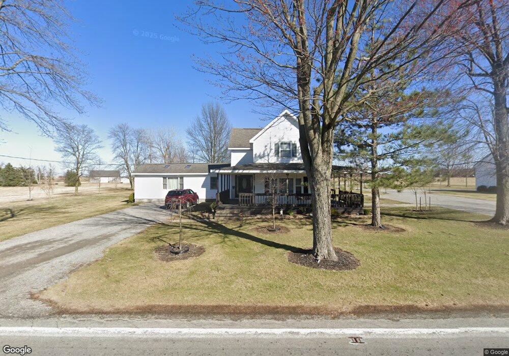
12639 State Route 698 Findlay, OH 45840
Estimated Value: $198,000 - $296,000
4
Beds
2
Baths
2,168
Sq Ft
$114/Sq Ft
Est. Value
About This Home
This home is located at 12639 State Route 698, Findlay, OH 45840 and is currently estimated at $246,803, approximately $113 per square foot. 12639 State Route 698 is a home located in Hancock County with nearby schools including Cory-Rawson Elementary School and Cory-Rawson High School.
Ownership History
Date
Name
Owned For
Owner Type
Purchase Details
Closed on
Mar 15, 2017
Sold by
Shields Dewayne E and Orwick Jacqueline L
Bought by
Orwick Jacqueline L
Current Estimated Value
Home Financials for this Owner
Home Financials are based on the most recent Mortgage that was taken out on this home.
Original Mortgage
$100,000
Outstanding Balance
$67,167
Interest Rate
4.1%
Mortgage Type
New Conventional
Estimated Equity
$179,636
Create a Home Valuation Report for This Property
The Home Valuation Report is an in-depth analysis detailing your home's value as well as a comparison with similar homes in the area
Home Values in the Area
Average Home Value in this Area
Purchase History
| Date | Buyer | Sale Price | Title Company |
|---|---|---|---|
| Orwick Jacqueline L | $56,500 | None Available |
Source: Public Records
Mortgage History
| Date | Status | Borrower | Loan Amount |
|---|---|---|---|
| Open | Orwick Jacqueline L | $100,000 |
Source: Public Records
Tax History Compared to Growth
Tax History
| Year | Tax Paid | Tax Assessment Tax Assessment Total Assessment is a certain percentage of the fair market value that is determined by local assessors to be the total taxable value of land and additions on the property. | Land | Improvement |
|---|---|---|---|---|
| 2024 | $1,585 | $53,460 | $11,600 | $41,860 |
| 2023 | $1,579 | $53,460 | $11,600 | $41,860 |
| 2022 | $1,587 | $53,460 | $11,600 | $41,860 |
| 2021 | $1,501 | $45,110 | $11,440 | $33,670 |
| 2020 | $1,479 | $45,110 | $11,440 | $33,670 |
| 2019 | $1,443 | $45,110 | $11,440 | $33,670 |
| 2018 | $1,213 | $39,490 | $9,950 | $29,540 |
| 2017 | $1,213 | $39,490 | $9,950 | $29,540 |
| 2016 | $1,272 | $39,490 | $9,950 | $29,540 |
| 2015 | $963 | $32,400 | $9,950 | $22,450 |
| 2014 | $940 | $31,340 | $9,950 | $21,390 |
| 2012 | $1,026 | $31,340 | $9,950 | $21,390 |
Source: Public Records
Map
Nearby Homes
- 11741 Township Road 10
- 6993 County Road 313
- 10601 County Road 9
- 13666 County Road 12
- 12159 County Road 12
- 000 County Road 12
- 1609 Foraker Ave
- 0 Township Road 77
- 3323 Western Ave
- 9653 Early Dr
- 0 Bushwillow Dr Unit Lot 156
- 0 Bushwillow Dr Unit Lot 155
- 0 Bushwillow Dr Unit Lot 154
- 0 County Road 99 Lot 2 Unit 6081480
- 0 Rock Candy Rd Or Bushwillow Dr Lot 173 Unit 6079093
- 0 Rock Candy Rd Lot 171 Unit 6079088
- 0 Rock Candy Rd Lot 170 Unit 6079087
- 0 Rock Candy Rd Lot 168 Unit 6079085
- 0 Bearcat Way Or 0 Rock Candy Rd Lot 167 Unit 6079083
- 0 Rock Candy Rd Lot 162 Unit 6079070
- 12639 Ohio 698
- 7943 County Road 313
- 12817 State Route 698
- 8055 County Road 313
- 12820 State Route 698
- 7918 County Road 313
- 12520 Township Road 10
- 8070 County Road 313
- 12500 Township Road 10
- 7870 County Road 313
- 12480 Township Road 10
- 12442 Township Road 10
- 12445 Township Road 10
- 7957 Township Road 48
- 7730 Cr 313
- 7730 County Road 313
- 7740 Township Road 48
- 12205 Township Road 10
- 8446 Trail 48
- 8446 Township Road 48