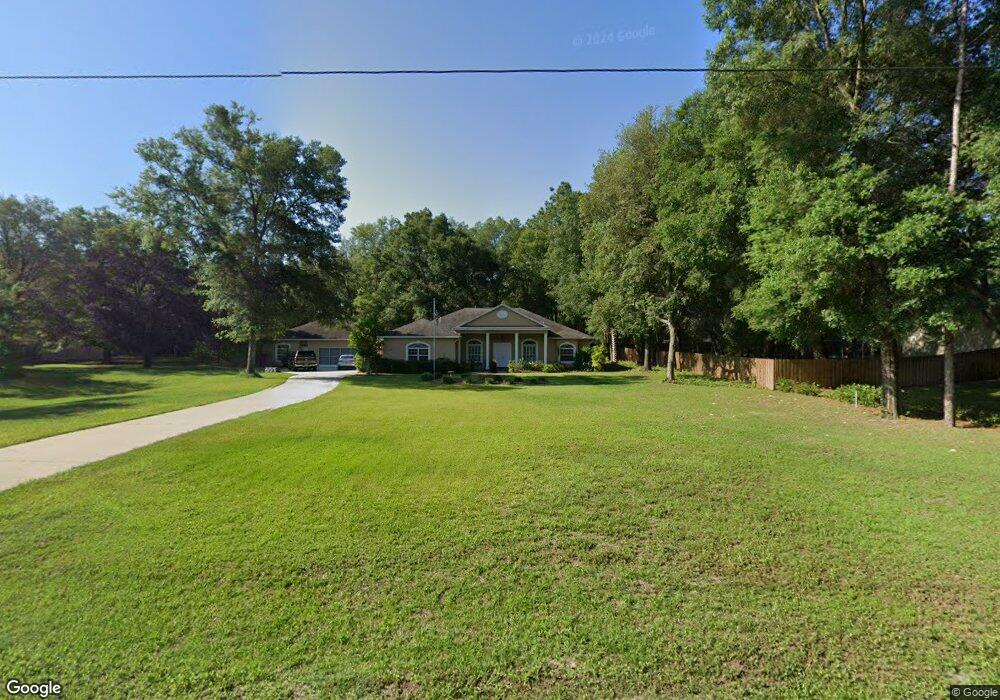
1264 E Bluebird Ct Hernando, FL 34442
Estimated Value: $386,000 - $498,000
3
Beds
2
Baths
2,350
Sq Ft
$189/Sq Ft
Est. Value
About This Home
This home is located at 1264 E Bluebird Ct, Hernando, FL 34442 and is currently estimated at $444,132, approximately $188 per square foot. 1264 E Bluebird Ct is a home located in Citrus County with nearby schools including Central Ridge Elementary School, Citrus Springs Middle School, and Citrus High School.
Ownership History
Date
Name
Owned For
Owner Type
Purchase Details
Closed on
Dec 8, 2003
Sold by
Baute Michael
Bought by
Hagen Ronald J and Hagen Lynn J
Current Estimated Value
Purchase Details
Closed on
Apr 10, 2002
Sold by
Revocabl Patterson Sr George L and Revocabl George L Patterson Sr
Bought by
Baute Michael
Purchase Details
Closed on
Feb 1, 2001
Bought by
Hagen Ronald J and Hagen Lynn J
Purchase Details
Closed on
Jun 1, 2000
Bought by
Hagen Ronald J and Hagen Lynn J
Create a Home Valuation Report for This Property
The Home Valuation Report is an in-depth analysis detailing your home's value as well as a comparison with similar homes in the area
Home Values in the Area
Average Home Value in this Area
Purchase History
| Date | Buyer | Sale Price | Title Company |
|---|---|---|---|
| Hagen Ronald J | $195,000 | Citrus Land Title | |
| Baute Michael | $6,000 | Crystal River Title | |
| Hagen Ronald J | $100 | -- | |
| Hagen Ronald J | $8,100 | -- |
Source: Public Records
Tax History
| Year | Tax Paid | Tax Assessment Tax Assessment Total Assessment is a certain percentage of the fair market value that is determined by local assessors to be the total taxable value of land and additions on the property. | Land | Improvement |
|---|---|---|---|---|
| 2025 | $2,944 | $232,174 | -- | -- |
| 2024 | $2,874 | $225,631 | -- | -- |
| 2023 | $2,874 | $219,059 | $0 | $0 |
| 2022 | $2,691 | $212,679 | $0 | $0 |
| 2021 | $2,583 | $206,484 | $0 | $0 |
| 2020 | $2,485 | $258,080 | $11,870 | $246,210 |
| 2019 | $2,454 | $241,720 | $11,870 | $229,850 |
| 2018 | $2,429 | $223,670 | $11,870 | $211,800 |
| 2017 | $2,423 | $191,325 | $11,870 | $179,455 |
| 2016 | $2,455 | $187,390 | $11,870 | $175,520 |
| 2015 | $2,493 | $186,087 | $11,870 | $174,217 |
| 2014 | $2,549 | $184,610 | $12,583 | $172,027 |
Source: Public Records
Map
Nearby Homes
- 1255 E Bluebird Ct
- 1335 E Silver Thorn Loop
- 1219 E Silver Thorn Loop
- 1107 E Bluebird Ct
- 7105 N Grackle Point
- 1380 E Silver Thorn Loop
- 994 E Keighley Ln
- 7402 N Iron Point
- 7472 N Iron Point
- 7424 N Iron Point
- 7436 N Iron Point
- 7059 N Lecanto Hwy
- 7692 N Fisher Terrace
- 7582 N Fisher Terrace
- 7073 N Lecanto Hwy
- 823 E Dellbrook Ln
- 7724 N Manville Rd
- 702 E Sequoia Place
- 7808 N Manville Rd
- 7752 N Walton Terrace
- 1240 E Bluebird Ct
- 1292 E Bluebird Ct
- 7169 N Grackle Point
- 1185 E Bluebird Ct
- 1156 E Bluebird Ct
- 0 E Bluebird Ct
- 2 E Bluebird Ct
- 52 E Bluebird Ct
- 7171 N Grackle Point
- 1280 E Silver Thorn Loop
- 1210 E Bluebird Ct
- 1324 E Bluebird Ct
- 1295 E Bluebird Ct
- 1260 E Silver Thorn Loop
- 7170 N Grackle Point
- 1325 E Bluebird Ct
- 7365 N Redbird Terrace
- 7160 N Grackle Point
- 7350 N Redbird Terrace
- 7149 N Grackle Point
Your Personal Tour Guide
Ask me questions while you tour the home.